
Parc national d'Aiguebelle Fatbike trails
Parc national d'Aiguebelle Fatbike trails
Rouyn-Noranda (Mont-Brun), Rouyn-Noranda
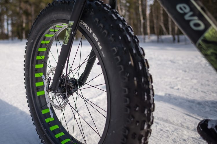
The Aiguebelle national park is 2.7 billion years of rock overlooking a clay plain where a history is still evolving. It is also landscapes full of faults, hills, plains, frozen lakes and fortuitous encounters that invite discovery. Discover more than 10 km of groomed fatbike trails in the heart of the boreal forest for a memorable experience. Bikes with oversized tires have ideal traction on snowy surfaces.
- electrocardiogram Easy
- mountain 10.5 Km (Linear)
- calendar seasonal
Sections
Sentier-L'Alucite Fatbike
- electrocardiogram Easy
- mountain 2.85 km (Linear)
Sentier-L'Amiral Fatbike
- electrocardiogram Easy
- mountain 4.41 km (Linear)
Sentier-La Guêpe Fatbike
- electrocardiogram Easy
- mountain 2.45 km (Linear)
Sentier-Le Bourdon Fatbike
- electrocardiogram Easy
- mountain 0.73 km (Linear)
L'Alucite Fatbike Trail
- electrocardiogram Easy
- mountain 2.85 km (Linear)
L'Amiral Fatbike Trail
- electrocardiogram Easy
- mountain 4.41 km (Linear)
La Guêpe Fatbike Trail
- electrocardiogram Easy
- mountain 2.45 km (Linear)
Le Bourdon Fatbike Trail
- electrocardiogram Easy
- mountain 0.73 km (Linear)
Points of service and interest
Category Name
-
 Parking
Stationnement de la Route 1
48°28'4,194"N
Parking
Stationnement de la Route 1
48°28'4,194"N
78°39'13,494"O -
Parking
Stationnement du Camping du Sablon
48°26'55,193"N
78°41'3,528"O -
 Tourist information
Centre de service Mont-Brun et Boutique Nature
(Parc national d'Aiguebelle)
48°26'55.191”N
Tourist information
Centre de service Mont-Brun et Boutique Nature
(Parc national d'Aiguebelle)
48°26'55.191”N
78°41'8.308”O -
 Rustic camp for rent
Le Bourdon (lac du Sablon) fd
48°30'7,999"N
Rustic camp for rent
Le Bourdon (lac du Sablon) fd
48°30'7,999"N
78°39'32,379"O -
Rustic camp for rent
L'Alucite (lac aux Bûcherons)
48°30'1,048"N
78°40'36,282"O
Accessibility
Access Rights
 Required and payable | Welcome infrastructure: 7 days / 7, from 9:00 am to 8:00 pm.
Directions to the Aiguebelle National Park
MONT-BRUN SERVICE CENTRE - SOUTH ENTRANCE (accessible year round) :
Via the Mont-Brun district and the Hudon (south entrance accessible year round) about 50 km from downtown Rouyn-Noranda.
12373, Aiguebelle Road, Rouyn-Noranda, Québec, J0Z 2Y0
T 819 637-7322 | parc.aiguebelle@sepaq.com
![]() View the route from your location on Google Map
View the route from your location on Google Map
From Val-d’Or :
- Take highway 117 north for about 65 km, then turn right on the road to Mont-Brun (22 km on a paved road). At the intersection of Mont-Brun, take the Route d'Aiguebelle on your right. Cross the village of Mont-Brun. At the bridge, turn right onto Aiguebelle road. The park entrance is located 8 km from the village of Mont-Brun. The Discovery and Service Centre (Reception) is located on route 2 5 km from the entrance.
From Rouyn-Noranda :
- Take route 101 Nord. When you reach D'Alembert, turn right on the route d'Aiguebelle. Cross the village of Cléricy and go to the village of Mont-Brun. At the intersection of the road to Mont-Brun, turn left. Pass through the village of Mont-Brun. At the bridge, turn right onto Aiguebelle road. The park entrance is located 8 km from the village of Mont-Brun. The Discovery and Service Centre (Home) is located on Route 2, 5 km from the entrance.
From La Sarre :
- Take route 101 South. When you reach D'Alembert, turn left on the route d'Aiguebelle. Cross the village of Cléricy and go to the village of Mont-Brun. At the intersection of the road to Mont-Brun, turn left. Pass through the village of Mont-Brun.At the bridge, turn right onto Aiguebelle road. The park entrance is located 8 km from the village of Mont-Brun. Follow the signs to Route 2, the service center is 5 km from the entrance.
From Amos :
- Take route 109 south. Arrived at Rivière-Héva, turn right on route 117 North for about 28 km, then turn right on the road to Mont-Brun. At the intersection of the village of Mont-Brun, take the road to Aiguebelle on your right. Cross the village of Mont-Brun. At the bridge, turn right onto Aiguebelle road. The park entrance is located 8 km from the village of Mont-Brun. Follow the signs to Route 2, the service center is 5 km from the entrance.
Specifications
The Rental of oversized bike (fatbike) is offered at the park.
Natural Environment
The geology
The park is part of the Canadian Shield, which began to form about 3.8 billion years ago. It is formed of magma that has poured out in successive layers under the ocean. From 2.79 billion years, a new background takes shape covering the entire Abitibi-Témiscamingue.
From this rock, several rocky massifs of the region whose Abijévis hills and faults will be formed a few million years later during major upheavals.
The geomorphology
The last ice age, Wisconsin, which began about 100,000 years ago, is responsible for the current shape of the territory. This glacier covered the entire territory of Abitibi and has progressed to the state of Wisconsin. Traces of erosion and several formations testify to its presence. For example, there are glacial streaks created by the friction of materials transported by the glacier and a network of giant pots located in the path Les marmites.
the hydrology
The main hydrographic feature of the territory is the passage of the water divide between the St. Lawrence and James Bay watersheds. This line runs between Lake La Haie and Lake Sault. There are nearly 80 lakes. Located in the hills, they are small and their waters are clear, which is exceptional at a regional level. Located in the plain, they are typical of the Abitibi: large, shallow and their waters are cloudy and brown.
Wildlife
The two wildlife representatives of the boreal forest are moose and beaver. They are ubiquitous in the park. The diversity of the territory in terms of geomorphology, hydrology and flora contributes to the abundance and diversity of animal species by offering a wide variety of habitats. Some species are at the limit of their range, such as the Grey-throated Warbler and the Long-tailed Grouse. Others are exceptional for the region such as Touladi.
Flora
The vegetation cover of the park is boreal forest. It consists mainly of young forest stands related to repeated fire passages. This promotes the growth of pioneer species such as aspen poplar and grey pine. A little more rare species for the region such as yellow birch and black ash are added to the landscape. The particular morphology of the fault lakes has allowed the creation of small exceptional habitats that are home to very rare species such as Gymnocarpium jessoense.
Comments social0
Tools ready to go
- map Guide map (PDF)
- mapsquare Download GPS track (GPX)
- Google driving directions
-
 Sunrise : 07:20
Sunset : 18:47 -
Equipment for rent Parc national d'Aigueblle
Info & advice
- Care
- Carte et orientation
- Clothes
- Emergency
- Nutrition
- Prevention
Caution
This sheet has been prepared from information provided by outdoor enthusiasts deemed sufficiently reliable and experienced. Errors or omissions are always possible and Tourisme Abitibi-Témiscamingue cannot accept responsibility for any problem or accident that may arise from this sheet or be attributed to its use. If you notice any errors or omissions during your expedition, we would be very grateful if you would let us know by email pleinair@atrat.org in order to keep our information up to date.
