
Roche du millénaire Snowshoe trail
Roche du millénaire Snowshoe trail
Preissac, Amos Région
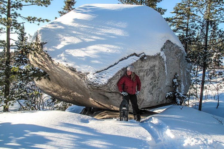
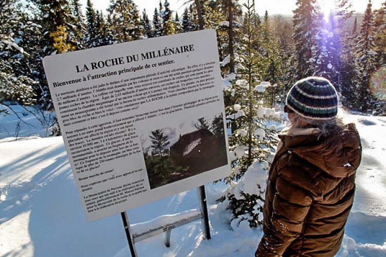
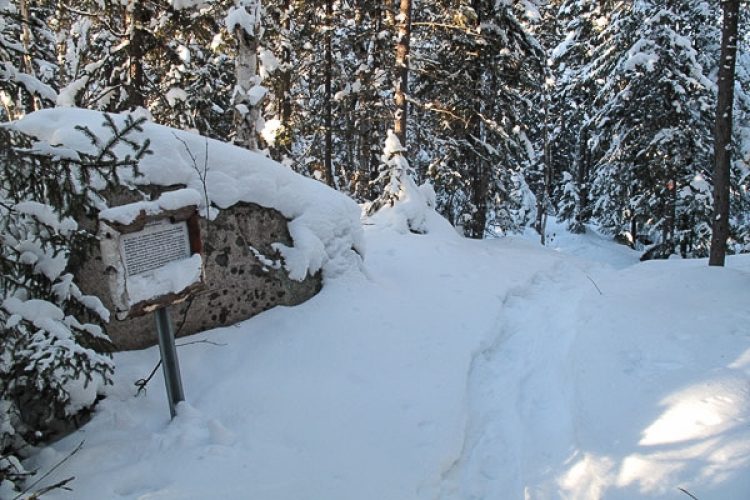
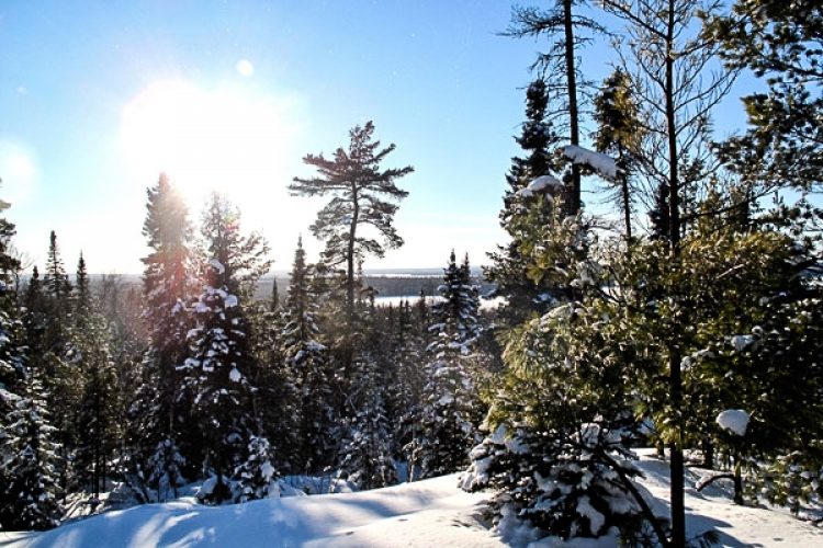
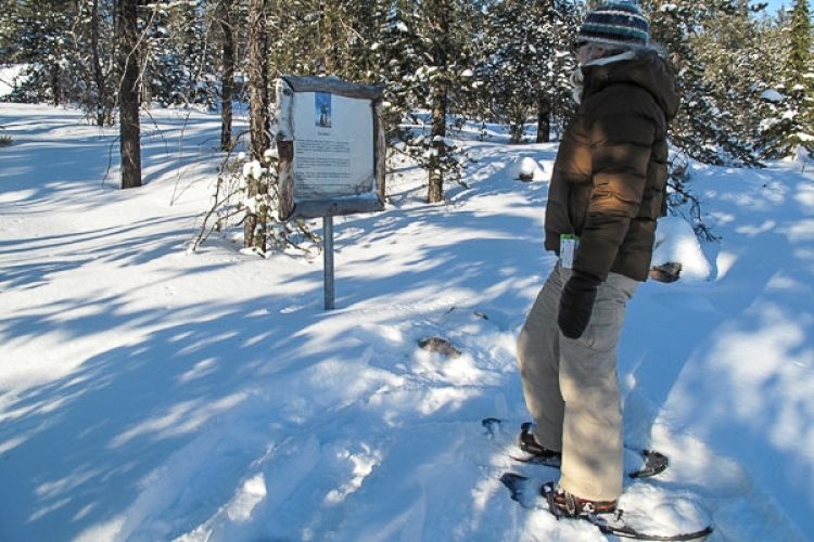
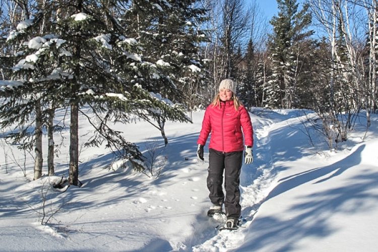
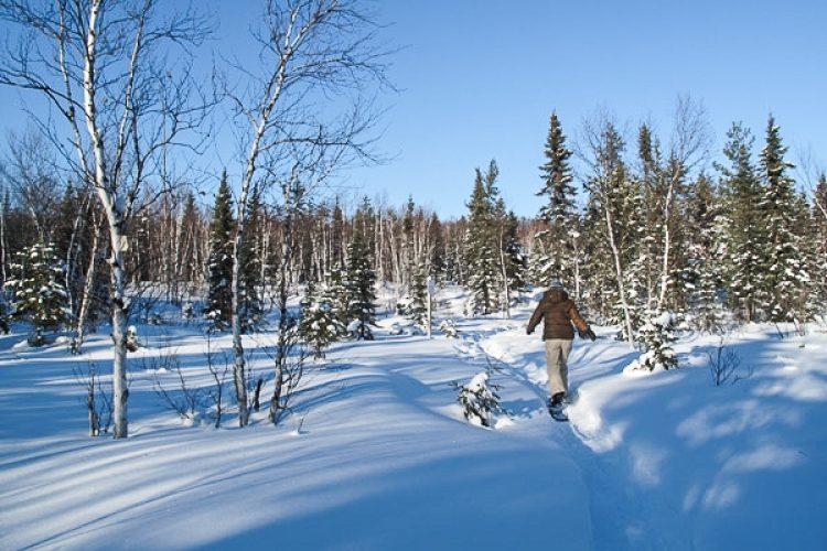
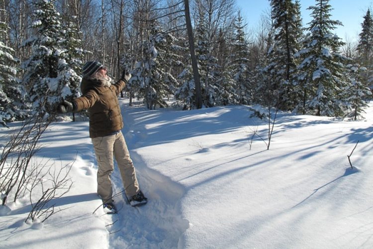
The La Roche de Preissac trail winds through the boreal forest. You will see several geological phenomena, explained by interpretive panels. Other panels provide information on the plant species present. The trail then climbs up a hill, from where you have a view of the forest and lakes in the area. On the way, you can catch a glimpse of the inukshuts' snow and get familiar with this symbol. A small ornithological trail allows you to learn about the birds of the territory, especially on the flights of partridges and the peregrine falcon. The highlight of the route is the Rock, a 250-ton erratic block, an ancient segment of the mountain torn off and deposited there by the melting of a glacier. You continue your walk on the path of the spring where a small water source flows in summer.
- electrocardiogram Easy
- mountain 2.4 Km (Linear)
- calendar seasonal
Sections
La Roche
- electrocardiogram Easy
- mountain 1.59 km (Linear)
La Source
- electrocardiogram Moderate
- mountain 0.50 km (Linear)
L'Ornithologie
- electrocardiogram Easy
- mountain 0.28 km (Loop)
Points of service and interest
Category Name
-
 Parking
Stationnement de la route 395
48°19'6,307"N
Parking
Stationnement de la route 395
48°19'6,307"N
78°23'46,456"O -
 Observation tower
Tour d’observation
(route 395, Preissac)
48°19'10,356"N
Observation tower
Tour d’observation
(route 395, Preissac)
48°19'10,356"N
78°23'35,418"O -
 Toilet
te sèche
48°19'11,57"N
Toilet
Toilette sèche
48°19'11,57"N
78°23'35,888"O -
 Bench
Banc
48°19'12,86"N
Bench
Banc
48°19'12,86"N
78°24'0,198"O -
Bench
Banc
48°19'16,896"N
78°24'43,826"O -
 Point of interest
Bloc erratique (roche du millénaire)
48°19'21.7"N
Point of interest
Bloc erratique (roche du millénaire)
48°19'21.7"N
78°24'34.1"O -
 Picnic table
Table de pique-nique
48°19'21,686"N
Picnic table
Table de pique-nique
48°19'21,686"N
78°24'13,311"O -
Picnic table
Table de pique-nique
48°19'21,722"N
78°24'34,133"O -
Bench
Source et banc
48°19'14,479"N
78°24'50,237"O -
Parking
Stationnement du chemin de la Source
48°19'14,692"N
78°24'51,955"O
Accessibility
Access Right
 Free, without visitor facilities.
![]() Pets are allowed.
Pets are allowed.
Directions to the starting point
From Amos, take Route 395 toward Preissac. After the village, continue for a few kilometers until you see the Municipality of Preissac / Sentier de la Roche sign. The parking lot is on the left, 200 meters past the observation tower, along Route 395.
From Val-d’Or, take Route 117 North and turn right onto Route 395. From Rouyn-Noranda, take Route 117 South and turn left onto Route 395. Cross the bridge and continue for a few kilometers until you see the Municipality of Preissac / Sentier de la Roche sign. The parking lot is on the left, 200 meters before the observation tower, along Route 395.
Parking: Free
Coordinates: 48°19'06.5"N 78°23'45.2"W Address: 425 de l’avenue du Lac, Preissac (near the observation tower)
![]() View the route from your location on Google Map
View the route from your location on Google Map
Contact
T 819 732-4938 Email: developpement@preissac.com Visit website
Trail Marking
Circles with small orange and blue arrows nailed to trees indicate the path to follow.
Specifications
- Maximum difference in altitude of 50 m.
- Interpretive Signs.
Comments social0
Tools ready to go
Info & advice
- Animation et interprétation
- Camping
- Care
- Carte et orientation
- Clothes
- Emergency
- Equipment
- Nutrition
- Prevention
- Training
Caution
This sheet has been prepared from information provided by outdoor enthusiasts deemed sufficiently reliable and experienced. Errors or omissions are always possible and Tourisme Abitibi-Témiscamingue cannot accept responsibility for any problem or accident that may arise from this sheet or be attributed to its use. If you notice any errors or omissions during your expedition, we would be very grateful if you would let us know by email pleinair@atrat.org in order to keep our information up to date.
