
Skinoramik Club Snowshoeing Trails
Skinoramik Club Snowshoeing Trails
Ste-Germaine-Boulé, La Sarre et l'Abitibi-Ouest
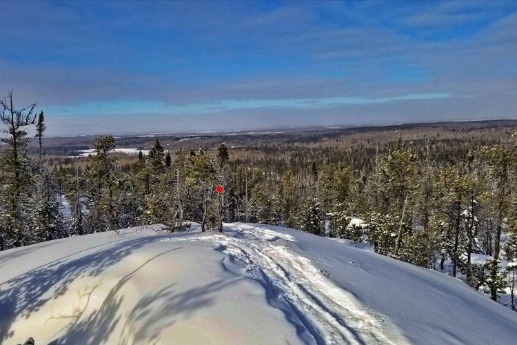
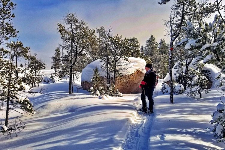
The clean, fresh air of Western Abitibi combined with quality facilities is what Skinoramik offers you, one of the most beautiful sites in the region. The trails, located at the bottom of the mountain, criss-cross a forest composed, among others, of aspen, birch, cedar, spruce and fir. They climb the mountain to two lookout points and a viewing tower, offering views of other mountains, surrounding municipalities and, on clear days, Macamic Lake.
- electrocardiogram Easy to Demanding
- mountain 12 Km (Mixed)
- calendar seasonal
Sections
La Seigneurie
- electrocardiogram Easy
- mountain 1.89 km (Linear)
Le Trappeur
- electrocardiogram Easy
- mountain 2.05 km (Linear)
La Montée du Trappeur
- electrocardiogram Easy
- mountain 0.09 km (Linear)
La Traverse du Gros Tony
- electrocardiogram Easy
- mountain 0.22 km (Linear)
La Bretelle à Jack
- electrocardiogram Easy
- mountain 1.36 km (Linear)
Le Loup Solitaire
- electrocardiogram Easy
- mountain 2.51 km (Linear)
La Drave-Galerie
- electrocardiogram Easy
- mountain 1.58 km (Linear)
La Traverse du Porspecteur
- electrocardiogram Easy
- mountain 0.75 km (Linear)
Du Vaillant
- electrocardiogram Easy
- mountain 2.09 km (Linear)
Des Voyageurs
- electrocardiogram Easy
- mountain 0.95 km (Linear)
Le Passe-Pied
- electrocardiogram Easy
- mountain 2.03 km (Linear)
Interest : multipurpose trail
La Montée des Pionniers
- electrocardiogram Easy
- mountain 4.05 km (Linear)
Interest : multipurpose trail
Points of service and interest
Category Name
-
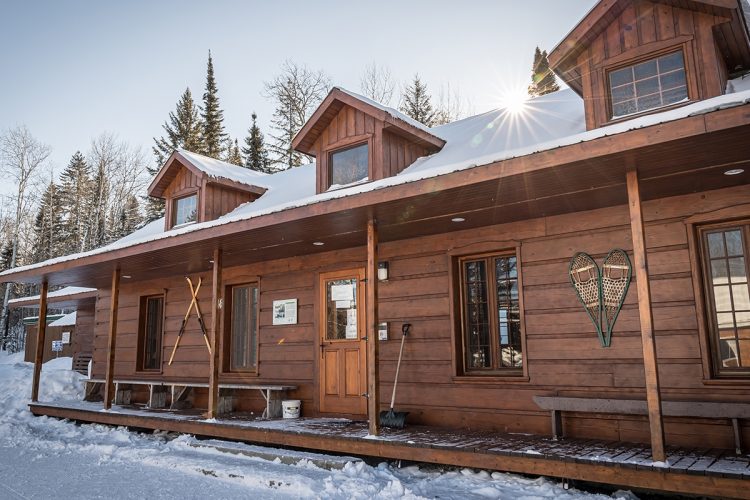
 Reception et services
Chalet d'accueil du club Skinoramik
48°36'07.776"N
Reception et services
Chalet d'accueil du club Skinoramik
48°36'07.776"N
79°02'17.558"O -
 Parking
Stationnement Skinoramik
48°36'09.2"N
Parking
Stationnement Skinoramik
48°36'09.2"N
79°02'19.5"O -
Sentiers de ski de fond
-
Glissade pour les enfants
-
 Refuge
Shack à Pépère
48°36'24,037"N
Refuge
Shack à Pépère
48°36'24,037"N
79°1'0,779"O -
 Panorama
Belvédère #1 La Fouine
48°36'13,333"N
Panorama
Belvédère #1 La Fouine
48°36'13,333"N
79°0'50,856"O -
Panorama
Belvédère #2 la Chouette
48°36'14,948"N
79°0'47,647"O -
Panorama
Belvédère #3 de la Grande Ourse
48°35'24,235"N
79°1'55,966"O
Accessibility
Access Rights
Cottage open on Saturday and Sunday, from 10 am to 4:30 pm.
Trails accessible on weekdays without reception and service.
![]() Pets NOT ALLOWED.
Pets NOT ALLOWED.
Directions to the starting point
From La Sarre, take Highway 393 South. Turn left onto 2nd and 3rd Concession Road. In the heart of the village, continue straight ahead on the 2nd and 3rd Concession Road path. The club is at the end of the path.
From Rouyn-Noranda, take Highway 101 north. Turn left on 1st and 10th Concession Road, and right on 1st to 2nd Concession Road. Turn right again on 2nd and 3rd Concession Road. The club is at the end of the road.
Parking: free
Position: 48°36'09.2"N 79°02'19.5"O
![]() View the route from your location on Google Map
View the route from your location on Google Map
Contact
Address : 2000, Rang 2 et 3 Est, Sainte-Germaine-Boulé, Québec, J0Z 1M0 phone : 819 787-6178
Email : clubskinoramik@gmail.com
Specifications
Services (Saturday and Sunday)
- Snowshoe rental (voluntary contribution).
- Restauration.
- CPE and Child Care at a $3 admission fee per child | Reservation required at 819 787-6178.
Infrastructures
- 1 reception cottage.
- 2 heated shelters.
Related activities
- cross-country skiing.
- Fatbike.
- Free slide for everyone.
Natural Environment
Wildlife
It is possible to see foxes, hares, partridges and traces of moose.
Flora
The forest consists of aspen, birch, cedar and maple trees.
Comments social0
Tools ready to go
- map Guide map (PDF)
- mapsquare Download GPS track (GPX)
- Google driving directions
-
 Sunrise : 07:21
Sunset : 18:47
Info & advice
- Animation et interprétation
- Camping
- Care
- Carte et orientation
- Clothes
- Emergency
- Equipment
- Nutrition
- Prevention
- Training
Caution
This sheet has been prepared from information provided by outdoor enthusiasts deemed sufficiently reliable and experienced. Errors or omissions are always possible and Tourisme Abitibi-Témiscamingue cannot accept responsibility for any problem or accident that may arise from this sheet or be attributed to its use. If you notice any errors or omissions during your expedition, we would be very grateful if you would let us know by email pleinair@atrat.org in order to keep our information up to date.
