
La Yol Snowshoeing Trails
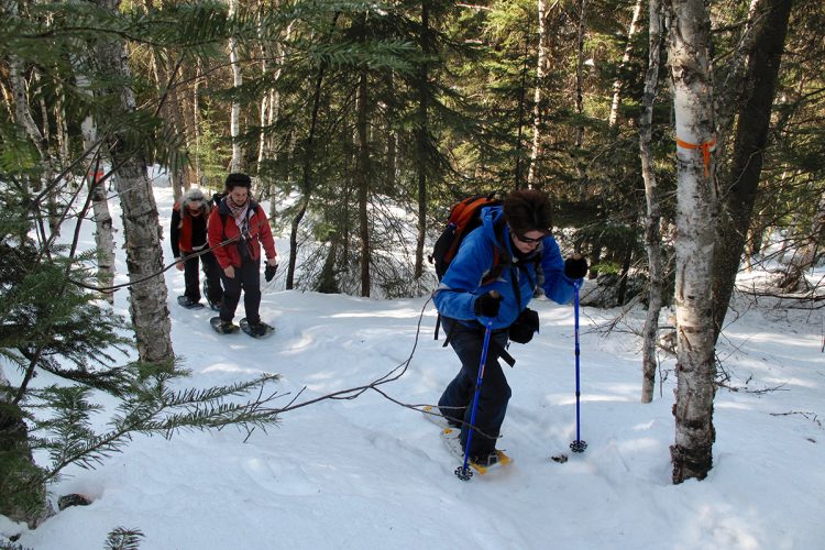
La Yol Snowshoeing Trails
Rouyn-Noranda (Arntfield), Rouyn-Noranda
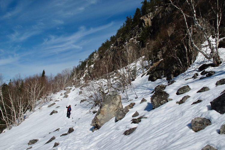
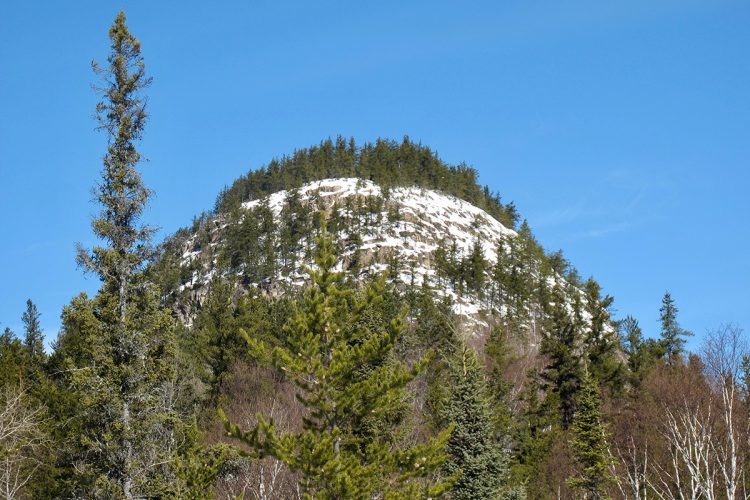
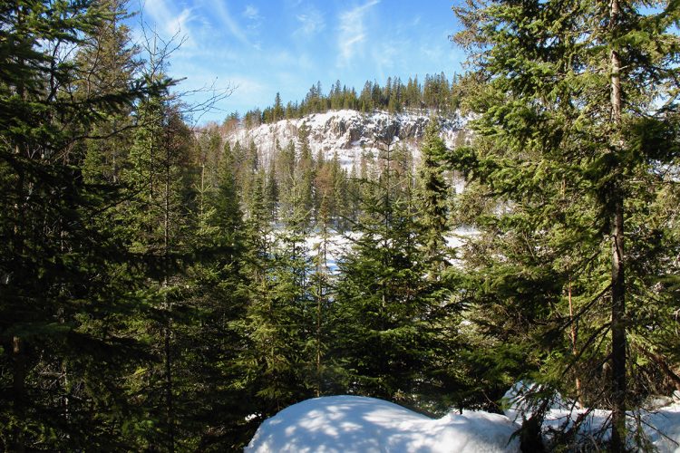
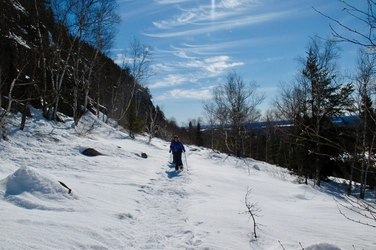
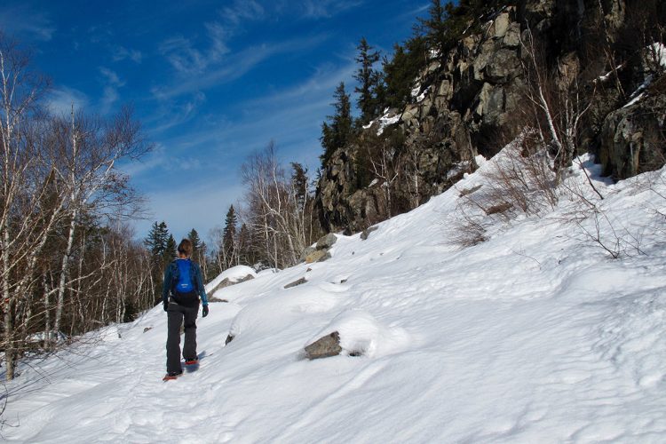
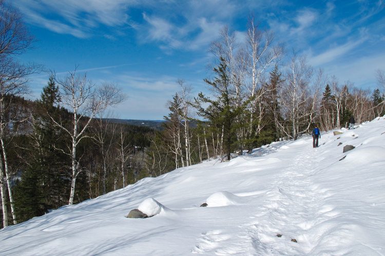
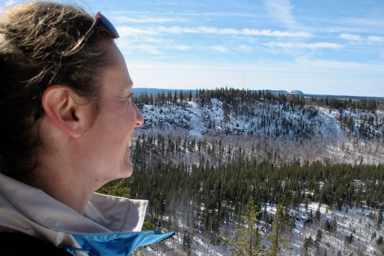
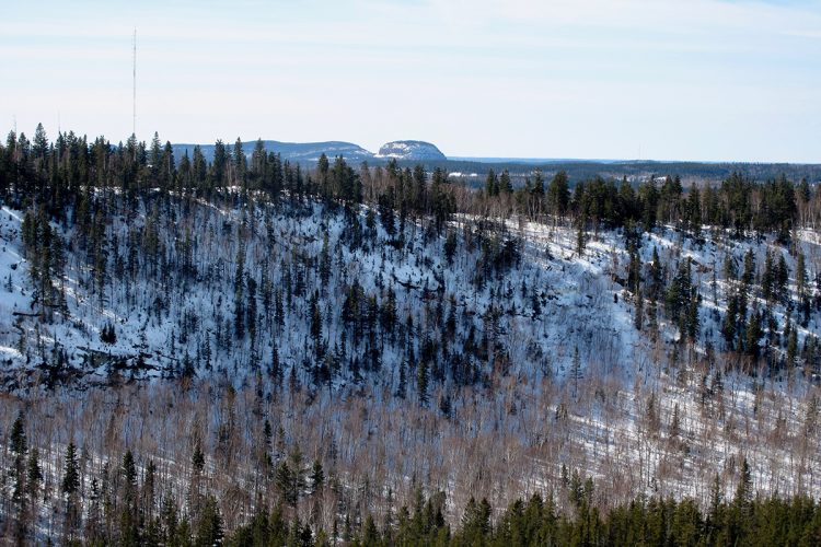
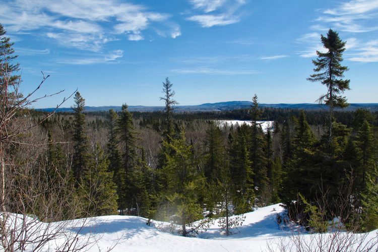
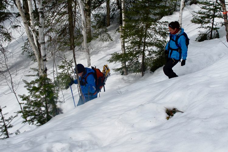
By taking the La Yol trail network, you walk through a beautiful diversity of ecosystems and geological formations with several exceptional panoramas. The view from the top of Mount Lion on the Kékéko hills, on the Mont Chaudron and on the many lakes below is spectacular. Flirting topographically with the water divide, the site lets you contemplate through wide cutouts of foliage the beginning of the Arctic and Atlantic basins with to the north, Lake Dasserat and to the south, Lake Opasatica. The Mount Kanasuta area is a major river flow corridor for the Algonquins and has various Algonquin spiritual meanings. Mount Lion was, according to some Indian legends, a high place of shamanic initiation.
- electrocardiogram Easy to Very demanding
- mountain 8.2 Km (Mixed)
- calendar seasonal
Sections
Le Sommet
- electrocardiogram Easy
- mountain 0.47 km (Linear)
Lac Castor
- electrocardiogram Easy
- mountain 1.34 km (Linear)
La Vallée du Ruisseau Clinchamp
- electrocardiogram Easy
- mountain 1.52 km (Linear)
Le Chemin de Terre
- electrocardiogram Easy
- mountain 3.54 km (Linear)
Le Surplomb Rocheux
- electrocardiogram Easy
- mountain 0.37 km (Linear)
L'Estival
- electrocardiogram Easy
- mountain 0.64 km (Linear)
L'Éboulis
- electrocardiogram Easy
- mountain 1.13 km (Linear)
La Montée du K2 Est
- electrocardiogram Easy
- mountain 0.68 km (Linear)
La Montée
- electrocardiogram Easy
- mountain 0.29 km (Linear)
Le Détour de la Montée
- electrocardiogram Easy
- mountain 0.06 km (Linear)
Le Summit
- electrocardiogram Easy
- mountain 0.47 km (Linear)
Le Détour au Sommet
- electrocardiogram Easy
- mountain 0.16 km (Linear)
Lake Castor
- electrocardiogram Easy
- mountain 1.34 km (Linear)
Passage à l'Ouest
- electrocardiogram Easy
- mountain 0.26 km (Linear)
La Kanasutorama
- electrocardiogram Easy
- mountain 0.48 km (Linear)
Clinchamp Creek Valley
- electrocardiogram Easy
- mountain 1.52 km (Linear)
Le Val Canyon
- electrocardiogram Easy
- mountain 1.49 km (Linear)
Points of service and interest
 Parking
Accessibility
Access Rights
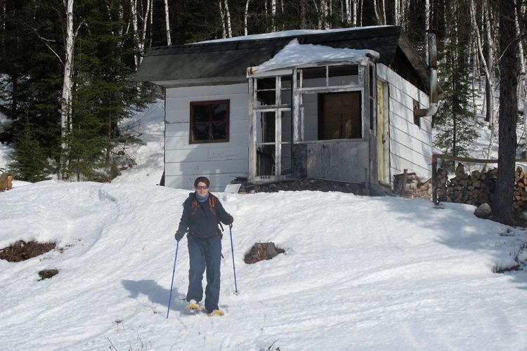
 Free, no reception infrastructure.
![]() Pets are allowed.
Pets are allowed.
Directions to the starting point
From Rouyn-Noranda, take Route 117 North. After about twenty kilometres, turn right to stay on 117 North (signs for Kirkland Lake). Turn right onto the Mount Kanasuta path and continue to the mountain.
Parking (large): Free, open year-round.
Position : 48°25'06,3"N | 77°46'33,6"O
Address : 376 Mont Kanasuta Road, Rouyn-Noranda
![]() View the route from your location on Google Map
View the route from your location on Google Map
Beaconing
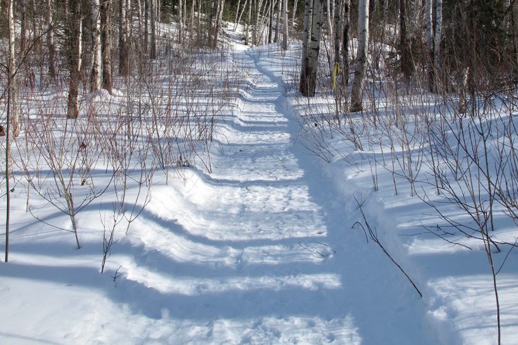
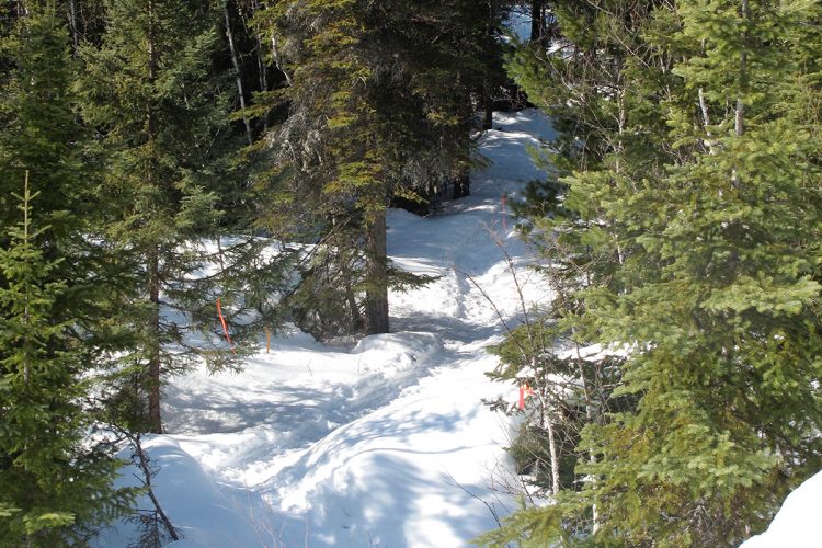
Orange ribbons hanging from a few branches or girding a trunk at good height along the edge of the track and some signs.
Contact
376 Mont Kanasuta Road | Rouyn-Noranda, Quebec T 819 279-2333
Email : info@kanasuta.com
Specifications
- Some good gradients.
Natural Environment
History
Historically, the Mount Kanasuta area has had different spiritual meanings for the Algonquins in the region. On a summer day in the year of Grace 1884, while a small wind from the northwest was cooling this day that was announcing itself as candlelight, the Oblate missionary: Father Paradis, sitting comfortably in a canoe up the lake Opasatica, Asked Okoushin, his faithful Algonquin guide, named after two twin mountains whose singular cut cut strangely on the horizon; "Kamasuta Kamatwesing, the place where you hear a sound," was the answer. The place where Machi manitoo is swinging," said a Mississagué Ojibwe. The place where the spirits dance" rebelled a third. In short it emerged from this exciting toponymy debate that the place was sacred and that since many moons future shamans were enthroned at the top of what was to become in English mapping; "the swinging hills". In addition to these Indian legends, Father Paradis brought back from his expedition a delicious watercolor from the Kanasuta Mountains and a repellent with an evocative name of "maringouinfuge" whose disturbing composition: lard, liquid tar and all the same lemongrass,f it is totally restrictive in terms of marketing.
Two centuries earlier, crossing the portage of the watershed at the foot of the Kanasuta Mountains, the Knight of Troyes with his commando of 100 strong men determined to push the English out of his counters in James Bay, would certainly have appreciated the dissuasive effects of the anti-mosquito spray.
Towards the end of the XIX century, an exploitation of natural resources worthy of the name was established in the vicinity of the 2 mountains. It was first the forest cuts prefiguring "The Boreal Error" of Richard Desjardins, then came the mining activity. They are still being practiced. As for the massif itself, it was not really used until the 1960s, with the creation of a ski centre on the slopes of K1.
Flora
The Kanasuta area, a long-time resource-rich area, has become a symbol of local environmentalists' struggle against clear-cutting. It is precisely this small mountain - Mount Kanasuta - that gave its title to the most recent album of the fervent Richard Desjardins. Certainly, in terms of forests, the site cannot be considered exceptional, except for a small stand of "large-toothed" poplars, a very rare species at this latitude, awaiting an official designation of "Exceptional Forest Ecosystem" (EFE).
Comments social0
Tools ready to go
- mapsquare Download GPS track (GPX)
- Google driving directions
-
 Sunrise : 07:20
Sunset : 18:47 -
Equipment for rent RécréOsisko
Info & advice
- Animation et interprétation
- Camping
- Care
- Carte et orientation
- Clothes
- Emergency
- Equipment
- Nutrition
- Prevention
- Training
Caution
This sheet has been prepared from information provided by outdoor enthusiasts deemed sufficiently reliable and experienced. Errors or omissions are always possible and Tourisme Abitibi-Témiscamingue cannot accept responsibility for any problem or accident that may arise from this sheet or be attributed to its use. If you notice any errors or omissions during your expedition, we would be very grateful if you would let us know by email pleinair@atrat.org in order to keep our information up to date.
