
Opasatica Snowshoeing Trails
Opasatica Snowshoeing Trails
Rouyn-Noranda (Montbeillard), Rouyn-Noranda
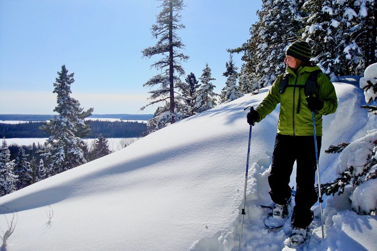
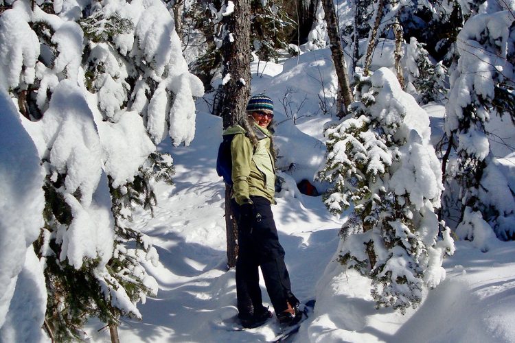
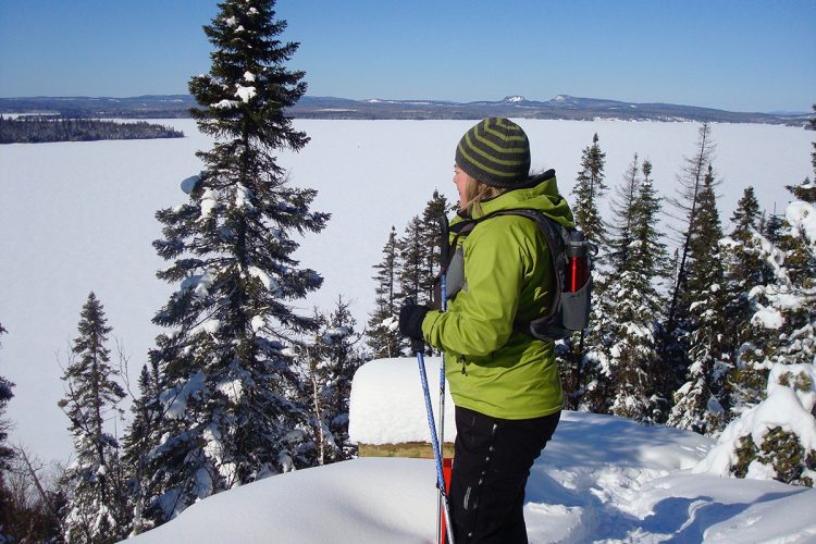
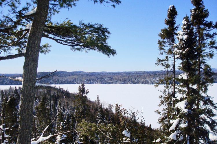
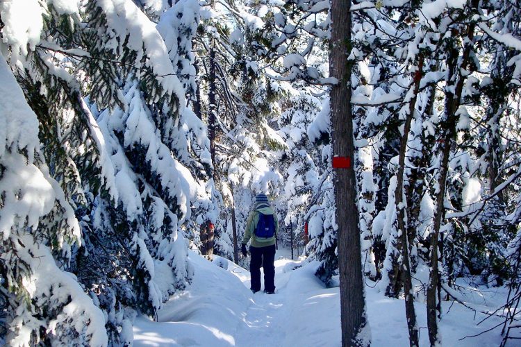
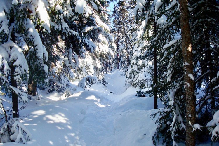
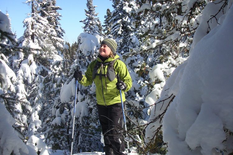
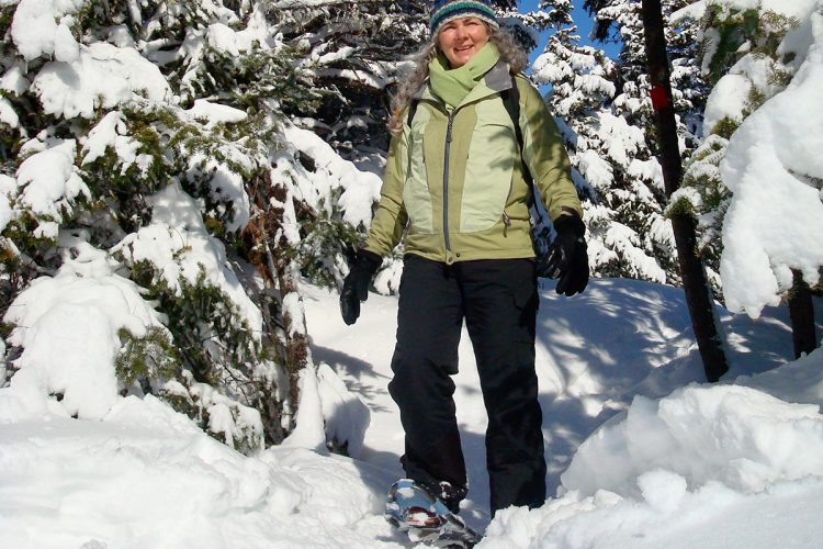
The Opasatica Snowshoeing Trails – also known as the “José Trails” – are nestled on a narrow strip of land between Baie Verte and Baie de l’Orignal on Lake Opasatica. As you walk along the ridgeline, you'll reach promontories offering breathtaking views of the lake and surrounding landscapes. Venturing into the forest, you’ll experience the simple pleasure of being present – with no screen between you and your thoughts.
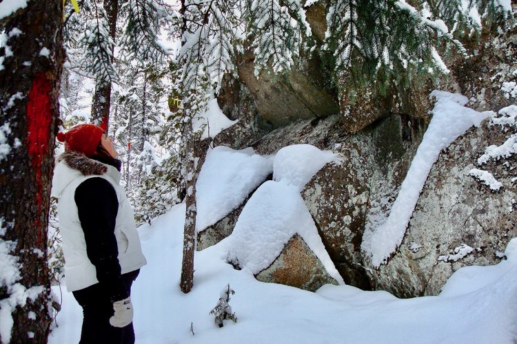
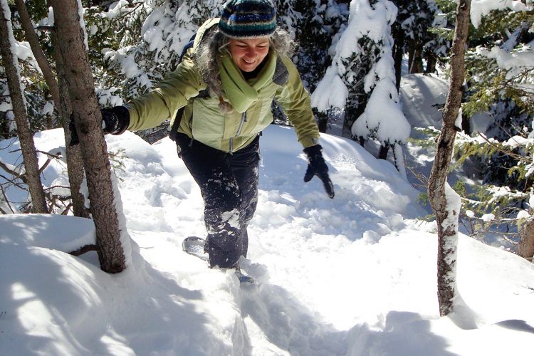
Some sections skirt beautiful cliffs, adding to the trail's scenic appeal. The network features multiple access points and three parallel routes of varying difficulty. Choose your path based on your fitness level and how much time you have. The mountainous terrain and patchwork of forest ecosystems make this natural area ecologically rich and rewarding to explore.
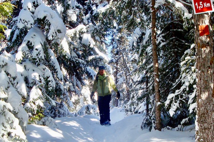
Trail Marking : Paint and tape
- Some good gradients sometimes on uneven terrain and rocky outcrops.
- Presence of cliffs.
- Several very secure observation points with safety ramps.
- electrocardiogram Easy to Demanding
- mountain 12 Km (Mixed)
- calendar seasonal
Sections
Accès-Rue des amis 1
- electrocardiogram Easy
- mountain 0.40 km (Linear)
Accès-Rue des amis 2
- electrocardiogram Easy
- mountain 0.16 km (Linear)
Accès-Rue des amis 3
- electrocardiogram Easy
- mountain 0.47 km (Linear)
Connexion 007
- electrocardiogram Easy
- mountain 0.03 km (Linear)
Connexion 01
- electrocardiogram Easy
- mountain 0.17 km (Linear)
Connexion 02
- electrocardiogram Easy
- mountain 0.18 km (Linear)
Connexion 03
- electrocardiogram Easy
- mountain 0.21 km (Linear)
Connexion 04
- electrocardiogram Easy
- mountain 0.21 km (Linear)
Connexion 05
- electrocardiogram Easy
- mountain 0.07 km (Linear)
Connexion 07
- electrocardiogram Easy
- mountain 0.12 km (Linear)
Détour du point de vue 1
- electrocardiogram Easy
- mountain 0.19 km (Linear)
Détour du point de vue 2
- electrocardiogram Easy
- mountain 0.03 km (Linear)
Détour du point de vue 4
- electrocardiogram Easy
- mountain 0.03 km (Linear)
Détour du point de vue 5
- electrocardiogram Easy
- mountain 0.05 km (Linear)
Détour du point de vue 6
- electrocardiogram Easy
- mountain 0.05 km (Linear)
Détour du point de vue 7
- electrocardiogram Easy
- mountain 0.01 km (Linear)
Sentier-Bleu
- electrocardiogram Easy
- mountain 1.46 km (Linear)
Sentier-Jaune
- electrocardiogram Easy
- mountain 2.47 km (Linear)
Sentier-Pointe Jaune
- electrocardiogram Easy
- mountain 0.35 km (Linear)
Sentier-Pointe rouge
- electrocardiogram Easy
- mountain 0.99 km (Linear)
Sentier-Rouge
- electrocardiogram Easy
- mountain 3.84 km (Linear)
Blue-Trail
- electrocardiogram Easy
- mountain 1.46 km (Linear)
Yellow-Trail
- electrocardiogram Easy
- mountain 2.47 km (Linear)
Yellow Point-Trail
- electrocardiogram Easy
- mountain 0.35 km (Linear)
Red Point-Trail
- electrocardiogram Easy
- mountain 0.99 km (Linear)
Red-Trail
- electrocardiogram Easy
- mountain 3.84 km (Linear)
Detour from viewpoint 1
- electrocardiogram Easy
- mountain 0.19 km (Linear)
Access-Rue des amis 1
- electrocardiogram Easy
- mountain 0.40 km (Linear)
Access-Rue des amis 2
- electrocardiogram Easy
- mountain 0.16 km (Linear)
Access-Rue des amis 3
- electrocardiogram Easy
- mountain 0.47 km (Linear)
Connection 01
- electrocardiogram Easy
- mountain 0.17 km (Linear)
Connection 02
- electrocardiogram Easy
- mountain 0.18 km (Linear)
Connection 03
- electrocardiogram Easy
- mountain 0.21 km (Linear)
Connection 04
- electrocardiogram Easy
- mountain 0.21 km (Linear)
Connection 05
- electrocardiogram Easy
- mountain 0.07 km (Linear)
Connection 07
- electrocardiogram Easy
- mountain 0.12 km (Linear)
Points of service and interest
Category Name
-
 Parking
Stationnement des sentiers Opasatica
48°6'31,784"N
Parking
Stationnement des sentiers Opasatica
48°6'31,784"N
79°17'54,745"O -
Parking
Stationnement des sentiers Opasatica
48°7'16,14"N
79°17'10,212"O -
Parking
Stationnement des sentiers Opasatica
48°6'20,361"N
79°18'22,525"O -
 Panorama
Point de vue Opasaticap
48°6'44,208"N
Panorama
Point de vue Opasaticap
48°6'44,208"N
79°17'17,304"O -
 Rocky beach / swimming
Plage de galet Opasatica
48°06'03.6"N
Rocky beach / swimming
Plage de galet Opasatica
48°06'03.6"N
79°18'37.8"O -
Panorama
Point de vue
48°6'59,532"N
79°16'39,911"O -
Panorama
Point de vue Opasatica
48°6'59,236"N
79°16'42,2"O -
Panorama
Point de vue OpasaticaP
48°7'5,501"N
79°16'49,711"O -
Panorama
Point de vue Opasatica
48°6'15,808"N
79°18'25,163"O -
Panorama
Point de vue
48°6'39,316"N
79°17'30,303"O -
Panorama
Point de vue Opasatica
48°7'9,408"N
79°16'55,308"O -
 Bench
Banc Opasatica
48°6'14,261"N
Bench
Banc Opasatica
48°6'14,261"N
79°18'23,367"O -
Bench
Banc Opasatica
48°6'20,541"N
79°18'8,856"O -
Bench
Banc Opasatica
48°6'47,113"N
79°17'3,505"O -
Bench
Banc Opasatica
48°6'44,1"N
79°17'7,08"O
Accessibility
Access Rights
Free, no reception infrastructure.
Pets allowed.
Directions to the starting point
From Rouyn-Noranda, take Route 101 South towards Ville-Marie. Continue on Highway 101 South and 6.3 km after the fork of Highway 117 North which leads into Ontario, turn right onto Green Bay Road (be vigilant). The first parking lot is on your left after 1.6 km and the second at the end of rue des Amis, keeping left, 2.7 km further on. Parking: free, located at the east end of the trail on Green Bay Street.
Coordinates
Rue de la Baie-Verte, Rouyn-Noranda (Monbeillard)
T.: 819 797-2985
Natural Environment
History
The lake was formed when glaciers melted about 20,000 years ago. It is located in the important traffic axis of the Abitibi River and the Ottawa River, which formed a real prehistoric highway. Archaeological excavations have revealed a 2,500 year old Aboriginal occupation.
Geography
Lake Opasatica, also called Long Lake, is one of the largest water bodies in the region with 48 kme area. The lake is 33 kilometres long and 6 kilometres wide. It is 60 metres deep. With 20% of its shore inhabited, it is one of the wildest lakes in the area. Its relief is a hilly plain with some hills. The altitude varies between 263 and 373 meters.
Flora
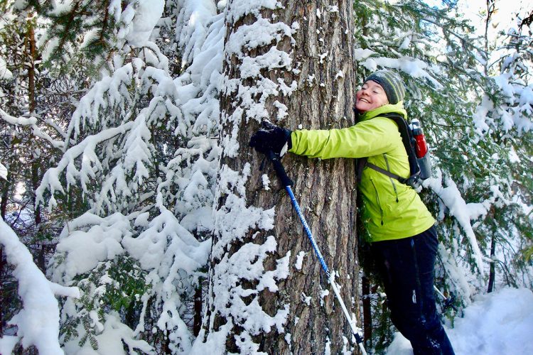
There is a particular vegetation for the area, made up of several species of trees such as very large pines, spruces, thujas and yellow birches and in several places, the path is covered with a beautiful carpet of moss. The territory is a projected biodiversity reserve currently on the BAPE table.
Toponymy
Of Algonquin origin, the name Opasatica*, listed since the beginning of the 20th century, would be formed from Obié or Opa, which means shrunken and Satika, translated as there are aspens. According to the sources, one gets lake surrounded by poplars, strait of poplars or lake closed by aspens.
Comments social0
Tools ready to go
- map Guide map (PDF)
- mapsquare Download GPS track (GPX)
- Google driving directions
-
 Sunrise : 07:29
Sunset : 18:36 -
Equipment for rent RécréOsisko
Info & advice
- Animation et interprétation
- Camping
- Care
- Carte et orientation
- Clothes
- Emergency
- Equipment
- Nutrition
- Prevention
- Training
Caution
This sheet has been prepared from information provided by outdoor enthusiasts deemed sufficiently reliable and experienced. Errors or omissions are always possible and Tourisme Abitibi-Témiscamingue cannot accept responsibility for any problem or accident that may arise from this sheet or be attributed to its use. If you notice any errors or omissions during your expedition, we would be very grateful if you would let us know by email pleinair@atrat.org in order to keep our information up to date.
