
Duhamel-Ouest Winter Recreational Trails
Duhamel-Ouest Winter Recreational Trails
Duhamel-Ouest, Témiscamingue
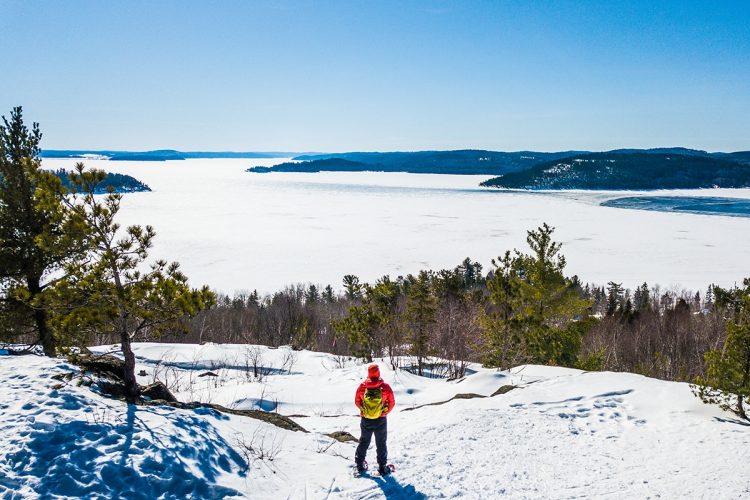
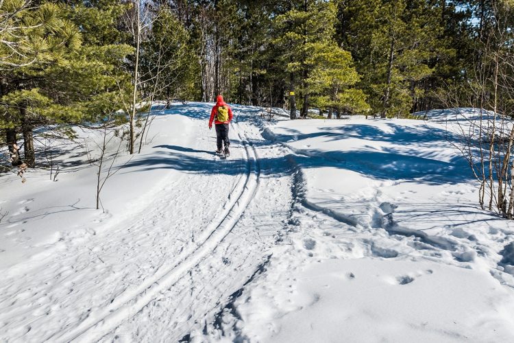
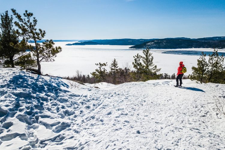
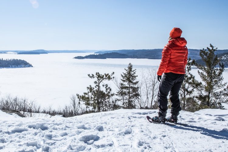
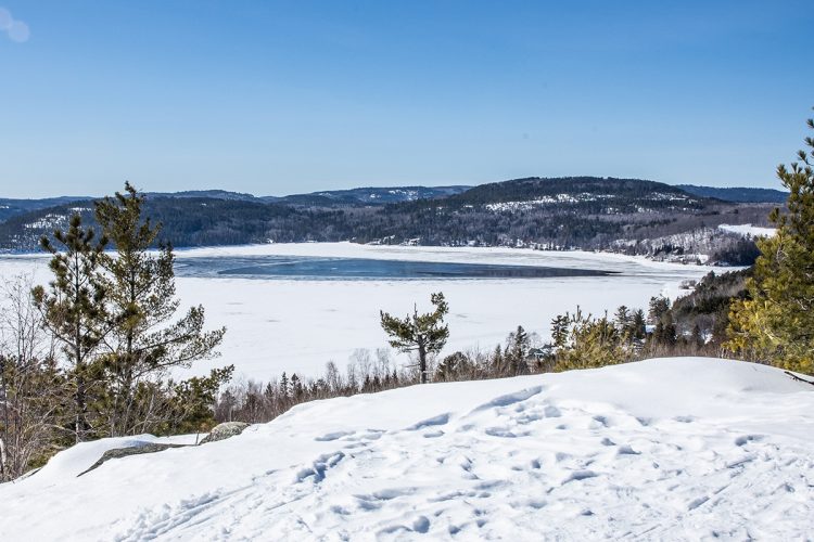
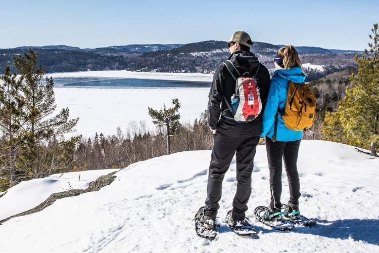
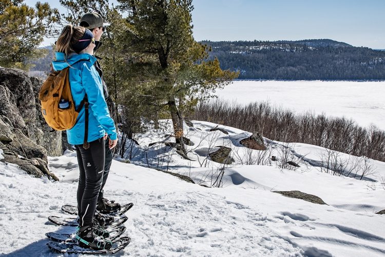
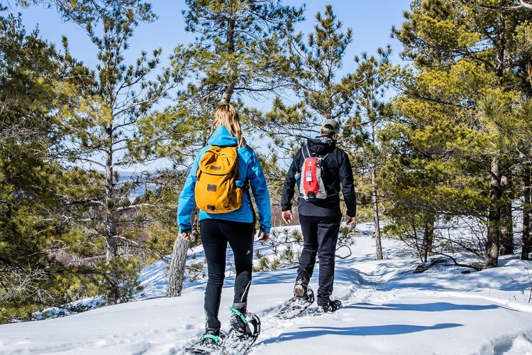
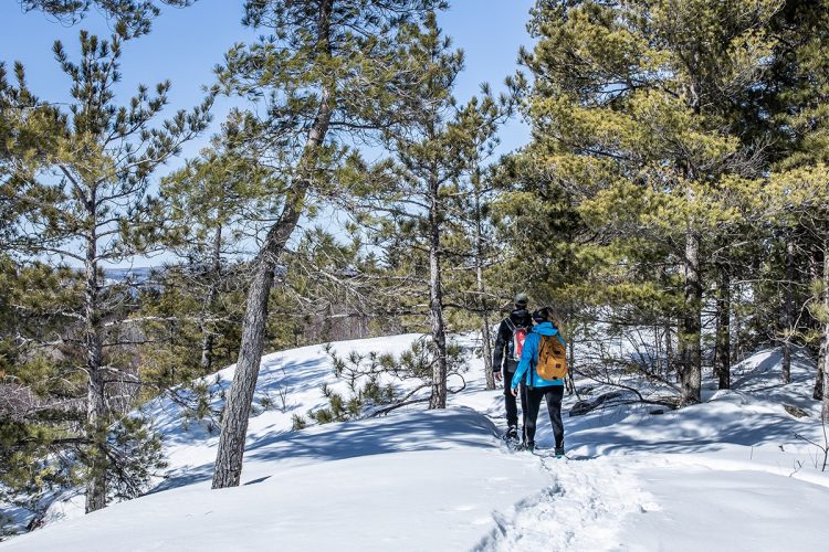
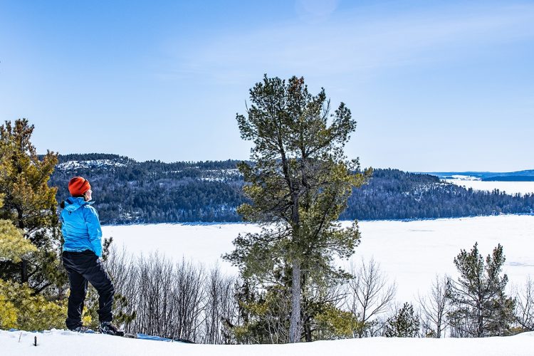
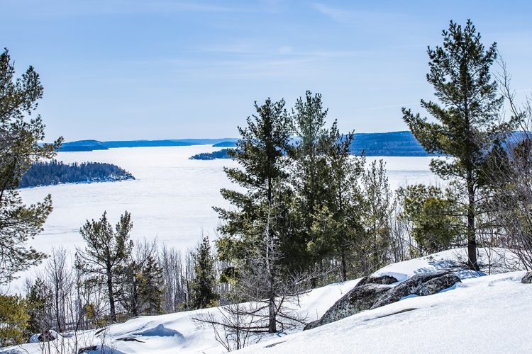
The winter recreational trails stretch between two mountains — La Bannik and Lachapelle Mountain, near Ville-Marie. The highest points reach 267 meters, offering breathtaking views of majestic Lake Témiscamingue, Lake Laperrière, and the town of Ville-Marie. A trail circles the Laperrière marsh, a true bird sanctuary. A footbridge between the marsh and Lake Laperrière brings you into the heart of a wide-open landscape — peaceful and enchanting. The trail network winds through the Témiscamingue boreal forest, where a rich variety of coniferous and deciduous trees can be found, including cedars, pines, oaks, and maples.
- electrocardiogram Easy to Moderate
- mountain 24.1 Km (Mixed)
- calendar seasonal
Sections
La Côte à Cardinal
- electrocardiogram Easy
- mountain 0.34 km (Linear)
La Croix
- electrocardiogram Easy
- mountain 0.55 km (Linear)
Le Porc-Épic
- electrocardiogram Easy
- mountain 0.54 km (Linear)
La Montagne Lachapelle
- electrocardiogram Easy
- mountain 1.50 km (Loop)
Le Versant Estel
- electrocardiogram Easy
- mountain 0.20 km (Linear)
Le Plateau Ovide
- electrocardiogram Easy
- mountain 0.44 km (Linear)
L'Intrépide
- electrocardiogram Moderate
- mountain 0.38 km (Linear)
Le Lièvre
- electrocardiogram Easy
- mountain 0.73 km (Linear)
La Boucle du Marais Laperrière
- electrocardiogram Easy
- mountain 2.03 km (Loop)
Le Sentier du Pavillon
- electrocardiogram Easy
- mountain 0.17 km (Linear)
Le Raccourci du Marais
- electrocardiogram Easy
- mountain 0.10 km (Linear)
Le Sentier du Quai
- electrocardiogram Easy
- mountain 0.09 km (Linear)
La Côte du Harfang
- electrocardiogram Moderate
- mountain 0.26 km (Linear)
La Boucle Réva
- electrocardiogram Easy
- mountain 1.39 km (Loop)
Le Jaseur
- electrocardiogram Easy
- mountain 0.35 km (Loop)
Le Faucon Pèlerin
- electrocardiogram Easy
- mountain 2.64 km (Loop)
La Traversée de la Mésange
- electrocardiogram Easy
- mountain 0.27 km (Linear)
Le Geai Bleu
- electrocardiogram Easy
- mountain 1.07 km (Mixed)
Le Grand-Duc
- electrocardiogram Moderate
- mountain 6.71 km (Linear)
Points of service and interest
Category Name
-
 Guiding Adventure
Coop de l'Arrière-Pays
47°19'58.2"N
Guiding Adventure
Coop de l'Arrière-Pays
47°19'58.2"N
79°26'14.9"O -
 Panorama
Point de vue du sentier de La Croix
47°19'21.6"N
Panorama
Point de vue du sentier de La Croix
47°19'21.6"N
79°26'39.8"O -
Panorama
Point de vue du sentier Le Porc-Épic
47°19'04.3"N
79°26'44.3"O -
 Parking
Stationnement du Marais Laperrière
47°18'33.1"N
Parking
Stationnement du Marais Laperrière
47°18'33.1"N
79°27'11.2"O -
 Bench
Banc
47°18'33.8"N
Bench
Banc
47°18'33.8"N
79°27'04.0"O -
 Picnic table
Tables de pique-nique
47°18'30,009"N
Picnic table
Tables de pique-nique
47°18'30,009"N
79°27'0,976"O -
 Toilet
 sèche du stationnement du Marais Laperrière
47°18'29,581"N
Toilet
Toilet sèche du stationnement du Marais Laperrière
47°18'29,581"N
79°27'2,012"O -
Bench
Banc
47°18'23,18"N
79°26'44,253"O -
Bench
Banc
47°18'20,912"N
79°26'54,931"O -
 Bridge
Passerelle du Marais Laperrière
47°18'19.6"N
Bridge
Passerelle du Marais Laperrière
47°18'19.6"N
79°26'46.5"O -
 Belvedere
Station d'écoute
47°18'26,895"N
Belvedere
Station d'écoute
47°18'26,895"N
79°26'45,683"O -
 Observation tower
Tour d'observation
47°18'18,994"N
Observation tower
Tour d'observation
47°18'18,994"N
79°26'41,428"O -
Panorama
Point de vue La Bannik
47°17'43.9"N
79°27'31.1"O -
Panorama
Point de vue La Bannik
47°17'44.0"N
79°27'19.9"O -
Panorama
Point de vue La Bannik
47°17'48.3"N
79°27'09.2"O -
Belvedere
Belvédère de la Bannik
47°17'37.9"N
79°26'56.8"O -
Belvedere
Belvédère du Corbeau
47°17'39.3"N
79°26'48.1"O -
Parking
Stationnement La Bannik des sentiers récréatifs d'hiver
47°17'29.6"N
79°27'12.1"O
Accessibility
Access Rights
 Free, no welcome infrastructure.
![]() Pets are allowed.
Pets are allowed.
Directions to access trails
ACCESS THE MARAIS LAPERRIÈRE
From Ville-Marie, go south on rue des Oblats Sud/QC-101 Sud. Turn right on Saint-Andre/QC-101 Sud (600 m). Turn right onto Rue Notre-Dame Sud (2.4 km). The destination is on your left.
Parking: free
Position : 47°18'32.9"N | 79°27'11.6"O
![]() View the route from your location on Google Map
View the route from your location on Google Map
ACCESS LA BANNIK
From Ville-Marie, head south on Rue des Oblats Sud/QC-101 South. Turn right onto Saint-Andre/QC-101 South (signs for Témiscaming) (4.7 km). Turn right onto Chemin du Vieux Fort (1.1 km). Continue on Chemin du Vieux Fort (800 m). Keep right (700 m). The destination will be on your right.
Parking : Free
Position : 47°17'29.6"N | 79°27'12.1"O
Specifications
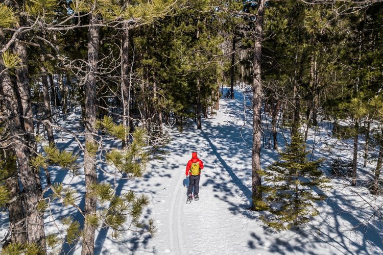
The trails are designated for classic skiing (single track), snowshoeing, and hiking.
Comments social0
Tools ready to go
- mapsquare Download GPS track (GPX)
- Google driving directions
-
 Sunrise : 07:30
Sunset : 18:38 -
Equipment for rent Coop de l'Arrière-Pays
Info & advice
- Animation et interprétation
- Camping
- Care
- Carte et orientation
- Clothes
- Emergency
- Equipment
- Nutrition
- Prevention
- Training
Caution
This sheet has been prepared from information provided by outdoor enthusiasts deemed sufficiently reliable and experienced. Errors or omissions are always possible and Tourisme Abitibi-Témiscamingue cannot accept responsibility for any problem or accident that may arise from this sheet or be attributed to its use. If you notice any errors or omissions during your expedition, we would be very grateful if you would let us know by email pleinair@atrat.org in order to keep our information up to date.
