
Harricana River Source Paddling Trail
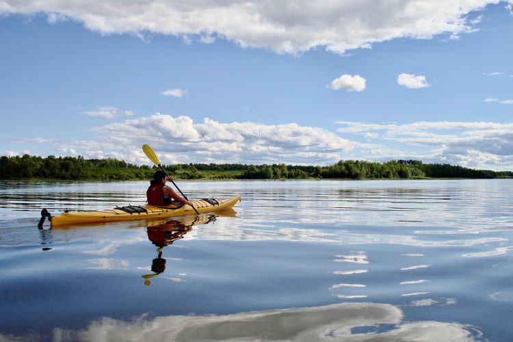
Harricana River Source Paddling Trail
Val-d’Or, Amos Région
Mourier Lake / Lemoine Lake / Thompson River / De Montigny Lake / Harricana River / Malartic Lake / La Motte Lake/ Figuery Lake / Harricana River (Amos)
- electrocardiogram Moderate
- mountain 95.7 Km (Linear)
- calendar seasonal
Sections
Lake Mourier, Lake Lemoine, and Thompson River
- electrocardiogram Easy
- mountain 28,2 km (Linear)
Access : Via the boat launch at Lake Mourier
Interest : Elongated body of water, relatively flat terrain.
Danger : Motorized boat traffic.
De Montigny lake
- electrocardiogram Moderate
- mountain 7 km (Linear)
Access : Via the Thompson River.
Interest : Body of water in an urban area, high concentration of cottages and residences along the shores, relatively flat terrain.
Danger : Turbulent in strong winds, motorized boat traffic.
Harricana River
- electrocardiogram Easy
- mountain 18,5 km (Linear)
Access : Par le lac De Montigny.
Interest : Wild environment, relatively flat terrain, marshy, spruce-dominated forest, a few hunting camps along the shores, clay banks.
Malartic Lake, Harricana River et La Motte Lake
- electrocardiogram Moderate
- mountain 22,2 km (Linear)
Access : Par la rivière Harricana.
Interest : Agricultural and rural environment, relatively flat terrain, rocky and sandy shores, high concentration of cottages and residences along the shores..
Danger : Turbulent in strong winds, motorboat traffic.
Figury Lake et Harricana River (Amos)
- electrocardiogram Moderate
- mountain Via La Motte.Lake (Linear)
Interest : Agricultural and rural environment, urban environment, relatively flat terrain, clay shores, high concentration of cottages and residences along the shores.
Danger : Motorboat traffic.
Points of service and interest
Category Name
-
 Launching ramp
Mise à l’eau du Centre plein air du Lac Mourier
(12, avenue Baie du Club, Malartic)
47°58'58.408”N
Launching ramp
Mise à l’eau du Centre plein air du Lac Mourier
(12, avenue Baie du Club, Malartic)
47°58'58.408”N
78°7'55.452”O -
 Sandy beach / Swimming
Plage du lac Lemoine
48°0'12.151”N
Sandy beach / Swimming
Plage du lac Lemoine
48°0'12.151”N
78°0'18.709”O -
Launching ramp
Marina Thompson
(33, de la Marina, dans le quartier Dubuisson à Val-d’Or)
48°5'22.845”N
77°53'5.206”O -
 Wild camping
Camping sauvage de la rivière Harricana
48°12'50.189N
Wild camping
Camping sauvage de la rivière Harricana
48°12'50.189N
77°58'2.425”O -
Launching ramp
Rampe de mise à l’eau de La Motte
48°20'13.938”N
78°6'34.969”O -
Wild camping
Camping sauvage de l'île Lorette
48°21'1.948N
78°5'57.664”O -
Wild camping
Camping sauvage de l'île Jeannine
48°21'55.305N
78°5'13.274”O -
Wild camping
Camping sauvage de l'île aux Fesses
48°26'19.465N
78°4'4.842”O -
Launching ramp
Rampe de mise à l’eau de St-Marc-de-Figuery
48°28'21.392”N
78°5'26.558”O -
Launching ramp
Rampe de mise à l’eau du Club nautique d’Amos
(chemin de la Marina, Amos)
48°33'31.39”N
78°6'41.461”O
Accessibility
Indications to the starting point
From Val-d'Or, take the road 117 North. Turn left on La Salle Street. Turn left on the way to Lac Mourier. Turn left to continue on the Fournier Lac Mourier road. Turn left on Avenue Baie du Club to the beach.
Public outdoor parking and launch ramp.
Position : 78°7'55,452"O 47°58'58,408"N
Indications to the point of arrival
In Amos, go to the end of the Marina Road.
Public outdoor parking and launch ramp
Position : 78°6'41,461"O 48°33'31,39"N
Specifications
Topographic Maps
Topographic maps at a scale of 1:50,000 exist for the entire course of the river and we recommend that you use them in conjunction with this guide card.
32 C/4 La Lemoine, riv. Thomson, lac De Montigny, riv. Harricana
32 C/5 Harricana River, Malartic Lake, La Motte Lake
32 D/8 Harricana River, Malartic Lake, La Motte Lake
32 D/9 Harricana River
Total slope: none
Danger
The lakes De Montigny, Marlartic and La Motte are tumultuous by strong wind.
Campsite
Campsites are sufficient. They are distributed all
along the route and vary in quality.
Natural Environment
Géography
James Bay watershed
The Harricana River flows northward, originates in Lakes Blouin, De Montigny, Lemoine and Mourier, and empties into James Bay some 553 km further north.
The Harricana River is the second longest waterway in Canada (170 km of waterway). It originates in the lakes Blouin, De Montigny, Lemoine and Mourier near Val-d'Or and flows into James Bay some 553 kilometres to the north.
Fauna
The course is known for its very diverse wildlife which includes, among others, black duck, kingfisher, great heron, great woodpecker, porcupine, red squirrel, beaver, muskrat, hare, weasel, marten, mink, striped skunk, otter, orignal, black bear, grey wolf, coyote, red fox, lynx.
Flora
The water bodies are located in the boreal forest in the area of white birch fir, which includes, among others, cedar, white and black spruce, balsam fir, aspen and birch.
History
An interesting flow and relatively calm terrain, relative to the other rivers of James Bay, have made the Harricana River a busy waterway. The first users were the Algonquins. As a tributary of James Bay, and thus of Hudson Bay, the Harricana River and its basin were owned by the Hudson’s Bay Company until they were purchased by Canada in 1869. The territory was officially annexed to the province of Quebec in 1898 and settlement efforts began. In 1906, Henry O'Sullivan explored the banks of the Harricana and in 1908, the first camps were established on the banks of the river at the height of the rapids. These are supply camps for the construction of a transcontinental railway. Some years later, in 1910, the first settlers arrived and founded the town of Amos in 1912 at the point where the railway crosses the river.
Toponymy
The original name of the Harricana River is "Nanikana". But the missionaries of the time learned the Algonquin language from sound and distorted this word to make it "Harricana". The Algonquin expression Nanikana takes on its full meaning when it is explained that it means " The main way". Some sources claim that the name is of Algonquin origin and means Biscuit River. The term biscuits refers to the many flat pebbles found on the banks of the river.
Comments social0
Tools ready to go
- map Guide map (PDF)
- mapsquare Download GPS track (GPX)
- Google driving directions
-
 Sunrise : 07:24
Sunset : 18:30
- pdf Planification
- pdf Pmu Harricana
- pdf Ps Harricana
- pdf Autoevaluation Kayak
- pdf Trousse Kayak
- pdf Equipement Kayak
- pdf Trousse Canot
- pdf Autoevaluation Canot
- pdf Equipement Canot
Info & advice
- Animation et interprétation
- Camping
- Care
- Carte et orientation
- Caution
- Classification
- Emergency
- Equipment
- Jamais sans mon chien
- Nutrition
-
Prevention
- 10 articles de première nécessité
- Bien s'hydrater
- Comment lire la météo dans les nuages? Faire la pluie et le beau temps !
- Connaître son groupe et son plan d’eau
- Éviter les mauvaises rencontres en milieu sauvage
- Feu de camp sécuritaire : trois étapes à respecter
- Insectifuges
- Les moustiques
- Lunettes de soleil
- MALADIE DE LYME : PRÉVENIR LES PIQÛRES DE TIQUE EN RANDONNÉE
- Perdu en forêt : quoi faire?
- Règles de sécurité en canot et en kayak
- Se protéger contre le soleil
- Signalisation nautique internationale
- Vaporisateur Chasse-ours
- Progression
- Réglementation
- Training
Caution
This sheet has been prepared from information provided by outdoor enthusiasts deemed sufficiently reliable and experienced. Errors or omissions are always possible and Tourisme Abitibi-Témiscamingue cannot accept responsibility for any problem or accident that may arise from this sheet or be attributed to its use. If you notice any errors or omissions during your expedition, we would be very grateful if you would let us know by email pleinair@atrat.org in order to keep our information up to date.
