
Kinojevis Paddling Trail
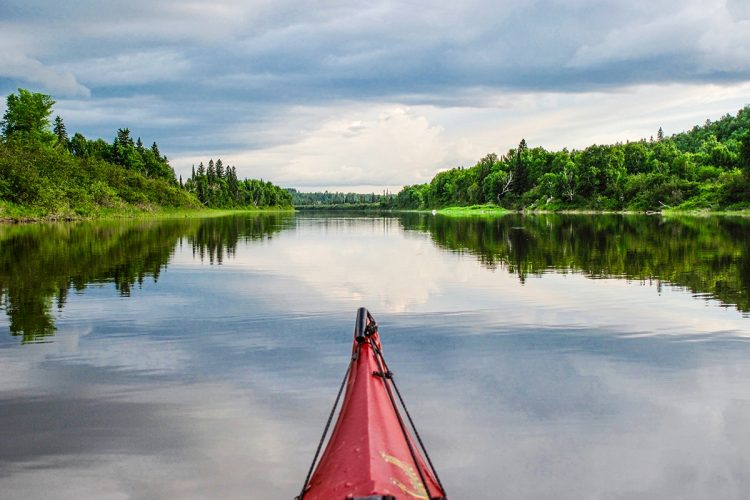
Kinojevis Paddling Trail
Preissac, Amos Région
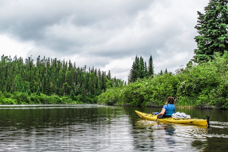
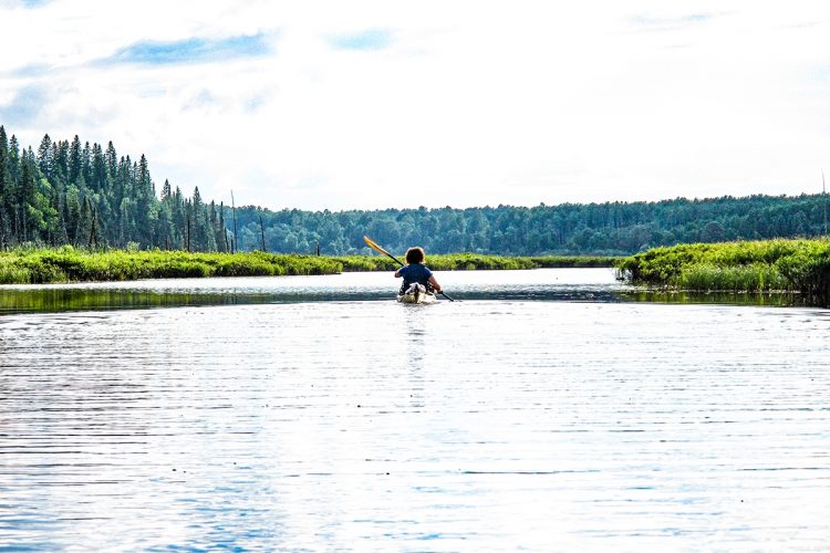
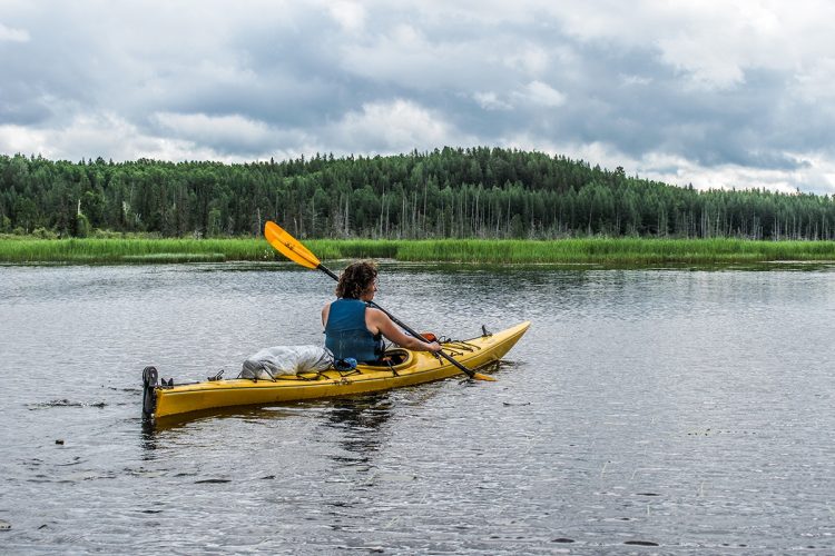
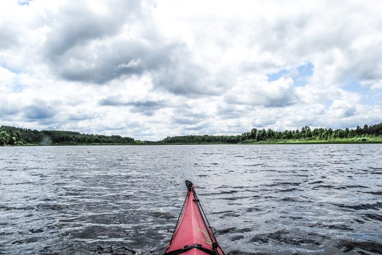
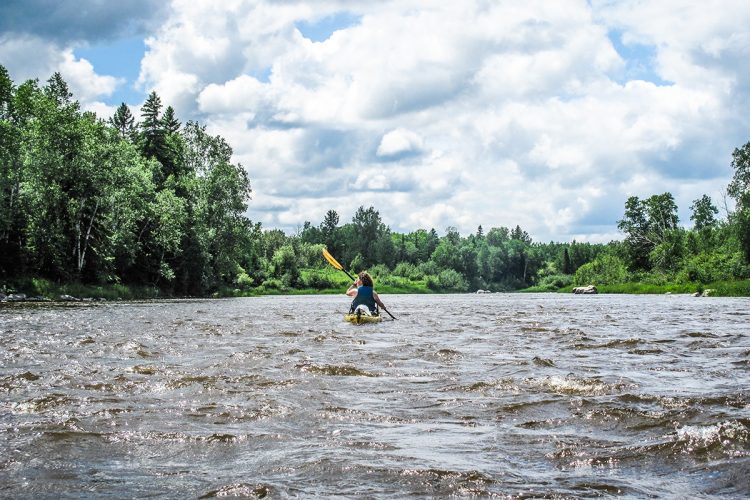
Kinojévis River - from Preissac to Rouyn-Noranda (Mont-Brun, Cléricy, McWatters)
- electrocardiogram Demanding
- mountain 94 Km (Linear)
- calendar seasonal
Sections
From Preissac to parc national d’Aiguebelle
- electrocardiogram Demanding
- mountain 36,5 km (Linear)
Access : By the Preissac water ramp.
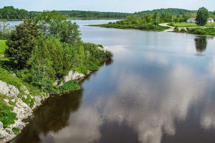
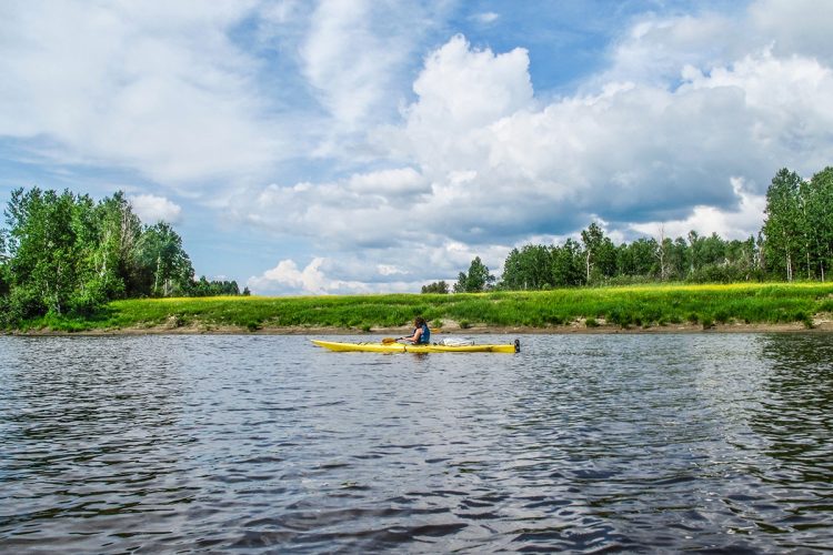
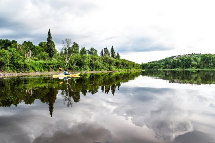
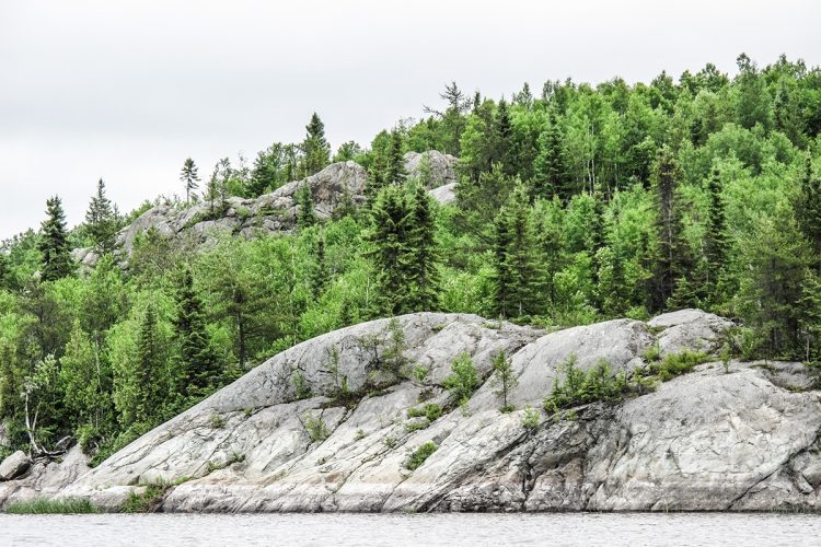
Interest : Preissac interpretive circuit, wilderness, slow current, low relief, wide water course, clay banks, several hunting camps.
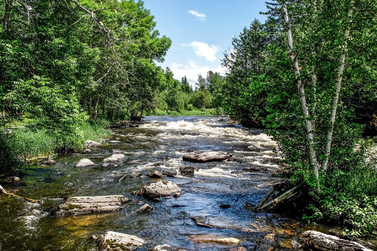
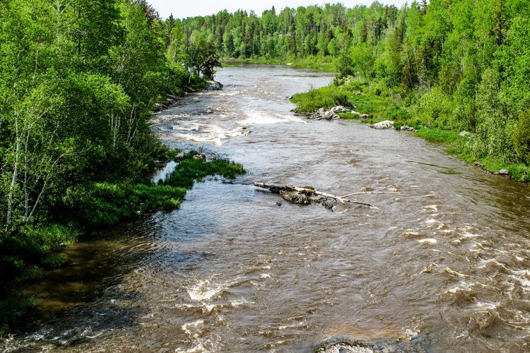
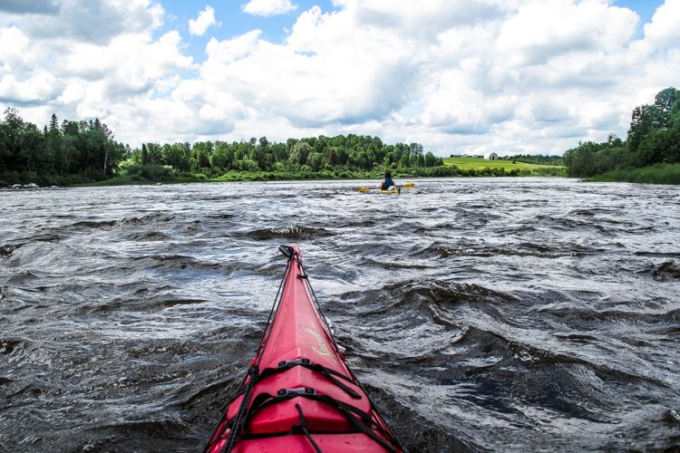
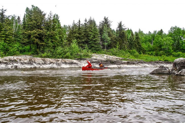
Danger : 3 rapids of class Rll and Rlll 1/5 without carrying.
From ruisseau Matissard to Camping Abijévis
- electrocardiogram Moderate
- mountain 2,1 km (Linear)
Access : By the inojévis river.
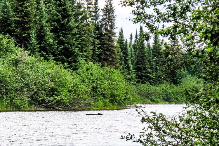
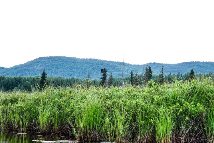
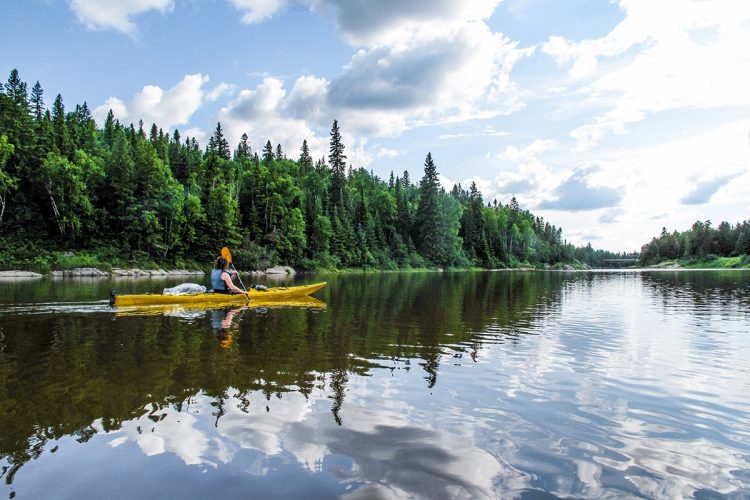
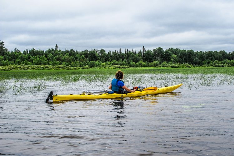
Interest : Swampy, wild and mature forest landscapes, clay and sandy shores, bird watching, hiking trail (Aiguebelle national park).
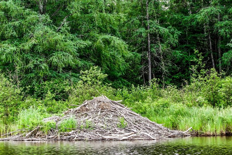
Danger : Cordelle and crosses a beaver dam.
From parc national d’Aiguevelle to Mont-Brun
- electrocardiogram Easy
- mountain 9,5 km (Linear)
Access : By Matissard Lake, Matissard Creek and Kinojévis River.
Interest : Wilderness, discreet relief, widening of the river to the bridge of the village.
From Mont-Brun to Cléricy
- electrocardiogram Moderate
- mountain 14,4 km (Linear)
Access : On the Kinojevis River.
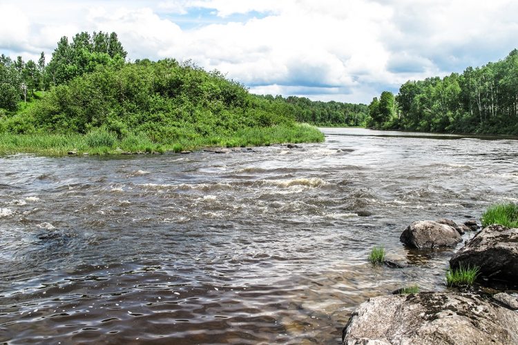
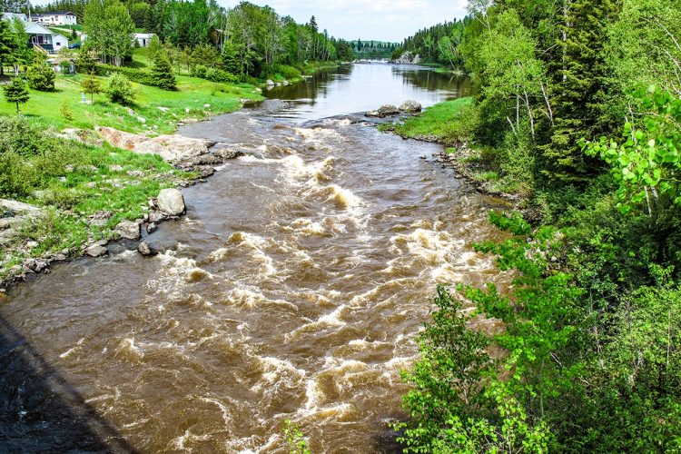
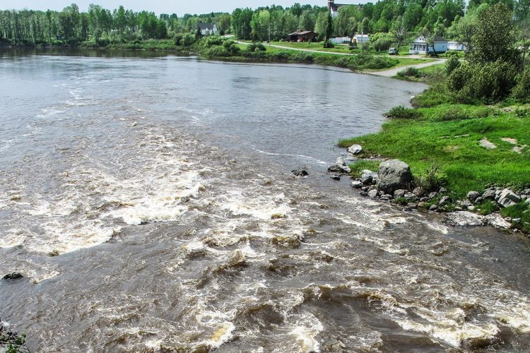
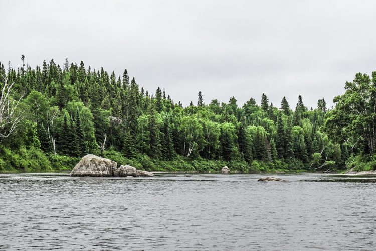
Interest : Agricultural and rural environment, rocky and clay shores, beauty of rapids.
Danger : 3 rapids and clear water.
Cléricy to the 117 bridge
- electrocardiogram Moderate
- mountain 31,6 km (Linear)
Access : Sur la rivière Kinojévis.
Interest : Wild environment, dense forest, multiple hunting camps, marshy areas, birdwatching.
Danger : 2 rapids and clear water
Points of service and interest
Category Name
-
 Boat launching site
Mise à l’eau du pont de la route 395 à Preissac
48°27'21.143”N
Boat launching site
Mise à l’eau du pont de la route 395 à Preissac
48°27'21.143”N
78°21'42.248”O -
 Rapids
Rapide entre Preissac et le chemin Vautrin
48°25'26.954”N
Rapids
Rapide entre Preissac et le chemin Vautrin
48°25'26.954”N
78°21'2.821”O -
 Halte sur galet
Butte rocheuse
48°22'52.276”N
Halte sur galet
Butte rocheuse
48°22'52.276”N
78°45'1.725”O -
 Launching ramp
Rampe de mise à l’eau de la rivière Kinojévis à Preissac
48°24'2.468”N
Launching ramp
Rampe de mise à l’eau de la rivière Kinojévis à Preissac
48°24'2.468”N
78°21'50.054”O -
Boat launching site
Mise à l’eau en aval des rapides de Preissac
48°24'31.489”N
78°21'55.9”O -
 Wild camping
Camping sauvage en aval du pont du rang Vautrin
48°27'41.502”N
Wild camping
Camping sauvage en aval du pont du rang Vautrin
48°27'41.502”N
78°19'51.7”O -
 Carrying
Portage des rapides de Preissac
48°24'31.489”N
Carrying
Portage des rapides de Preissac
48°24'31.489”N
-
Rapids
Rapide 1 de Preissac
48°24'20.033”N
78°21'52.046”O -
Rapids
Rapide 2 de Preissac sous le pont
48°24'30.249”N
78°21'59.708”O -
 Point of interest
Observation d’oiseaux, lac Métissard, Parc national d’Aiguebelle
48°25'50.568”N
Point of interest
Observation d’oiseaux, lac Métissard, Parc national d’Aiguebelle
48°25'50.568”N
78°40'33.172”O -
Evacuation sled
Sortie d’urgence au pont du rang Vautrin à Preissac
48°26'42.745”N
78°20'6.806”O -
Wild camping
Camping sauvage en amont de “Flat Rapid”
48°26'27.339”N
78°30'17.174”O -
Rapids
“Flat Rapid”
48°26'30.259”N
78°30'27.621”O -
Rapids
Rapide Burn
48°26'29.234”N
78°34'44.754”O -
 Picnic table
Abri de pique-nique
48°23'11.257”N
Picnic table
Abri de pique-nique
48°23'11.257”N
78°49'22.08”O -
Eau maigre sous le pont du ruisseau Matissard
en direction du camping Abijévis du Parc national d’Aiguebelle
48°25'49.228”N
78°39'56.252”O -
Barrage de castor du ruisseau Matissard
en direction du camping Abijévis
48°25'51.336”N
78°40'4.634”O -
 Commercial campsite
Camping aménagé Abijévis (Parc national d'Aiguebelle, lac Matissard)
48°25'53.599"N
Commercial campsite
Camping aménagé Abijévis (Parc national d'Aiguebelle, lac Matissard)
48°25'53.599"N
78°41'31.819"O -
Wild camping
Camping sauvage en aval des rapides de Mont-Brun
48°23'11.183”N
78°46'17.43”O -
Rapids
Rapide Clayhill de Mont-Brun
48°22'25.836”N
78°43'28.926”O -
Carrying
Portage du rapide 1 de Mont-Brun
48°22'16.552”N
78°42'58.019”O -
Rapids
Rapide 1 de Mont-Brun
48°22'18.41”N
78°42'58.825”O -
Rapids
Rapide 2 de Mont-Brun
48°22'28.445”N
78°43'12.286”O -
Eau vive en aval de Mont-Brun
48°22'51.701”N
78°44'59.126”O -
Launching ramp
Rampe de mise à l’eau de la rivière Kinojévis dans le quartier Mont-Brun à Rouyn-Noranda
48°22'11.331”N
78°42'50.235”O -
Wild camping
Camping sauvage au premier rapide en amont du rapides Windfall à Cléricy
48°21'52.815”N
78°51'24.027”O -
Eau vive en aval de Cléricy
48°17'43.252”N
78°52'35.111”O -
Rapids
Rapide en amont du rapide Windfall de Cléricy
48°21'51.998”N
78°51'22.083”O -
Carrying
Long portage du rapide Windfall et en amount de celui-ci de Cléricy
48°21'52.187”N
78°51'22.639”O -
Carrying
Portage du rapide Windfall de Cléricy
48°21'46.286”N
78°51'32.114”O -
Rapids
Rapide Windfall de Cléricy
48°21'47.101”N
78°51'33.686”O -
Launching ramp
Rampe de mise à l’eau de la rivière Kinojévis dans le quartier Cléricy à Rouyn-Noranda
48°21'48.111”N
78°51'48.1”O -
Evacuation sled
Sortie d’urgence en aval du quartier de Cléricy à Rouyn-Noranda
48°19'19.91”N
78°52'39.699”O -
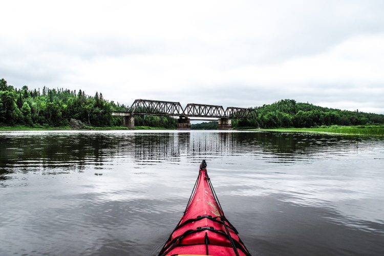
Boat launching site
Rampe de mise à l’eau de la rivière Kinojévis à Rouyn-Noranda
(chemin du Vieux-Pont Est)
48°12'28.074”N
78°51'44.007”O -
Pieux de bois à hauteur d’eau en dessous du pont de la voie ferrée
48°13'8.16”N
78°50'51.998”O -
Point of interest
Observation d’oiseaux, lac Routhier
48°14'34.325”N
78°54'20.2”O
Accessibility
Indications to the starting point
From Amos, take road 395 South. From Rouyn-Noranda and Val-d'Or, on the 117, take route 395 North. In Preissac, cross the bridge on Rue des Rapides. Turn right on Main Avenue. Take the fork to the right to the launch ramp.
Free outdoor parking and launch ramp.
Position : 78°21'50,054"O 48°24'2,468"N
Indications to the point of arrival
From Rouyn-Noranda, take the 117 South road. After the bridge, turn right on the way to the Draveurs. Turn right on the way to the Old East Bridge to the gravel launch ramp.
Free outdoor parking and launch ramp.
Position : 78°51'44,007"O 48°12'28,074"N
Specifications
Topographic maps
Topographic maps at a scale of 1:50,000 exist for the entire course of the river and we recommend that you use them in conjunction with this guide card.
32 D/8 Rivière Kinojévis
32 D/7 Rivière Kinojévis
32 D/2 Rivière Kinojévis, lac Routhier
Total slope: 10 meters
Obstacles and Dangers :
RAPIDS
- Presence of many surface rocks in the rapids making the descent demanding.
PORTAGE
- Well-equipped porting trails at the rapids of Preissac, Mont-Brun and Cléricy.
- No portage arranged at the edge of the rapids between Preissac and the Vautrin, the Flat Rapid and the Burn Rapid RII-III with a length of 830 meters.
Campsite :
The camping sites are insufficient at the end of the journey between Cléricy and the arrival point.
Natural Environment
Geology
James Bay Hydrographic Basin
The Kinojévis River, 140 km long, flows northwards, originates in the lakes Preissac, Chassignol, Frontbon and Cadillac and flows into the Ottawa River downstream of the Rapid Two.
Fauna
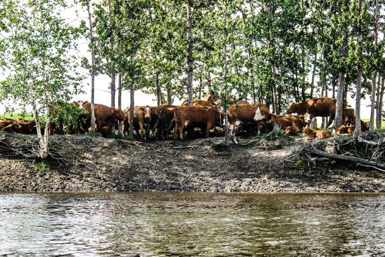
The course is known for its very diverse fauna which includes, among others, black duck, fisherman, large heron, large peak, porcepice, red squirrel, beaver, musky rat, hare, marten, mink, mink, striped skunk, otter, mocalon, black bear, gray wolf, coyote, red fox, lynx.
Flora
The bodies of water are located in boreal forest in the domain of the white birch hoe which includes, inter alia, cedar, white and black spruce, balsam fir, aspen and birch.
On the eastern shore of the river, in the cantons of Joannes and Rouyn, there is the teaching and research forest of the Kinojévis established by the Ministry of Forests in May 1993. It was at the request of the Abitibi-Témiscamingue CEGEP that this forest was created in a territory that covers 410 hectares.
History
For thousands of years, the Kinojévis River served as a communications route for hunting Algonquins who traveled between the basins of the Harricana and Ottawa rivers. It was up the Outaouais and Kinojévis that forestry workers, prospectors and farmers began to arrive in the region during the 1920s. Commercial navigation and timber flotation were facilitated by the widening of the river into several lakes: Routhier, Vallet, Kinojévis.
Typonomy
John Bignell’s 1895 map identifies this river as the Algonquin name Kinojeviskaskatik, a term that refers to pike. This name is still used among the Aboriginal people of the region according to a toponym survey carried out in 1976. Others claim that Kinojevis is an adaptation of the term algonquin kinogewich, meaning bad pike, which would be reminiscent of the bad taste of pike fishing. The subsequent normalization of writing added emphasis on e to make it a Kinojevis, as evidenced by the 1914 Dictionary of Rivers and Lakes of the Province of Quebec. The forms Kewagama, Ke-Wa-Gama, Kinoje Oskatig and Kinojovis were also noted.
Comments social0
Tools ready to go
- map Guide map (PDF)
- mapsquare Download GPS track (GPX)
- Google driving directions
-
 Sunrise : 07:27
Sunset : 18:30
- pdf Planification
- pdf Equipement Canot
- pdf Trousse Canot
- pdf Autoevaluation Canot
- pdf Trousse Kayak
- pdf Equipement Kayak
- pdf Autoevaluation Kayak
- pdf Systemes Communications
- pdf Pmu Kinojevis
- pdf Ps Kinojevis
- pdf Trousses Premiers Soins
- pdf Sans Trace Apa
Info & advice
- Animation et interprétation
- Camping
- Care
- Carte et orientation
- Caution
- Classification
- Emergency
- Equipment
- Jamais sans mon chien
- Nutrition
-
Prevention
- 10 articles de première nécessité
- Bien s'hydrater
- Comment lire la météo dans les nuages? Faire la pluie et le beau temps !
- Connaître son groupe et son plan d’eau
- Éviter les mauvaises rencontres en milieu sauvage
- Feu de camp sécuritaire : trois étapes à respecter
- Insectifuges
- Les moustiques
- Lunettes de soleil
- MALADIE DE LYME : PRÉVENIR LES PIQÛRES DE TIQUE EN RANDONNÉE
- Perdu en forêt : quoi faire?
- Règles de sécurité en canot et en kayak
- Se protéger contre le soleil
- Signalisation nautique internationale
- Vaporisateur Chasse-ours
- Progression
- Réglementation
- Training
Caution
This sheet has been prepared from information provided by outdoor enthusiasts deemed sufficiently reliable and experienced. Errors or omissions are always possible and Tourisme Abitibi-Témiscamingue cannot accept responsibility for any problem or accident that may arise from this sheet or be attributed to its use. If you notice any errors or omissions during your expedition, we would be very grateful if you would let us know by email pleinair@atrat.org in order to keep our information up to date.
