You are looking for a means of transport to get to the starting point of this dream route? You have a single vehicle and you want to move it from the starting point to the arrival point?
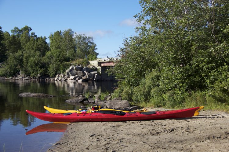
From Témiscaming, take the road to Kipawa Bay (8.2 km). Turn right onto the road to Maniwaki (31.4 km). Turn left (9.3 km). The launch is on your right (78°36'36,836"W | 46°50'28,491"N).
Free outdoor parking (unattended/ at your risk) Position : 78°36'39,115"O | 46°50'31,064"N
From Témiscaming, take the road to Kipawa Bay (8.8 km). The launching ramp is on your right in the municipality of Kipawa (78°58'51.2"W | 46°46'41.5"N).
Outdoor parking Position : 78°58’52,5”O 46°46’39,6”N
Topographic maps at 1/50,000 scale are available for the entire route and we recommend that you use them. 31 L/15 Lac McLachlin / lac Desquerac / lac Grindstone / lac Bedout / lac Audoin / lac Sunnyside / lac Kipawa (section Sud) The use of a GPS containing the route layout is also required.
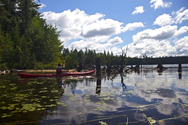
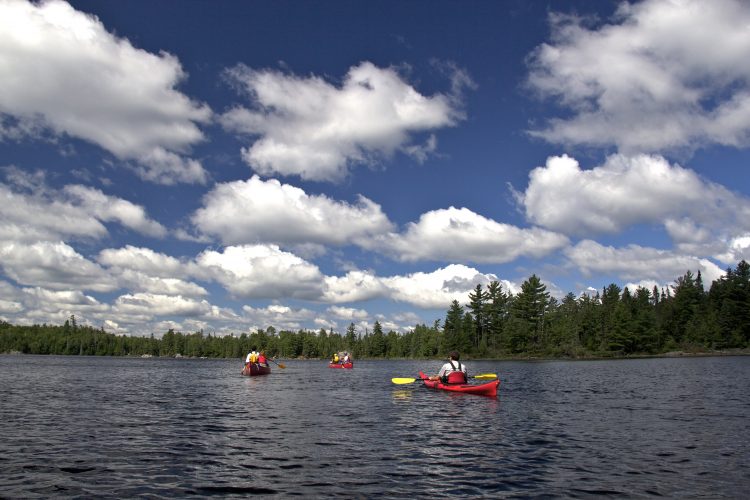
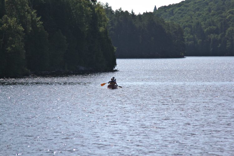
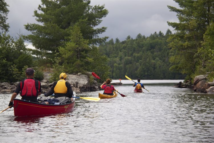
The Kipawa reservoir and its adjacent lakes are composed of a hundred bays and have a multitude of islands. It is very easy to feel disoriented and get lost while navigating this immense expanse of water.It is therefore necessary to have in your possession a GPS in which you have previously downloaded the route and batteries in sufficient quantity for the duration of your stay. It is also important to have a paper water map and compass.
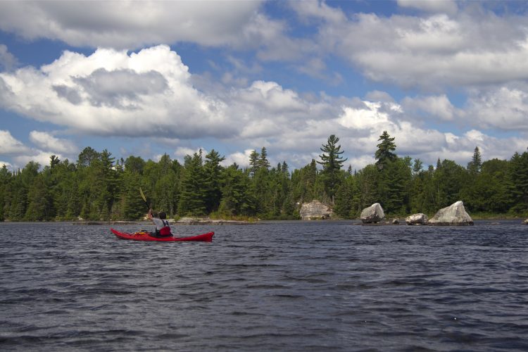
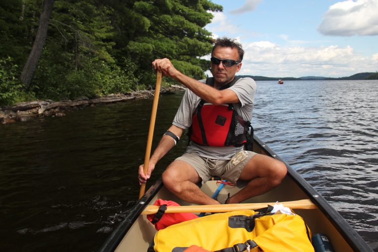
Lake Kipawa is tumultuous and even dangerous when there are strong winds. It is recommended to go along the shores. Some sections run along large rock walls without any possibility of landing.
The wind can change rapidly in strength and direction. It can create short, sharp waves that make it difficult to maintain a direction that could destabilize boats and cause them to capsize.
Near the large rock walls, the waves collide with each other (swells) making boats unstable.
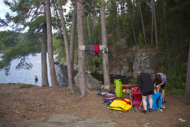
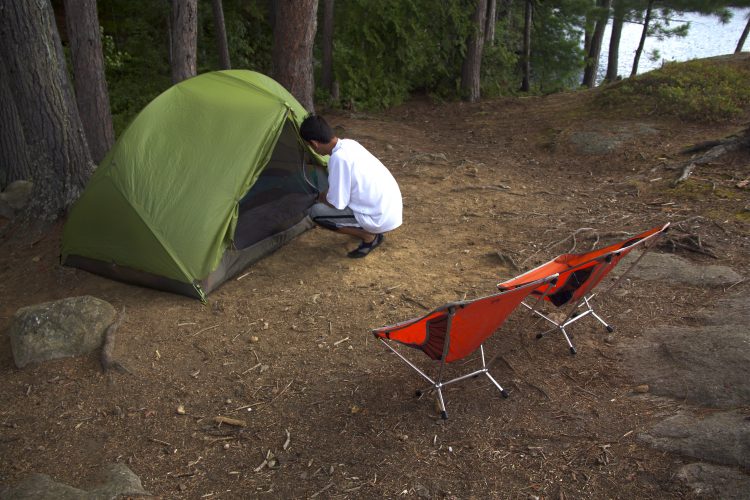
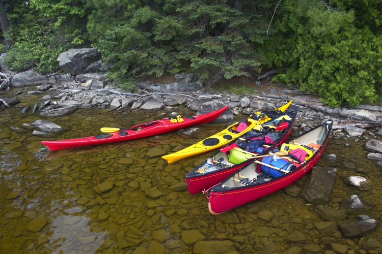
Campsite
Campsites are sufficient and of quality located on peaks, beaches and islands.
They are distributed along the course. It is essential to leave the campsites in an impeccable condition following the principles of ethics Sans Trace.
Human presence
Movement of motor boats.
Several outfitters scattered throughout the reservoir and on nearby lakes.
Natural Environment
History
Kipawa Lake is located on the ancestral territory of the Anicinabeg of Hunter’s Point.
As early as the mid-18th century, several forestry companies began harvesting the white and red pine forests of the Kipawa. At the end of the 19th century, J. R. Both Lumber was well established.
Part of the Kipawa River became a reservoir following the construction of the Laniel and Kipawa dams in 1911. The Kipawa Dam, built to supply electricity to the plant and the city of Témiscamingue, is located at the mouth of Gordon Creek near the municipality of Kipawa.
Geography
With an area of 300 km2 and 1,307 km of banks characterized by many rocky cliffs, this body of water extends over five cantons. The lake is complex in form, being connected with several other bodies of water: Green, Grindstone, Bedout, McLachlin, Sheffield, Audoin, Sheffield, Trout, Hunter, Sunnyside and Moran.
The water reaches a maximum depth of 40 meters and its average depth is 11.5 meters.
The main hydrographic slopes of the Kipawa reservoir are:
North side: l'Africain stream, Lavallée river;
East side: Lake Bois Franc which flows into the Kipawa River;
Southwest: Beauchêne river draining Beauchêne lake, Petit lac Beauchêne, Windy, du Diable, Pin Blanc, Grand lac George and Petit lac Georges;
East side: the Ottawa River.
The reservoir is a veritable maze consisting of:
Berries: Chemagan, des Plongeurs, Profonde, du Huard, Dorval, Pratt, des Anglais, Campbell, McLaren, Dubreuil, Coalpit Bay, Trout and Pratt;
Islands: McKenzie, Fox, Bears, Big Moose Island, Garrot, Strawberry, Turtle, Bronson and Latour.
Peninsulas.
The Kipawa tank is powered by:
North side: Carr Lake discharge; Moran Lake, St-Amand, Grand Knife Lake and Guay Lake; Coeur Lake discharge; Caribou Lake discharge; Aubry Lake discharge; Bat Lake discharge; Clément, Jack-White and McKeown Lake discharge; Raisenne Lake discharge; Audoin Lake; Hunter Point Lake; Little Grindstone Lake; McCullough Lake; McKillop Lake;
East side: McLachlin Lake; McKillop Lake discharge; Kipawa River;
South side: discharge from Trout Lake (which empties into Pratt Bay).
Wildlife
The species observed on the Kipawa reservoir are the loon, the great heron, the osprey, the American crane, the bald eagle and a multitude of ducks.
Flora
Red pine giants, often tricentenaires or more, line the Kipawa reservoir in several places. There are also sugar maple trees and black ash trees. This body of water is characterized by areas with a high concentration of mature forests, including McKenzie Island, which has never been extensively logged.
Toponymy
The name Kipawa comes from Algonquin and means "It’s closed". The toponym was spelled in many ways before the Kipawa variant became official: Kippawa, Kippewa, Kepawa, Kipakowe, Kipahowe.
Related tracks
You can stretch the fun by combining your paddleable route with the adjacent course:
This sheet has been prepared from information provided by outdoor enthusiasts deemed sufficiently reliable and experienced. Errors or omissions are always possible and Tourisme Abitibi-Témiscamingue cannot accept responsibility for any problem or accident that may arise from this sheet or be attributed to its use. If you notice any errors or omissions during your expedition, we would be very grateful if you would let us know by email pleinair@atrat.org in order to keep our information up to date.
Ce fichier texte est en format GPX. Il contient les données de traces et de points de navigation (waypoints). Il peut être visualisé via un éditeur de texte. Téléchargez gratuitement le gratuiciel GPS Babel pour importer le fichier contenant les traces et les points de navigation dans votre GPS.
Dans la section INPUT, sélectionner « Fichier ». Dans la rubrique Format, à l’aide de la liste déroulante, « GPX XML ». Cliquer sur le bouton File Name(s) pour accéder au fichier GPX téléchargé dans l’ordinateur.
Dans la section Translation Options, sélectionner « Waypoints » et « Traces ».
Brancher le GPS à l’ordinateur à l’aide d’un câble USB.
Dans la section Sortie, sélectionnez « Périphérique ». Choisir le format correspondant à la marque du GPS. Dans la rubrique Nom de périphérique, sélectionner « usb : ».

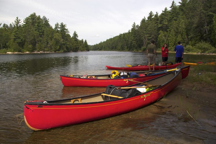
 Launching ramp
Rampe de mise à l'eau de la chute du Pin Rouge
46°50'28,491"N
Launching ramp
Rampe de mise à l'eau de la chute du Pin Rouge
46°50'28,491"N Parking
Stationnement de la chute du Pin Rouge
46°50'31,064"N
Parking
Stationnement de la chute du Pin Rouge
46°50'31,064"N Wild camping
Camping du lac Desquerac
46°49'11,095"N
Wild camping
Camping du lac Desquerac
46°49'11,095"N Sandy beach / Swimming
Pointe de sable du Chenal Bélanger de l'île La Tortue
46°52'34,786"N
Sandy beach / Swimming
Pointe de sable du Chenal Bélanger de l'île La Tortue
46°52'34,786"N Halte sur galet
Halte
46°54'20,798"N
Halte sur galet
Halte
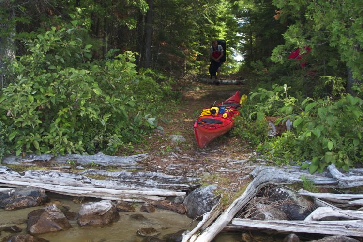
46°54'20,798"N Carrying
Portage du lac Grindstone
46°49'4,779"N
Carrying
Portage du lac Grindstone
46°49'4,779"N Rocky escarpment
Falaise
46°54'22,916"N
Rocky escarpment
Falaise
46°54'22,916"N Shuttle service
 Directions to the starting point
 Topographic maps
 Water level
  Obstacles et dangers
 Campsite
 Human presence
  Sunrise : 07:30