
Lac Loïs Kayaking route - Aiguebelle National Park
Lac Loïs Kayaking route - Aiguebelle National Park
Taschereau, La Sarre et l'Abitibi-Ouest
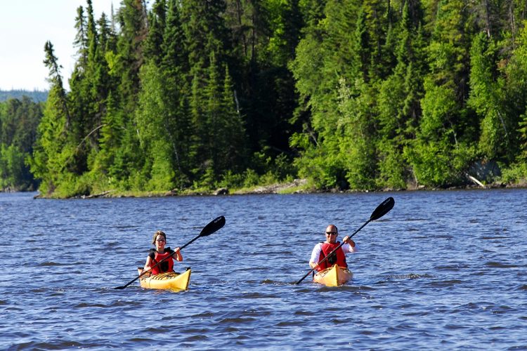
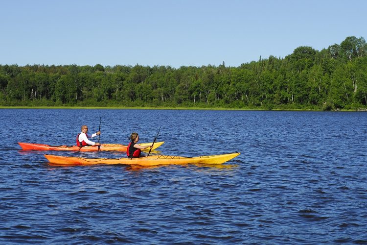
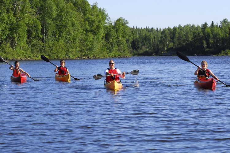
Aiguebelle National Park is 2.7 billion years of rock overlooking a clay plain where a history still evolving. It is also landscapes full of faults, hills, plains, clear or brown waters and fortuitous encounters that invite to discovery. By sea kayak, the lake Loïs, sprinkled with islands, is proving to be one of the most interesting for an exhilarating excursion while paddling on Lake Matissard, you access a pretty little marsh populated by birds with as background the beautiful hills Abijévis. This foray into the wild gives you minutes of total sensory grace.
- electrocardiogram Easy
- mountain Loop
- calendar seasonal
Points of service and interest
Category Name
-
 Reception et services
Centre de services Taschereau (Parc national d'Aiguebelle)
48°35'16,291"N
Reception et services
Centre de services Taschereau (Parc national d'Aiguebelle)
48°35'16,291"N
78°41'1,005"O -
 Parking
Stationnement du Centre de service Taschereau
48°35'15,229"N
Parking
Stationnement du Centre de service Taschereau
48°35'15,229"N
78°41'2,831"O -
 Dock
Quai de la station de kayak du lac Lo¨s
48°35'17.2"N
Dock
Quai de la station de kayak du lac Lo¨s
48°35'17.2"N
78°40'59.4"O -
 Commercial campsite
Camping piétonnier Ojibway (Parc national d'Aiguebelle, lac Loïs)
48°35'17.451"N
Commercial campsite
Camping piétonnier Ojibway (Parc national d'Aiguebelle, lac Loïs)
48°35'17.451"N
78°40'59.424"O -
 Cottage for rent
La Demoiselle (lac Loïs)
48°35'51,569"N
Cottage for rent
La Demoiselle (lac Loïs)
48°35'51,569"N
78°40'58,142"O -
Camping de groupe (à proximité du camping Abijébis)
48°34'29,013"N
78°42'14,62"O -
Kayak-camping 2
48°34'26,195"N
78°42'28,883"O -
 Rustic camp for rent
Le Longicorne (lac Loïs)
48°33'52,942"N
Rustic camp for rent
Le Longicorne (lac Loïs)
48°33'52,942"N
78°40'27,246"O
Accessibility
Access Rights
![]() Required and payable|Visitors facilies
Required and payable|Visitors facilies
Directions to reach the Aiguebelle National Park
MONT-BRUN SERVICE CENTER - SOUTH ENTRANCE (accessible year-round): Via the Mont-Brun district and Rang Hudon (southern entrance accessible year-round), about 50 km from downtown Rouyn-Noranda.
Address: 12373 Route d'Aiguebelle, Rouyn-Noranda, Québec, J0Z 2Y0
![]() View the route from your location on Google Map
View the route from your location on Google Map
From Val-d'Or:
Take Route 117 North for about 65 km, then turn right onto Mont-Brun Road (22 km on a paved road). At the Mont-Brun intersection, take Route d'Aiguebelle on your right. Drive through Mont-Brun village. At the bridge, turn right onto Route d'Aiguebelle. The park entrance is 8 km from Mont-Brun village. The Discovery and Service Center (reception) is on Route 2, 5 km from the entrance.
From Rouyn-Noranda:
Take Route 101 North. At D'Alembert, turn right onto Route d'Aiguebelle. Drive through Cléricy village and continue to Mont-Brun. At the Mont-Brun Road intersection, turn left. Drive through Mont-Brun village. At the bridge, turn right onto Route d'Aiguebelle. The park entrance is 8 km from Mont-Brun village. The Discovery and Service Center (reception) is on Route 2, 5 km from the entrance.
From La Sarre:
Take Route 101 South. At D'Alembert, turn left onto Route d'Aiguebelle. Drive through Cléricy village and continue to Mont-Brun. At the Mont-Brun Road intersection, turn left. Drive through Mont-Brun village. At the bridge, turn right onto Route d'Aiguebelle. The park entrance is 8 km from Mont-Brun village. Follow the signs to Route 2; the service center is 5 km from the entrance.
From Amos:
Take Route 109 South. At Rivière-Héva, turn right onto Route 117 North for about 28 km, then turn right onto Mont-Brun Road. At the Mont-Brun village intersection, take Route d'Aiguebelle on your right. Drive through Mont-Brun village. At the bridge, turn right onto Route d'Aiguebelle. The park entrance is 8 km from Mont-Brun village. Follow the signs to Route 2; the service center is 5 km from the entrance.
Contact
T 819 637-7322
Email: parc.aiguebelle@sepaq.com
Visit Website
Visit Facebook page
Natural Environment
The Geology
The park is part of the Canadian Shield, which began to form about 3.8 billion years ago. It is formed of magma that has poured out in successive layers under the ocean. From 2.79 billion years, a new background takes shape covering the entire Abitibi-Témiscamingue. From this rock, several rocky massifs of the region whose Abijévis hills and faults will form a few million years later during major upheavals.
The Geomorphology
The last ice age, the Wisconsin Ice Age, which began about 100,000 years ago, is responsible for the current shape of the territory. This glacier covered the entire territory of Abitibi and it has progressed to the state of Wisconsin. Traces of erosion and several formations testify to its presence. For example, glacial streaks created by the friction of materials transported by the glacier and a network of giant pots located in the path Les marmites.
The Hydrology
The main hydrographic feature of the territory is the passage of the water divide between the St. Lawrence and James Bay watersheds. This line runs between Lake La Haie and Lake Sault. There are nearly 80 lakes. Located in the hills, they are small and their waters are clear, which is exceptional at a regional level. Located in the plain, they are typical of the Abitibi: large, shallow and their waters are cloudy and brown.
Wildlife
The two wildlife representatives of the boreal forest are the moose and beaver. They are ubiquitous in the park. The diversity of the territory in terms of geomorphology, hydrology and flora contributes to the abundance and diversity of animal species by offering a wide variety of habitats. Some species are at the limit of their range such as the Grey-throated Warbler and Long-tailed Grouse. Others are exceptional for the region such as lake trout.
Flora
The vegetation cover of the park is boreal forest, composed mainly of young forest stands associated with repeated fire passages. This promotes the growth of pioneer species such as aspen poplar and grey pine. Some species a little more rare for the region such as yellow birch and black ash are added to the landscape. The particular morphology of the fault lakes has allowed the creation of small exceptional habitats that shelter very rare species such as Gymnocarpium jessoense.
Comments social0
Tools ready to go
- pdf Planification
- pdf Autoevaluation Kayak
- pdf Equipement Kayak
- pdf Pmu
- pdf Ps
- pdf Systemes Communications
Info & advice
- Animation et interprétation
- Camping
- Care
- Carte et orientation
- Caution
- Classification
- Emergency
- Equipment
- Jamais sans mon chien
- Nutrition
-
Prevention
- 10 articles de première nécessité
- Bien s'hydrater
- Comment lire la météo dans les nuages? Faire la pluie et le beau temps !
- Connaître son groupe et son plan d’eau
- Éviter les mauvaises rencontres en milieu sauvage
- Feu de camp sécuritaire : trois étapes à respecter
- Insectifuges
- Les moustiques
- Lunettes de soleil
- MALADIE DE LYME : PRÉVENIR LES PIQÛRES DE TIQUE EN RANDONNÉE
- Perdu en forêt : quoi faire?
- Règles de sécurité en canot et en kayak
- Se protéger contre le soleil
- Signalisation nautique internationale
- Vaporisateur Chasse-ours
- Progression
- Réglementation
- Training
Caution
This sheet has been prepared from information provided by outdoor enthusiasts deemed sufficiently reliable and experienced. Errors or omissions are always possible and Tourisme Abitibi-Témiscamingue cannot accept responsibility for any problem or accident that may arise from this sheet or be attributed to its use. If you notice any errors or omissions during your expedition, we would be very grateful if you would let us know by email pleinair@atrat.org in order to keep our information up to date.