
Climbing – Dalquier
Climbing – Dalquier
Saint-Félix-De-Dalquier, La Sarre et l'Abitibi-Ouest
The Dalquier site (often referred to as St-Félix) is located in the small rural municipality of St-Félix-de-Dalquier, bordering the town of Amos.
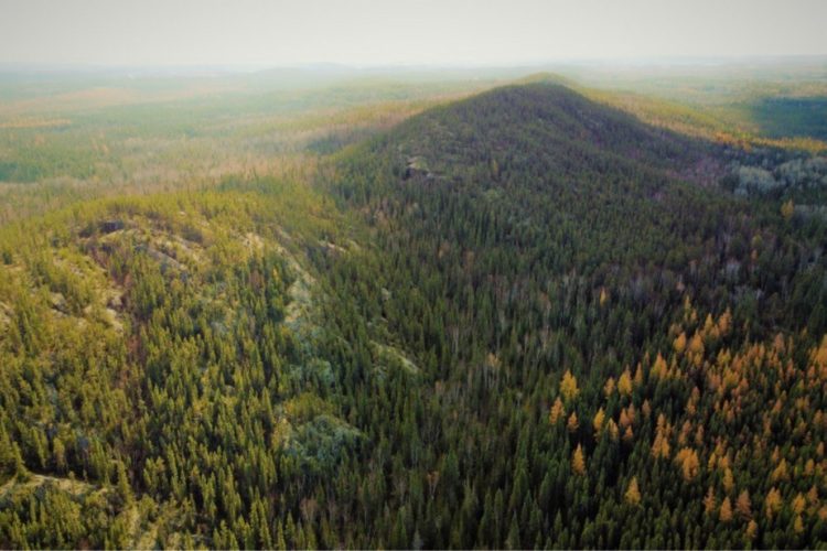
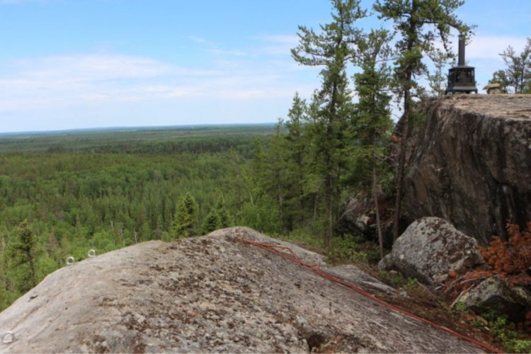
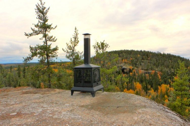
The three hills feature 13 km of marked trails, over 110 climbing routes, and magnificent viewpoints. At its highest point, at an elevation of 400 meters, the mountain offers a beautiful 360° panorama of the region.
***If you climb on a site federated by the FQME, it is obligatory to be a member of the FQME***
See Le Rappel du Nord website | See FQME website
- mountain Practice site
- calendar seasonal
Sections
Sentier d'escalade- Des Grimpeurs
- electrocardiogram Easy
- mountain 0.82 km (Linear)
Sentier d'escalade-L'Agartha
- electrocardiogram Easy
- mountain 0.02 km (Linear)
Sentier d'escalade-Le Camping
- electrocardiogram Easy
- mountain 1.38 km (Linear)
Sentier d'escalade-Le Sommet
- electrocardiogram Easy
- mountain 1.35 km (Linear)
Sentier d'escalade-Le Sphinx
- electrocardiogram Easy
- mountain 0.24 km (Linear)
Points of service and interest
Category Name
-
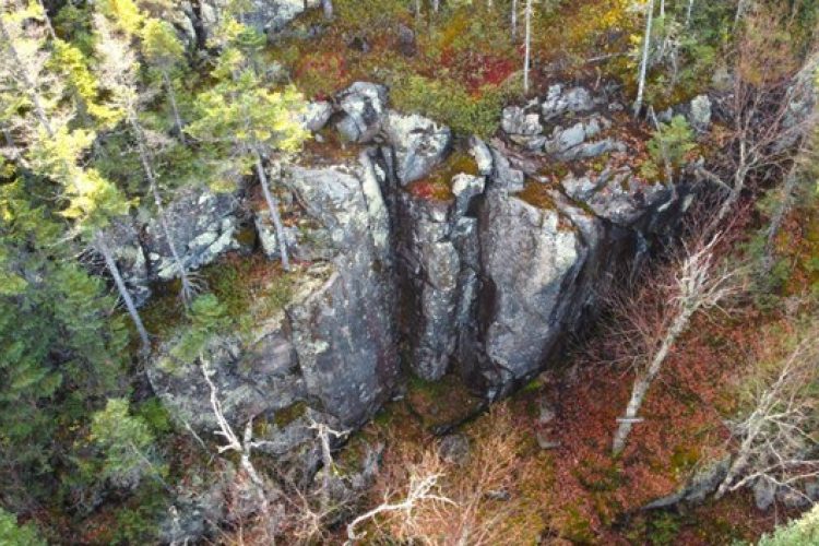
 Rock climbing site
Paroi-Blocs
48° 38.695'N
Rock climbing site
Paroi-Blocs
48° 38.695'N
78° 11.132'O -
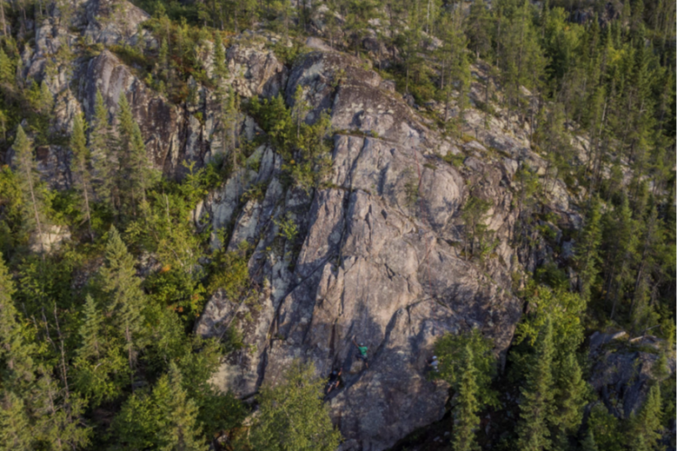
Rock climbing site
Paroi-Voies
48° 38.698'N
78° 11.127'O -
Rock climbing site
Paroi-École
48° 39.170'N
78° 10.412'O -
Rock climbing site
Paroi-La Maternelle
48° 39.173'N
78° 10.407'O -
Rock climbing site
Paroi-Les Mycologues
48° 39.168'N
78° 10.407'O -
Rock climbing site
Paroi-Le Camping
48° 38.423' N
78° 11.522'O -
Rock climbing site
Paroi-Le Sommet
48° 38.820'N
78° 10.808'O -
Rock climbing site
Paroi-Cap Noir
48° 38.950'N
78° 10.672'O -
Rock climbing site
Paroi-Vallée Manitou
48° 39.057'N
78° 10.530'O -
Rock climbing site
Paroi-Du Sphinx
48° 39.160'N
78° 10.438'O -
 Parking
Stationnement-Site d'escalade de Dalquier
48° 39.217'N
Parking
Stationnement-Site d'escalade de Dalquier
48° 39.217'N
78° 10.298'O
Accessibility
Access permitted
***If you climb on a site federated by the FQME, it is obligatory to be a member of the FQME***
Directions to reach the site:
From Amos, take Highway 109 North, turn left at Rang 5 & 6 West (the Rang with the white cross). Drive 3 km to the end of the Rang and follow the signs to the site parking lot: 1.5 km. The last 1.5 km from the end of the Rang is on an old, rather bumpy but solid forest road, so drive slowly.
Comments social0
Tools ready to go
Info & advice
- Activité
- Animation et interprétation
- Camping
- Care
- Carte et orientation
- Caution
- Emergency
- Encadrement
- Equipment
- Jamais sans mon chien
- Nutrition
-
Prevention
- 10 articles de première nécessité
- Bien s'hydrater
- Comment lire la météo dans les nuages? Faire la pluie et le beau temps !
- Éviter les ampoules aux pieds
- Éviter les mauvaises rencontres en milieu sauvage
- Feu de camp sécuritaire : trois étapes à respecter
- Insectifuges
- Les moustiques
- Lunettes de soleil
- MALADIE DE LYME : PRÉVENIR LES PIQÛRES DE TIQUE EN RANDONNÉE
- Perdu en forêt : quoi faire?
- Se protéger contre le soleil
- Vaporisateur Chasse-ours
- Progression
- Réglementation
- Training
Caution
This sheet has been prepared from information provided by outdoor enthusiasts deemed sufficiently reliable and experienced. Errors or omissions are always possible and Tourisme Abitibi-Témiscamingue cannot accept responsibility for any problem or accident that may arise from this sheet or be attributed to its use. If you notice any errors or omissions during your expedition, we would be very grateful if you would let us know by email pleinair@atrat.org in order to keep our information up to date.
