
Hiking trail to the Panoramique Mountain lookout point
Hiking trail to the Panoramique Mountain lookout point
Taschereau, La Sarre et l'Abitibi-Ouest
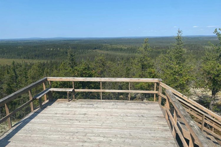
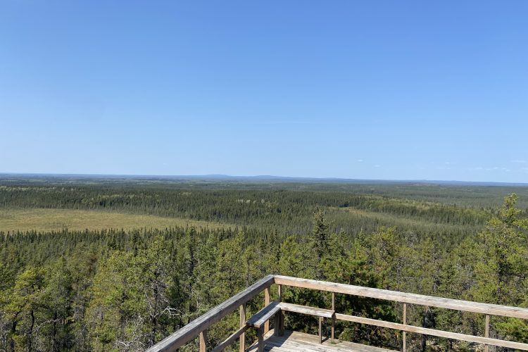
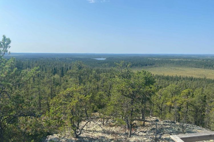
Panoramique Mountain is a rocky promontory that rises between the communities of Taschereau and Languedoc. A lookout has been built there. The summit of Panoramique Mountain offers an exceptional panorama of the boreal forest. A 1.5-kilometer hiking trail encircles the mountain. This trail overlooks a ledge and leads to the remains of an ice age river over 10,000 years old. The bed of the ancient river is formed by pebbles of uniform sizes.
- electrocardiogram Easy
- mountain 1 Km (Mixed)
Sections
Sentier pédestre du belvédère du mont panoramique
- electrocardiogram Easy
- mountain 0.38 km (Linear)
Points of service and interest
Category Name
 Parking
 Belvedere
Accessibility
Access
![]() Free, no reception.
Free, no reception.
Directions to reach the starting point
Trail located between the communities of Taschereau (5 km north) and Languedoc (10 km south). Parking with about ten spaces.
Comments social0
Tools ready to go
- pdf Planification Randonnee Apa
- pdf Equipement Randonnee Pedestre
- pdf Gestion Des Risques Randonnee Pedestre Apa
- pdf Sans Trace Apa
Info & advice
- Activité
- Animation et interprétation
- Camping
- Care
- Carte et orientation
- Caution
- Emergency
- Encadrement
- Equipment
- Jamais sans mon chien
- Nutrition
-
Prevention
- 10 articles de première nécessité
- Bien s'hydrater
- Comment lire la météo dans les nuages? Faire la pluie et le beau temps !
- Éviter les ampoules aux pieds
- Éviter les mauvaises rencontres en milieu sauvage
- Feu de camp sécuritaire : trois étapes à respecter
- Insectifuges
- Les moustiques
- Lunettes de soleil
- MALADIE DE LYME : PRÉVENIR LES PIQÛRES DE TIQUE EN RANDONNÉE
- Perdu en forêt : quoi faire?
- Se protéger contre le soleil
- Vaporisateur Chasse-ours
- Progression
- Réglementation
- Training
Caution
This sheet has been prepared from information provided by outdoor enthusiasts deemed sufficiently reliable and experienced. Errors or omissions are always possible and Tourisme Abitibi-Témiscamingue cannot accept responsibility for any problem or accident that may arise from this sheet or be attributed to its use. If you notice any errors or omissions during your expedition, we would be very grateful if you would let us know by email pleinair@atrat.org in order to keep our information up to date.
