
Montagne à Fred Hiking trails
Montagne à Fred Hiking trails
Macamic (Colombourg), La Sarre et l'Abitibi-Ouest
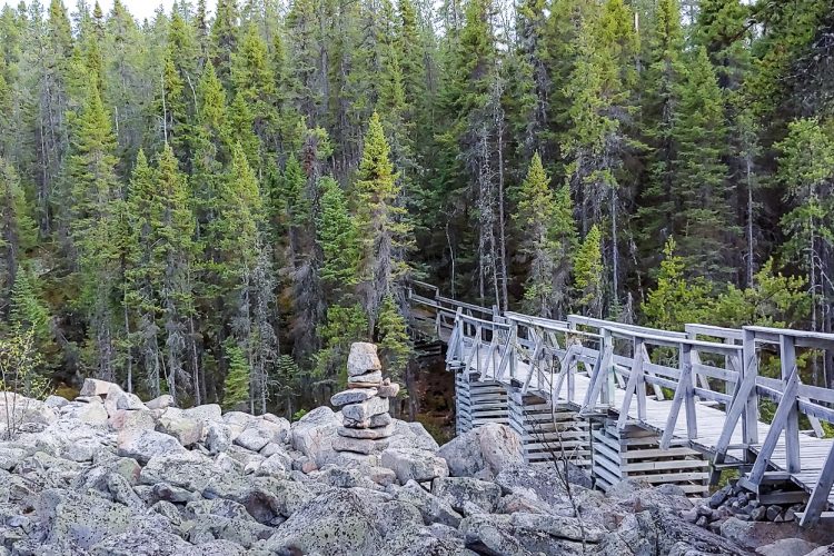
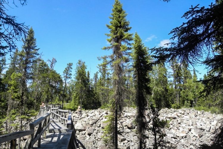
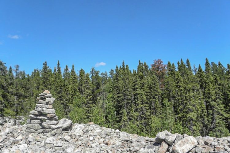
On this hillock steeped in history, you'll hike across large rocky headlands dotted with small jack pines. The trail on the southwest slope follows a fabulous, extensive "river of rocks."
Much of the mountain is young, so the forest is thin and sparse. There are numerous rocky outcrops. At the top of the clay plain, you'll see the municipalities of La Sarre, Palmarolle, and the famous Abitibi Lake.
- electrocardiogram Easy
- mountain 3.4 Km (Mixed)
Sections
Sentier Principal 001
- electrocardiogram Easy
- mountain 3.13 km (Linear)
traverse A 001
- electrocardiogram Easy
- mountain 0.24 km (Linear)
traverse B 001
- electrocardiogram Easy
- mountain 0.06 km (Linear)
Rivière de Roches
- electrocardiogram Easy
- mountain 0.14 km (Linear)
Points of service and interest
Category Name
 Parking
 Toilet
 Picnic table
Accessibility
Access
Free, without reception infrastructure.
Directions to reach the starting point
From La Sarre, take Highway 393 South and turn left onto 2nd and 3rd Rangs towards Colombourg. In the village of Colombourg, turn right onto Chemin Langlois then turn left onto Chemin du Petit Un. Drive 1.7 km to reach the parking lot.
Parking: Free outdoor parking, outhouse.
Position: 48°44'03.4"N 79°08'19.2"W
Contact
Tom St-Pierre, Director of Recreation, Culture and Community Life
P 819 782-4604 (ext. 275)
Natural Environment
History
Over 8,500 years ago, Fred’s Mountain was a small island in the ancient Ojibway-Barlow Sea that covered the area. At that time, large stones were transported to the island by ice in winter, while in summer, the waves would push smaller rocks and sand off the island.
Toponymy
Fred Roy was the owner of the land on this mountain. He built a camp at the summit where he lived during the summer, taking advantage of the constant winds that kept the flies away! In winter, Fred Roy lived in a log cabin located at the base of the mountain. Later, he built himself a new home made of wood and cement.
Comments social0
Tools ready to go
- map Guide map (PDF)
- mapsquare Download GPS track (GPX)
- Google driving directions
-
 Sunrise : 07:30
Sunset : 18:35
- pdf Planification Randonnee Apa
- pdf Equipement Randonnee Pedestre
- pdf Gestion Des Risques Randonnee Pedestre Apa
- pdf Sans Trace Apa
Info & advice
- Activité
- Animation et interprétation
- Camping
- Care
- Carte et orientation
- Caution
- Emergency
- Encadrement
- Equipment
- Jamais sans mon chien
- Nutrition
-
Prevention
- 10 articles de première nécessité
- Bien s'hydrater
- Comment lire la météo dans les nuages? Faire la pluie et le beau temps !
- Éviter les ampoules aux pieds
- Éviter les mauvaises rencontres en milieu sauvage
- Feu de camp sécuritaire : trois étapes à respecter
- Insectifuges
- Les moustiques
- Lunettes de soleil
- MALADIE DE LYME : PRÉVENIR LES PIQÛRES DE TIQUE EN RANDONNÉE
- Perdu en forêt : quoi faire?
- Se protéger contre le soleil
- Vaporisateur Chasse-ours
- Progression
- Réglementation
- Training
Caution
This sheet has been prepared from information provided by outdoor enthusiasts deemed sufficiently reliable and experienced. Errors or omissions are always possible and Tourisme Abitibi-Témiscamingue cannot accept responsibility for any problem or accident that may arise from this sheet or be attributed to its use. If you notice any errors or omissions during your expedition, we would be very grateful if you would let us know by email pleinair@atrat.org in order to keep our information up to date.
