
Kiwanis Agnico-Eagle Recreational Area Hiking Trail
Kiwanis Agnico-Eagle Recreational Area Hiking Trail
Rouyn-Noranda, Rouyn-Noranda
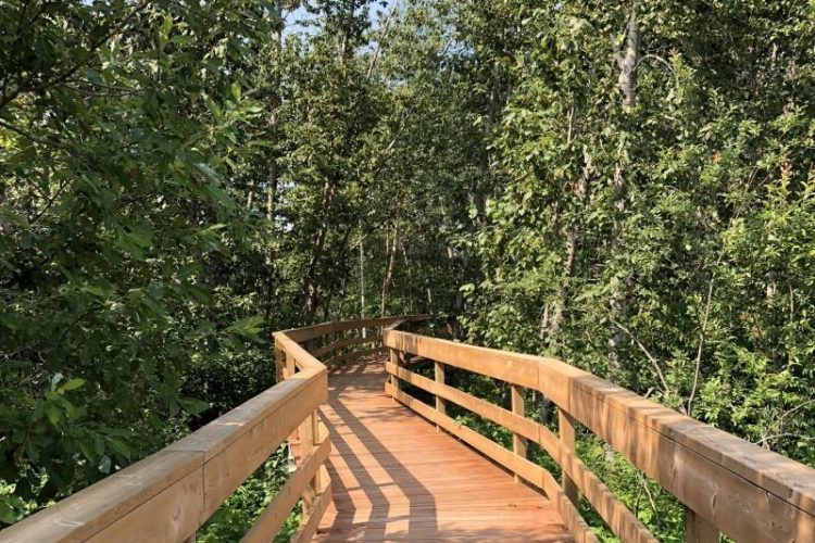
Just steps from the city center, enjoy the peace of nature on a walk around Noranda Lake. The beautiful Kiwanis Recreation Area Trail features gazebos, walkways, rest stops and a beautiful sandy beach.
- electrocardiogram Easy
- mountain 1.5 Km (Loop)
- calendar seasonal
Points of service and interest
Category Name
-
 Parking
Stationnement principal de l'Aire récréative Kiwanis
48°14'24.2"N
Parking
Stationnement principal de l'Aire récréative Kiwanis
48°14'24.2"N
79°02'08.2"O -
Parking
Stationnement Skiwanis
48°14'22.0"N
79°01'57.4"O -
Parking
Stationnement du chemin Sénateur
48°14'26.2"N
79°02'27.6"O -
 Belvedere
Poste d'observation de l'Aire récréative Kiwanis
48°14'15.7"N
Belvedere
Poste d'observation de l'Aire récréative Kiwanis
48°14'15.7"N
79°02'24.8"O -
 Sandy beach / Swimming
Plage Kiwanis
48°14'18.5"N
Sandy beach / Swimming
Plage Kiwanis
48°14'18.5"N
79°01'57.7"O
Accessibility
Access Rights
 Free, no welcome center.
![]() Pets are allowed.
Pets are allowed.
Directions to the starting point
In Rouyn-Noranda, the parking lot is near Lac Noranda (municipal beach) at the corner of 15th Street and Rideau Boulevard near a shopping centre. Another entrance is located on the Chemin Sénator behind the offices of the Sûreté du Québec.
Kiwanis Beach Parking: Free Position: 48°14'22.0"N 79°01'57.4"W
![]() View the route from your location on Google Map
View the route from your location on Google Map
Senators Road Parking: Free, Position: 48°14'26.2"N 79°02'27.6"W
![]() View the route from your location on Google Map
View the route from your location on Google Map
Contact
101 Rideau Boulevard, 15th Street and Rideau Boulevard (Lac Noranda)
Rouyn-Noranda, Québec, J9X 1N9
T 819 797-3195 / 1 888 797-3195 (Tourist Information Office)
Email tourisme@cldrn.ca
Specifications
ACTIVITIES
- Beach
SERVICES
- Rest area
- Viewpoint
- Bridge
- Parking
Comments social0
Tools ready to go
- pdf Planification Randonnee Apa
- pdf Equipement Randonnee Pedestre
- pdf Gestion Des Risques Randonnee Pedestre Apa
- pdf Sans Trace Apa
- pdf Trousses Premiers Soins
Info & advice
- Activité
- Animation et interprétation
- Camping
- Care
- Carte et orientation
- Caution
- Emergency
- Encadrement
- Equipment
- Jamais sans mon chien
- Nutrition
-
Prevention
- 10 articles de première nécessité
- Bien s'hydrater
- Comment lire la météo dans les nuages? Faire la pluie et le beau temps !
- Éviter les ampoules aux pieds
- Éviter les mauvaises rencontres en milieu sauvage
- Feu de camp sécuritaire : trois étapes à respecter
- Insectifuges
- Les moustiques
- Lunettes de soleil
- MALADIE DE LYME : PRÉVENIR LES PIQÛRES DE TIQUE EN RANDONNÉE
- Perdu en forêt : quoi faire?
- Se protéger contre le soleil
- Vaporisateur Chasse-ours
- Progression
- Réglementation
- Training
Caution
This sheet has been prepared from information provided by outdoor enthusiasts deemed sufficiently reliable and experienced. Errors or omissions are always possible and Tourisme Abitibi-Témiscamingue cannot accept responsibility for any problem or accident that may arise from this sheet or be attributed to its use. If you notice any errors or omissions during your expedition, we would be very grateful if you would let us know by email pleinair@atrat.org in order to keep our information up to date.
