
Domaine Roch Paradis hiking trail
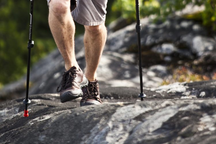
Domaine Roch Paradis hiking trail
Palmarolle, La Sarre et l'Abitibi-Ouest
To access the Domaine, you must take a gateway located at the entrance. The trails of this network crisscross a plantation forest composed of larch, American elm, white and road pines, yellow and white birches, maple, ash and cypress trees, as well as white and black spruce and norway. About 500 trees are planted each year. There are also many wild roses and small fruit trees such as cherry. The trails La montée du petit 8 and Des lièvres cross a cove located below. You will go down a small hill to go up the other side. These paths cross a stream. Next to the picnic area, a large panel shows the tree species present with an illustration for each. Benches have been installed along the trails.
- electrocardiogram Easy
- mountain 3.9 Km (Loop)
- calendar seasonal
Sections
Sentier-Des Lièvres
- electrocardiogram Easy
- mountain 0.67 km (Linear)
Sentier-Des Marmottes
- electrocardiogram Easy
- mountain 0.26 km (Linear)
Sentier-Des Perdrix
- electrocardiogram Easy
- mountain 0.37 km (Linear)
Sentier-Des Renards
- electrocardiogram Easy
- mountain 0.28 km (Linear)
Sentier-La Loutre
- electrocardiogram Easy
- mountain 0.40 km (Linear)
Sentier-La Montée
- electrocardiogram Easy
- mountain 0.63 km (Linear)
Sentier-Les Corneilles
- electrocardiogram Easy
- mountain 0.30 km (Linear)
Sentier-Les Écureuils
- electrocardiogram Easy
- mountain 0.32 km (Linear)
Sentier-Pic Bois
- electrocardiogram Easy
- mountain 0.62 km (Linear)
Trail-Les Corneilles
- electrocardiogram Easy
- mountain 0.30 km (Linear)
Trail -Des Lièvres
- electrocardiogram Easy
- mountain 0.67 km (Linear)
Trail -Des Marmottes
- electrocardiogram Easy
- mountain 0.26 km (Linear)
Trail -Des Perdrix
- electrocardiogram Easy
- mountain 0.37 km (Linear)
Trail -Des Renards
- electrocardiogram Easy
- mountain 0.28 km (Linear)
Trail -La Loutre
- electrocardiogram Easy
- mountain 0.40 km (Linear)
Trail-La Montée
- electrocardiogram Easy
- mountain 0.63 km (Linear)
Trail -Les Écureuils
- electrocardiogram Easy
- mountain 0.32 km (Linear)
Trail -Pic Bois
- electrocardiogram Easy
- mountain 0.62 km (Linear)
Points of service and interest
Category Name
-
 Parking
Stationnement du Domaine Roch Paradis
48°40'23.2"N
Parking
Stationnement du Domaine Roch Paradis
48°40'23.2"N
79°12'13.7"O -
 Picnic table
Table à pique-nique du domaine Roch Paradis
48° 40.380'N
Picnic table
Table à pique-nique du domaine Roch Paradis
48° 40.380'N
79° 12.231'O -
Parking
Stationnement du domaine Roch Paradis (Nord)
48° 40.206'N
79° 12.434'O -
Parking
Stationnement du domaine Roch Paradis (Sud Ouest)
48° 40.551'N
79° 12.437'O -
Parking
Stationnement du domaine Roch Paradis (Sud-Est)
48° 40.549'N
79° 12.235'O
Accessibility
Access Rights
![]() Free, without reception infrastructure.
Free, without reception infrastructure.
Directions to the starting point
From La Sarre, take Route 393 southbound. Turn right onto 12th Avenue West. The Estate is located at the end of the street, at the intersection of 1st West Street.
From Rouyn-Noranda, take Route 101 north. Turn left onto Route 393 and continue to the village of Palmarolle. Turn left onto 12th Avenue West. The Estate is located at the end of the street, at the intersection of 1st Street West.
Parking : along 1st Street West near 12th Avenue West
Position : 48°40'23.2"N 79°12'13.7"O
![]() View the route from your location on Google Map
View the route from your location on Google Map
Contact
M. Guy Fortin
T 819 787-2822
Natural Environment
History
In the spring of 1934, Ida Morrissette-Paradis, first postmaster and owner of the general store in Palmarolle, bought this 70-acre (28 ha) lot. In 1976, his eldest son becomes the buyer. In order to preserve and give an educational and recreational vocation to the 50 acres of forest, it partners and created on this family territory, the heritage forest of Palmarolle.
The development of the forest began in 1978, thanks to the involvement of members of the Paradis-Fortin family and the help of many volunteers (particularly Mr. Alain Shink and the Mercier and Nicol families), with the valuable cooperation of the municipal corporation of Palmarolle and that of the Ministry of Natural Resources and Wildlife.
The brothers Jean and Jos Boutin carry out extensive ploughing and preparation work in anticipation of reforestation. In 1979, a first plantation of white spruce is effected; other plantations of various forest species follow to recreate a natural woodland.
Comments social0
Tools ready to go
- map Guide map (PDF)
- mapsquare Download GPS track (GPX)
- Google driving directions
-
 Sunrise : 07:32
Sunset : 18:33
- pdf Planification Randonnee Apa
- pdf Equipement Randonnee Pedestre
- pdf Gestion Des Risques Randonnee Pedestre Apa
- pdf Sans Trace Apa
Info & advice
- Activité
- Animation et interprétation
- Camping
- Care
- Carte et orientation
- Caution
- Emergency
- Encadrement
- Equipment
- Jamais sans mon chien
- Nutrition
-
Prevention
- 10 articles de première nécessité
- Bien s'hydrater
- Comment lire la météo dans les nuages? Faire la pluie et le beau temps !
- Éviter les ampoules aux pieds
- Éviter les mauvaises rencontres en milieu sauvage
- Feu de camp sécuritaire : trois étapes à respecter
- Insectifuges
- Les moustiques
- Lunettes de soleil
- MALADIE DE LYME : PRÉVENIR LES PIQÛRES DE TIQUE EN RANDONNÉE
- Perdu en forêt : quoi faire?
- Se protéger contre le soleil
- Vaporisateur Chasse-ours
- Progression
- Réglementation
- Training
Caution
This sheet has been prepared from information provided by outdoor enthusiasts deemed sufficiently reliable and experienced. Errors or omissions are always possible and Tourisme Abitibi-Témiscamingue cannot accept responsibility for any problem or accident that may arise from this sheet or be attributed to its use. If you notice any errors or omissions during your expedition, we would be very grateful if you would let us know by email pleinair@atrat.org in order to keep our information up to date.
