
Osisko Multi Use Trail

Osisko Multi Use Trail
Rouyn-Noranda, Rouyn-Noranda
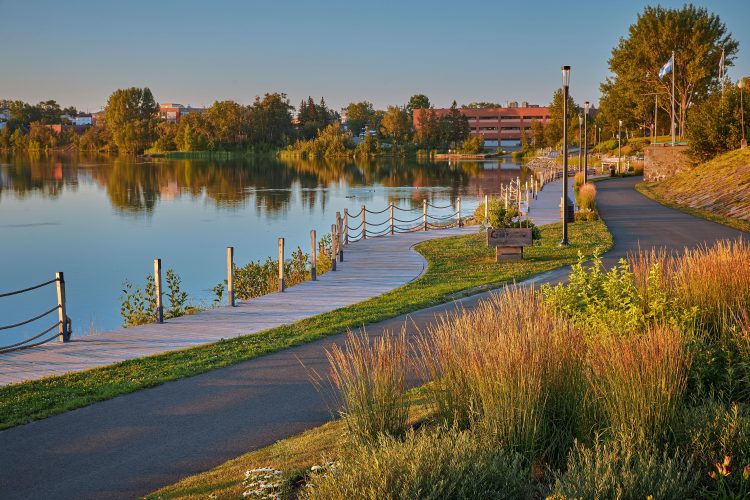
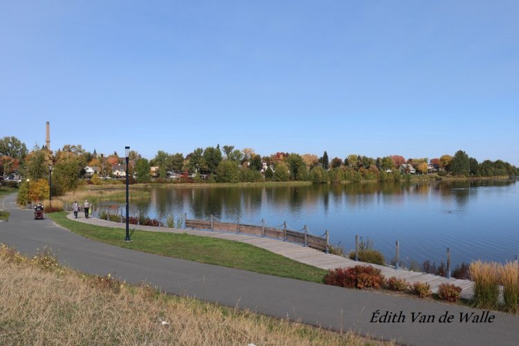
Experience nature in the heart of downtown! Along the shores of Lake Osisko, the urban multi-use trail forms a 7.8 km long asphalt loop. This trail is designed for multiple modes of travel, from cycling to skateboarding to inline skating and walking.
Ornithological information
The Abitibi-Témiscamingue offers a wide variety of habitats, which promotes a great diversity of birds. The Long-tailed Grouse, the Grey-throated Warbler and the large gatherings of Canadian Cranes are bird-eye features in the region that delight observers. Some sites, easily accessible, represent areas of interest and host species of birds that the Société du loisir ornithologique de l'Abitibi-Témiscamingue (SLOAT) wishes to disseminate to the public.
The site
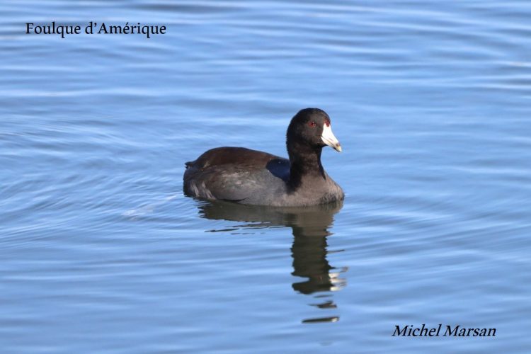
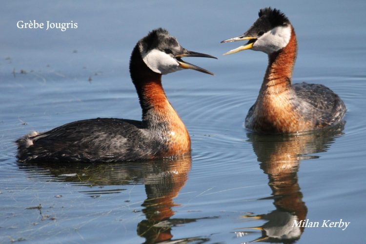
In the heart of the city of Rouyn-Noranda, Lake Osisko is the best place in Quebec to observe the nesting Grebe jougris. Several couples raising their young can observe each other very easily from the shores of the lake. The rocky islet near the parking lot of the peninsula is home to a colony of Ring-billed Gulls, where some nesting Common Tern remain. To the north of the trail, the smelter’s water treatment ponds adjoin part of the trail. The central basin with richer waters is particularly suitable for observing anatids in summer and even more during migrations. The most prominent species include Mallard, Red-headed Duck, Red-headed Warbler and American Coot. In the fall, the Collared Duck, the Lesser Common Duck, the Winter Teal and the American Duck gather in large numbers. No fewer than 192 species are listed. Visit the website of the Société du loisir ornithologique de l'Abitibi et du Témiscamingue to find out about upcoming activities. To participate, please contact the organization :
- electrocardiogram Easy
- mountain 7.9 Km (Loop)
- calendar seasonal
Sections
Tour du Lac Osisco
- electrocardiogram Easy
- mountain 7.84 km (Linear)
Tour du Lac Osisko
- electrocardiogram Easy
- mountain 7.84 km (Linear)
Points of service and interest
Category Name
 Cultural Visit
 Circonflexe
Accessibility
Access Rights
 Free, no visitors infrastructure.
Indication to reach the starting point
In Rouyn-Noranda, at the Grande place Edmund-Horne at the end of Avenue Murdoch, behind the Music School En sol mineur, towards the peninsula.
Other parking lots:
Magasin général Dumulon - 1924, at 191 avenue du lac.
Chemin Trémoy (behind the Notre-Dame-de-Protection School). Avenue du Lac parking (fee).
Specifications
- Asphalted course
Comments social0
Tools ready to go
Info & advice
- Activité
- Animation et interprétation
- Camping
- Care
- Carte et orientation
- Caution
- Emergency
- Encadrement
- Equipment
- Jamais sans mon chien
- Nutrition
-
Prevention
- 10 articles de première nécessité
- Bien s'hydrater
- Comment lire la météo dans les nuages? Faire la pluie et le beau temps !
- Éviter les ampoules aux pieds
- Éviter les mauvaises rencontres en milieu sauvage
- Feu de camp sécuritaire : trois étapes à respecter
- Insectifuges
- Les moustiques
- Lunettes de soleil
- MALADIE DE LYME : PRÉVENIR LES PIQÛRES DE TIQUE EN RANDONNÉE
- Perdu en forêt : quoi faire?
- Se protéger contre le soleil
- Vaporisateur Chasse-ours
- Progression
- Réglementation
- Training
Caution
This sheet has been prepared from information provided by outdoor enthusiasts deemed sufficiently reliable and experienced. Errors or omissions are always possible and Tourisme Abitibi-Témiscamingue cannot accept responsibility for any problem or accident that may arise from this sheet or be attributed to its use. If you notice any errors or omissions during your expedition, we would be very grateful if you would let us know by email pleinair@atrat.org in order to keep our information up to date.
