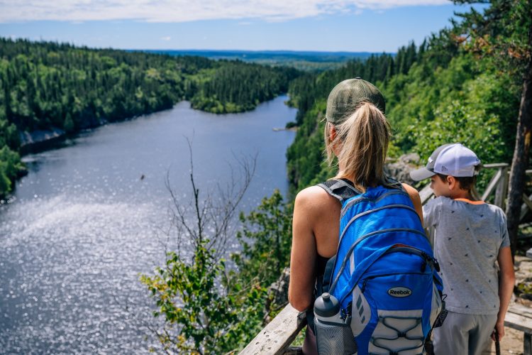
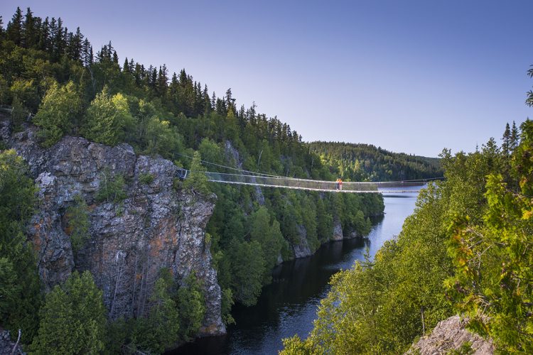
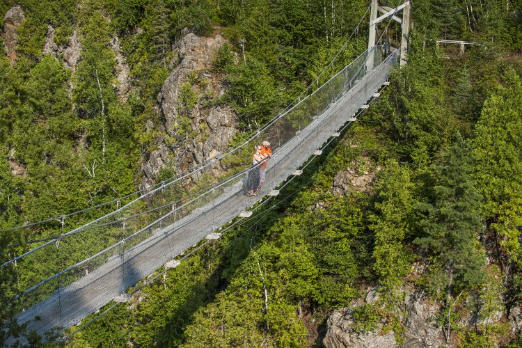
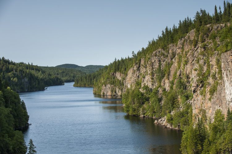
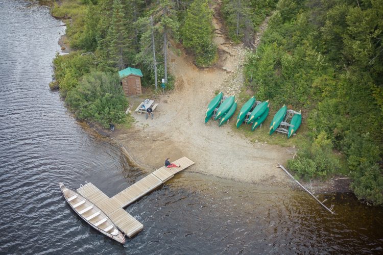
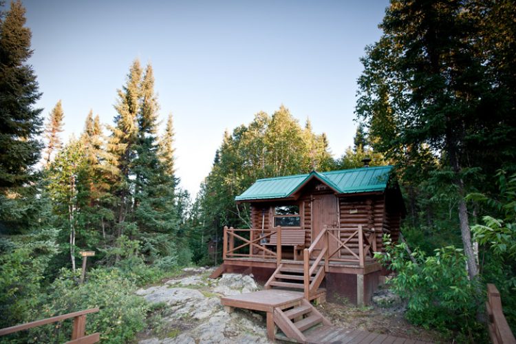
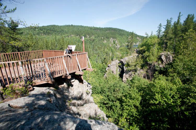
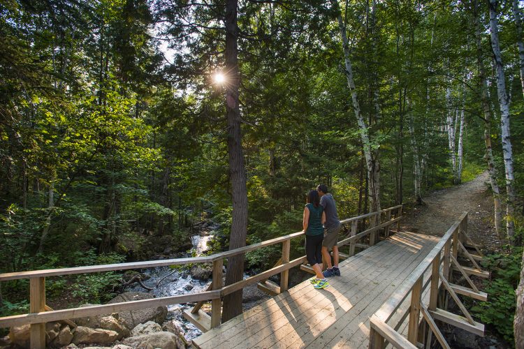
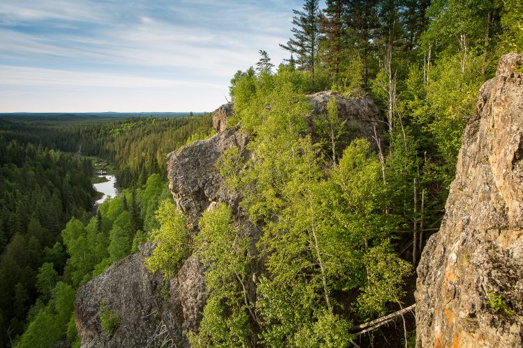
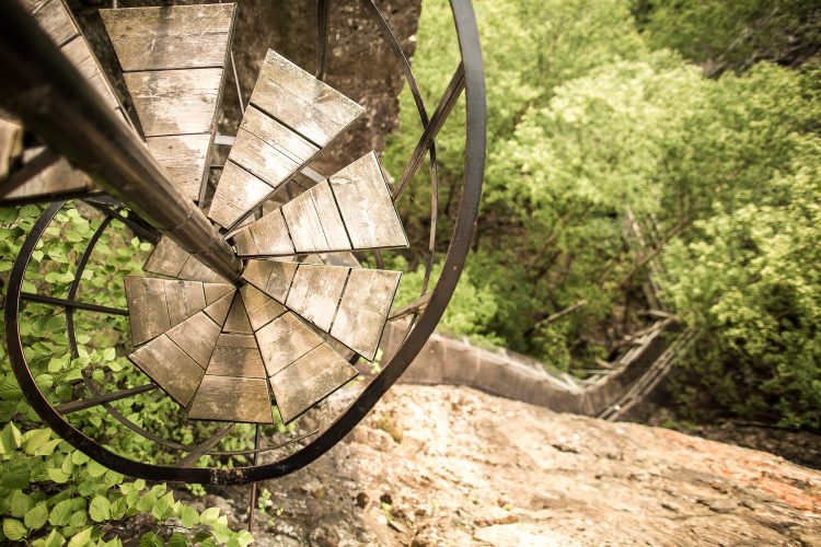
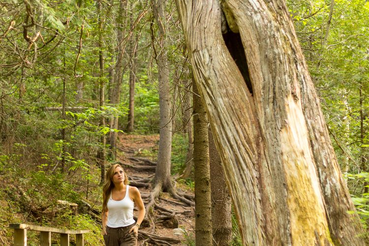
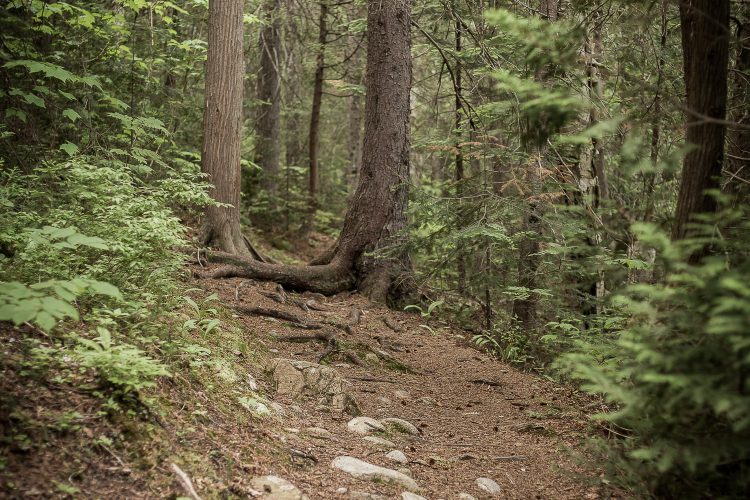
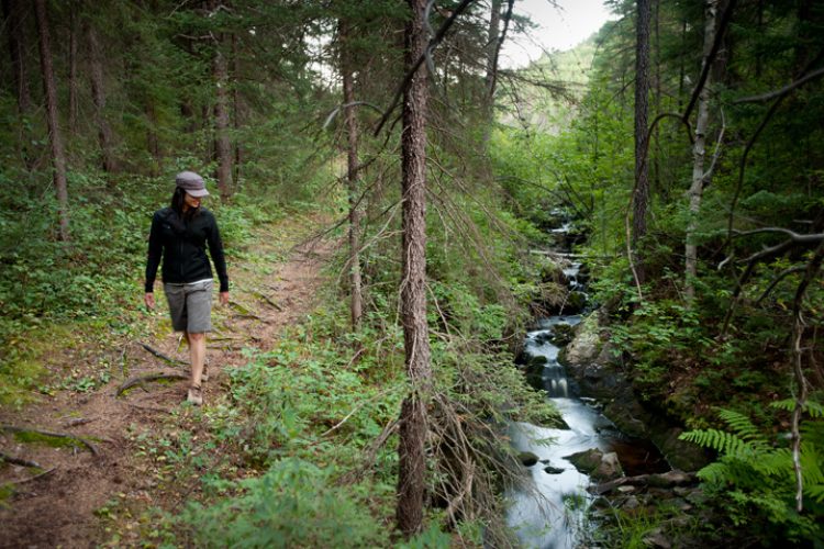
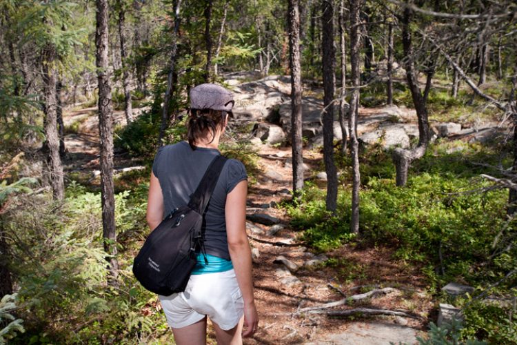
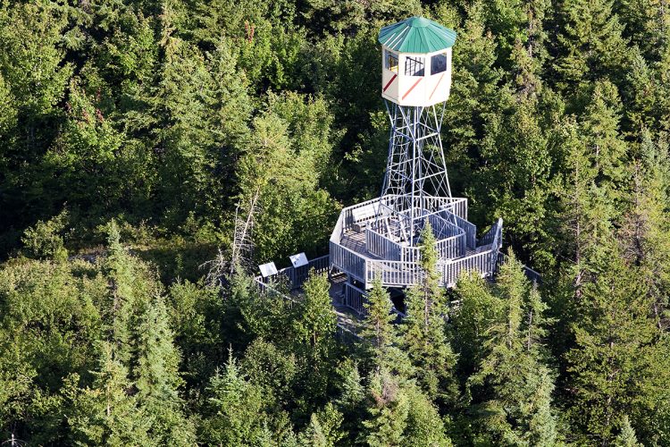
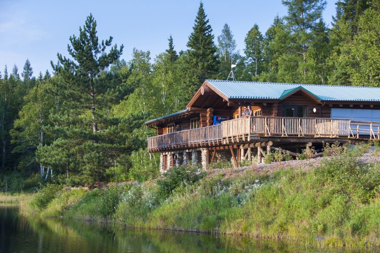
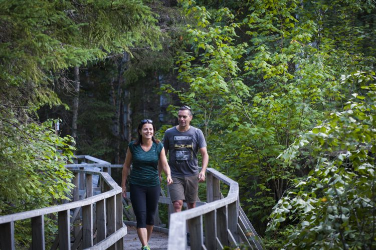
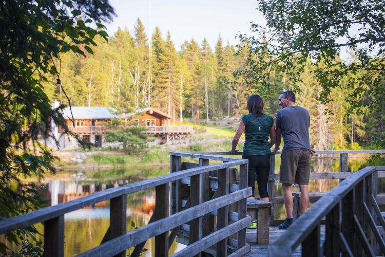
The Aiguebelle national park is 2.7 billion years of rock overlooking a clay plain where a history still evolving. It is also landscapes full of faults, hills, plains, clear or brown waters and fortuitous encounters that invite to discovery. More than 50 km of trails are available for a short or long hike with the possibility to spend the night in a rustic camp buried in nature. The Abijévis hills occupy the southern part of the park. The trails lead to lakes of faults, rocky escarpments or natural viewpoints. Other attractions such as the suspended walkway, the spiral staircase and the guard tower surprise while facilitating access to the hills. A trail for people with reduced mobility is located next to the discovery centre. Several types of accommodation are offered: furnished or rustic campsites, Huttopia tents, chalets and rustic camps.
Take highway 117 north for about 65 km, then turn right on the road to Mont-Brun (22 km on a paved road). At the intersection of Mont-Brun, take the Route d'Aiguebelle on your right. Cross the village of Mont-Brun. At the bridge, turn right onto the road to Aiguebelle. The entrance to the park is located 8 km from the village of Mont-Brun. The Discovery and Service Centre (Home) is located on Route 2, 5 km from the entrance.
From Rouyn-Noranda :
Take route 101 Nord. When you reach D'Alembert, turn right on the route d'Aiguebelle. Cross the village of Cléricy and go to the village of Mont-Brun. At the intersection of the road to Mont-Brun, turn left. Cross the village of Mont-Brun. At the bridge, turn right onto the road to Aiguebelle. The entrance to the park is located 8 km from the village of Mont-Brun. The Discovery and Service Centre (Home) is located on Route 2, 5 km from the entrance.
From La Sarre :
Take the road 101 South. Arrived at D'Alembert, turn left on the road to Aiguebelle. Cross the village of Cléricy and go to the village of Mont-Brun. At the intersection of the road to Mont-Brun, turn left. Cross the village of Mont-Brun. At the bridge, turn right still on the road to Aiguebelle. The entrance to the park is located 8 km from the village of Mont-Brun. Follow the signs to highway 2, the service center is 5 km from the entrance.
From Amos :
Take Route 109 South. When you reach Rivière-Héva, turn right on route 117 north for about 28 km, then turn right on the route de Mont-Brun. At the intersection of the village of Mont-Brun, take the road to Aiguebelle on your right. Cross the village of Mont-Brun. At the bridge, turn right onto the road to Aiguebelle. The entrance to the park is located 8 km from the village of Mont-Brun. Follow the signs to Route 2, the service center is 5 km from the entrance.
Take Route 111 North to Taschereau. Then take the road 390 for 3 km and turn left on the climb of Aiguebelle (road located in front of the Tembec factory). Continue for 10 km until you reach the entrance of the Taschereau sector park.
From La Sarre :
Take route 101 south to St-Rose-de-Paulaires. Beyond, take Route 390 east and follow the directions for the park entrance via Secteur Taschereau.
From Rouyn-Noranda :
Take Route 101 north to St-Rose-de-Paulary. From there, take Route 390 East and follow the directions for the park entrance via Secteur Taschereau.
From Val-d’Or
Take Route 111 North to Amos and continue to Taschereau. Then take the road 390 for 3 km and turn left on the climb of Aiguebelle (road located in front of the Tembec factory). Continue for 10 km until you reach the entrance of the Taschereau sector park.
Catering and other food services
À 10 km du centre de services Taschereau, vous trouverez un casse-croûte et une épicerie. Le village de Mont-Brun est desservi par une coopérative alimentaire et une station-service (8 km).
Framed access for dogs
Dogs are allowed in Aiguebelle National Park, in certain designated areas.
Main framework rules*:
At all times, the dog must remain in the permitted places.
The dog must be kept on a leash (max. 3 m) and under supervision at all times.
The person responsible must immediately collect the animal’s excrement.
Barking, howling or harming the welfare, peace and safety of other visitors is not tolerated.
* Any person who violates either of these rules may be required to leave the territory and/or receive a report of an offence, if applicable.
Compliance with the regulations is essential and the offer could be reviewed if a relaxation was found.
Authorized Areas
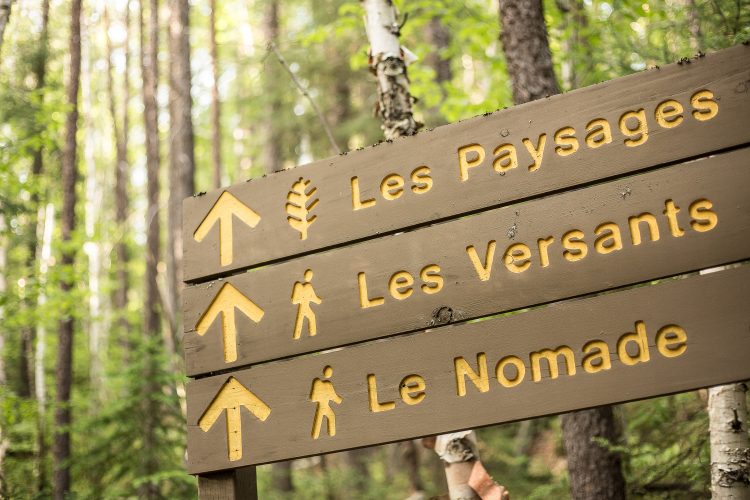
Summer trails: Le Petit Nomade, La Traverse, La Salamandre, La Castorière.
Camping: Ojibway Campsite (except Ready-to-Camp), Barlow VR Space.
Picnic area: Taschereau service centre, around Lac Loïs, la Haie parking lot
Nautical access: Launching at the Taschereau service center.
Natural Environment
Geology
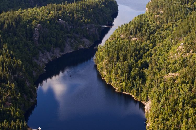
The park is part of the Canadian Shield, which began to form about 3.8 billion years ago. It is formed of magma that has poured out in successive layers under the ocean. From 2.79 billion years, a new background takes shape covering the entire Abitibi-Témiscamingue. From this rock, several rocky massifs of the region whose Abijévis hills and faults will form a few million years later during major upheavals.
Geomorphology
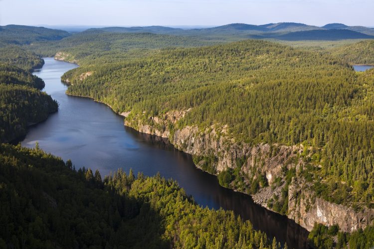
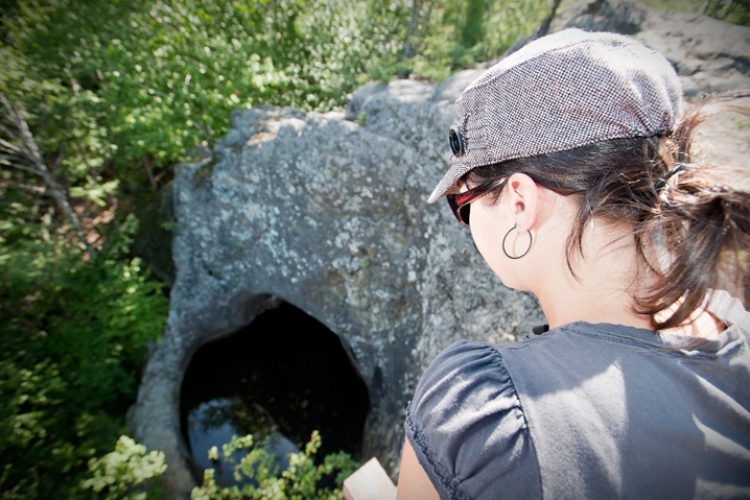
The last ice age, the Wisconsin Ice Age, which began about 100,000 years ago, is responsible for the current shape of the territory. This glacier covered the entire territory of Abitibi and it has progressed to the state of Wisconsin. Traces of erosion and several formations testify to its presence. For example, glacial streaks created by the friction of materials transported by the glacier and a network of giant pots located in the path Les marmites.
Hydrology
The main hydrographic feature of the territory is the passage of the water divide between the St. Lawrence and James Bay watersheds. This line runs between Lake La Haie and Lake Sault. There are nearly 80 lakes. Located in the hills, they are small and their waters are clear, which is exceptional at a regional level. Located in the plain, they are typical of the Abitibi: large, shallow and their waters are cloudy and brown.
Wildlife
The two wildlife representatives of the boreal forest are the moose and beaver. They are ubiquitous in the park. The diversity of the territory in terms of geomorphology, hydrology and flora contributes to the abundance and diversity of animal species by offering a wide variety of habitats. Some species are at the limit of their range such as the Grey-throated Warbler and Long-tailed Grouse. Others are exceptional for the region such as lake trout.
Flora
The vegetation cover of the park is boreal forest, composed mainly of young forest stands associated with repeated fire passages. This promotes the growth of pioneer species such as aspen poplar and grey pine. Some species a little more rare for the region such as yellow birch and black ash are added to the landscape. The particular morphology of the fault lakes has allowed the creation of small exceptional habitats that shelter very rare species such as Gymnocarpium jessoense.
This sheet has been prepared from information provided by outdoor enthusiasts deemed sufficiently reliable and experienced. Errors or omissions are always possible and Tourisme Abitibi-Témiscamingue cannot accept responsibility for any problem or accident that may arise from this sheet or be attributed to its use. If you notice any errors or omissions during your expedition, we would be very grateful if you would let us know by email pleinair@atrat.org in order to keep our information up to date.
Ce fichier texte est en format GPX. Il contient les données de traces et de points de navigation (waypoints). Il peut être visualisé via un éditeur de texte. Téléchargez gratuitement le gratuiciel GPS Babel pour importer le fichier contenant les traces et les points de navigation dans votre GPS.
Dans la section INPUT, sélectionner « Fichier ». Dans la rubrique Format, à l’aide de la liste déroulante, « GPX XML ». Cliquer sur le bouton File Name(s) pour accéder au fichier GPX téléchargé dans l’ordinateur.
Dans la section Translation Options, sélectionner « Waypoints » et « Traces ».
Brancher le GPS à l’ordinateur à l’aide d’un câble USB.
Dans la section Sortie, sélectionnez « Périphérique ». Choisir le format correspondant à la marque du GPS. Dans la rubrique Nom de périphérique, sélectionner « usb : ».

 Reception et services
Centre de service Mont-Brun
48°25'50.0"N
Reception et services
Centre de service Mont-Brun
48°25'50.0"N Tourist information
Centre de service Mont-Brun et Boutique Nature
(Parc national d'Aiguebelle)
48°26'55.191”N
Tourist information
Centre de service Mont-Brun et Boutique Nature
(Parc national d'Aiguebelle)
48°26'55.191”N Commercial campsite
Camping aménagé Abijévis (Parc national d'Aiguebelle, lac Matissard)
48°25'53.599"N
Commercial campsite
Camping aménagé Abijévis (Parc national d'Aiguebelle, lac Matissard)
48°25'53.599"N Paid wild camping
Camping rustique lac Du Sablon (lac Du Sablon)
48°30'10,111"N
Paid wild camping
Camping rustique lac Du Sablon (lac Du Sablon)
48°30'10,111"N Rustic camp for rent
La Guêpe (lac La Haie)
48°29'06.2"N
Rustic camp for rent
La Guêpe (lac La Haie)
48°29'06.2"N Cottage for rent
L'Éphémère (à proximité du Centre de découverte)
48°25'55,820"N
Cottage for rent
L'Éphémère (à proximité du Centre de découverte)
48°25'55,820"N Point of interest
Pont suspendu
48°27'49,249"N
Point of interest
Pont suspendu
48°27'49,249"N Observation tower
Tour de garde-feu
48°27'22,12"N
Observation tower
Tour de garde-feu
48°27'22,12"N Panorama
Point de vue du sentier L'Escalade
48°27'19,976"N
Panorama
Point de vue du sentier L'Escalade
48°27'19,976"N Parking
Stationnement du sentier Les Paysages
48°30'39,077"N
Parking
Stationnement du sentier Les Paysages
48°30'39,077"N Directions to reach the Aiguebelle National Park
 Sunrise : 07:20