
Hiking Trails chute à Ovide
Hiking Trails chute à Ovide
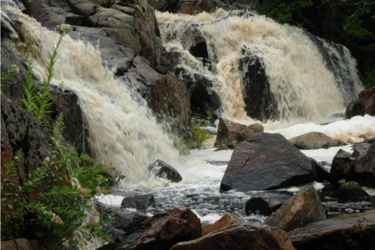
Latulipe, Témiscamingue
A rustic footpath takes you to the falls to enjoy the beauty of nature and see the remains of a sawmill from the early 20th century.
- electrocardiogram Easy
- mountain 1.7 Km (Linear)
Sections
Sentier-Chute à Ovide
- electrocardiogram Easy
- mountain 1.71 km (Linear)
Points of service and interest
Category Name
 Parking
 Fall / waterfall
Accessibility
Access Rights
 Free, no reception infrastructure.
 ![]() Pets are allowed.
Pets are allowed.
Directions to the starting point
Take Carrefour Street South to the church and continue on the Montée de la 9e Rang. Turn left at the intersection and continue on to 9th East Row. Turn onto the Chemin du Lac-des-Bois and continue for about 2 km.
Parking (large): Free, open year-round.
Position : 47°22'37,7"N | 79°01'10,7"O
![]() View the route from your location on Google Maps
View the route from your location on Google Maps
Contact
Municipality of Latulipe-et-Gaboury T 819 747-4281
Specifications
Closed during hunting season.
Comments social0
Tools ready to go
- pdf Planification Randonnee Apa
- pdf Equipement Randonnee Pedestre
- pdf Gestion Des Risques Randonnee Pedestre Apa
- pdf Sans Trace Apa
Info & advice
- Activité
- Animation et interprétation
- Camping
- Care
- Carte et orientation
- Caution
- Emergency
- Encadrement
- Equipment
- Jamais sans mon chien
- Nutrition
-
Prevention
- 10 articles de première nécessité
- Bien s'hydrater
- Comment lire la météo dans les nuages? Faire la pluie et le beau temps !
- Éviter les ampoules aux pieds
- Éviter les mauvaises rencontres en milieu sauvage
- Feu de camp sécuritaire : trois étapes à respecter
- Insectifuges
- Les moustiques
- Lunettes de soleil
- MALADIE DE LYME : PRÉVENIR LES PIQÛRES DE TIQUE EN RANDONNÉE
- Perdu en forêt : quoi faire?
- Se protéger contre le soleil
- Vaporisateur Chasse-ours
- Progression
- Réglementation
- Training
Caution
This sheet has been prepared from information provided by outdoor enthusiasts deemed sufficiently reliable and experienced. Errors or omissions are always possible and Tourisme Abitibi-Témiscamingue cannot accept responsibility for any problem or accident that may arise from this sheet or be attributed to its use. If you notice any errors or omissions during your expedition, we would be very grateful if you would let us know by email pleinair@atrat.org in order to keep our information up to date.
