
Forêt Ornithologique Askikwaj Hiking trails
Forêt Ornithologique Askikwaj Hiking trails
La Corne, Amos Région
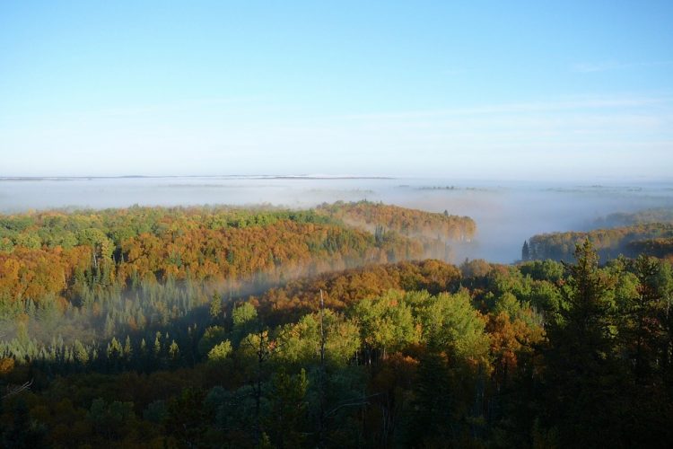
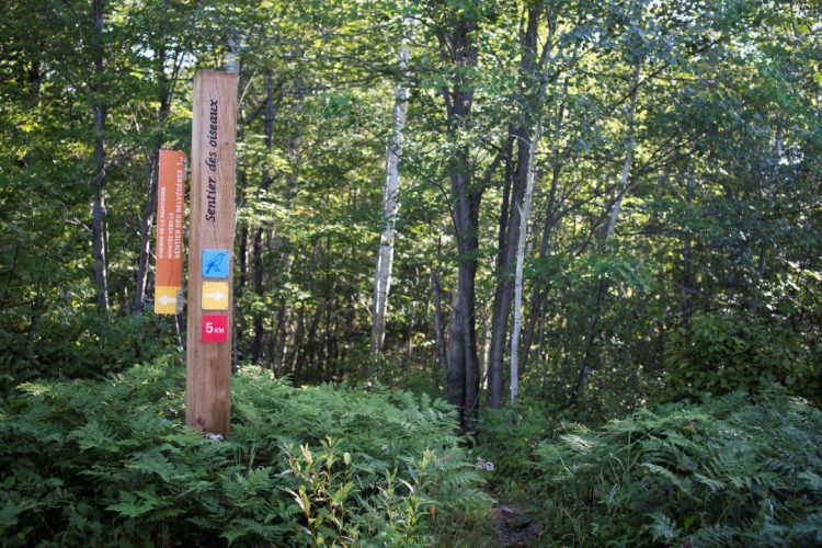
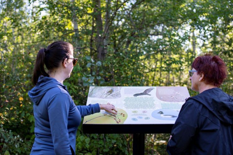
These trails are located in the Ornithological Forest, a conservation area featuring lakes and a hill. Commonly seen in the area are common loons, ruby-throated hummingbirds, and warblers, among others. The Sentier des Belvédères, accessible via Chemin de la Montagne, leads to numerous viewpoints overlooking the region. The Sentier des Oiseaux is dotted with over 70 birdhouses. Along the way, hikers will pass near Laflamme and Simard lakes. The trails are narrow, with a rustic layout.
- electrocardiogram Easy to Moderate
- mountain 6.45 Km (Loop)
- calendar seasonal
Sections
Des Oiseaux
- electrocardiogram Easy
- mountain 4.80 km (Loop)
Des Belvédères
- electrocardiogram Moderate
- mountain 1.15 km (Loop)
Chemin de la Montagne
- electrocardiogram Easy
- mountain 0.50 km (Linear)
Points of service and interest
 Parking
Accessibility
Access Rights
![]() Free, no welcome center.
Free, no welcome center.
Directions to the starting point
From Amos, take Route 111 and cross the municipality of La Corne. Turn right on Lane 3 km to Lane 3 and 4 West.
From Val-d'Or, take Route 111 and cross the municipality of Vassan. Turn left after 13.5 km on Rang 3 and 4 West. On Rows 3 and 4, walk 1.5 km. Parking and trail access are well marked at the top of the coast to your right.
Parking: free
Coordinates: 48°19'40.1"N 78°00'51.1"O
Address: 185, Rang 3 & 4 West, La Corne, Québec
![]() View the route from your location on Google Map
View the route from your location on Google Map
Contact :
T 819 799-3571 | adl@lacorne.ca
See website
Natural Environment
Wildlife
Notable sightings are the loon, the hummingbird, the spotted woodpecker near its nest and the black-throated warbler.
Flora
The 85 hectares of land include aspen, paper birch, a stand of 100-year-old grey pines, Pennsylvania cherry trees, red maple trees, ameanchiyus and even large-toothed poplars. On the heights, blueberries grow in abundance, while in the lowlands, a cranberry bog is noted.
Comments social0
Tools ready to go
- map Guide map (PDF)
- mapsquare Download GPS track (GPX)
- Google driving directions
-
 Sunrise : 07:27
Sunset : 18:29
Info & advice
- Activité
- Animation et interprétation
- Camping
- Care
- Carte et orientation
- Caution
- Emergency
- Encadrement
- Equipment
- Jamais sans mon chien
- Nutrition
-
Prevention
- 10 articles de première nécessité
- Bien s'hydrater
- Comment lire la météo dans les nuages? Faire la pluie et le beau temps !
- Éviter les ampoules aux pieds
- Éviter les mauvaises rencontres en milieu sauvage
- Feu de camp sécuritaire : trois étapes à respecter
- Insectifuges
- Les moustiques
- Lunettes de soleil
- MALADIE DE LYME : PRÉVENIR LES PIQÛRES DE TIQUE EN RANDONNÉE
- Perdu en forêt : quoi faire?
- Se protéger contre le soleil
- Vaporisateur Chasse-ours
- Progression
- Réglementation
- Training
Caution
This sheet has been prepared from information provided by outdoor enthusiasts deemed sufficiently reliable and experienced. Errors or omissions are always possible and Tourisme Abitibi-Témiscamingue cannot accept responsibility for any problem or accident that may arise from this sheet or be attributed to its use. If you notice any errors or omissions during your expedition, we would be very grateful if you would let us know by email pleinair@atrat.org in order to keep our information up to date.
