
Dumoine River Hiking Trails
Dumoine River Hiking Trails
TNO Les-Lacs-du-Témiscamingue, Témiscamingue
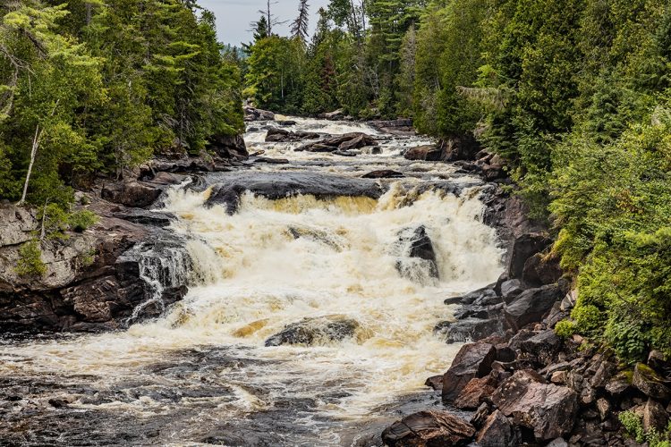
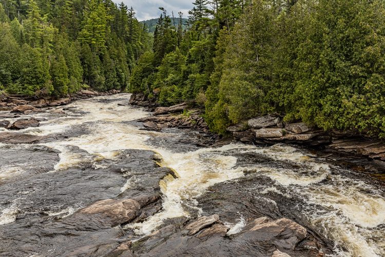
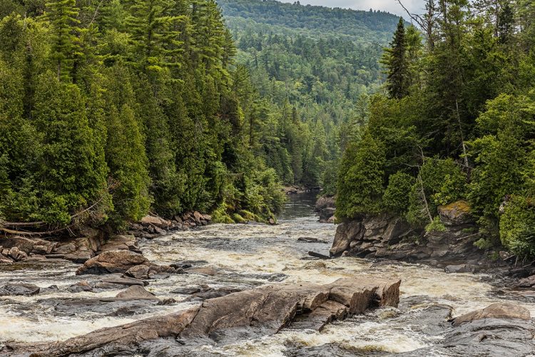
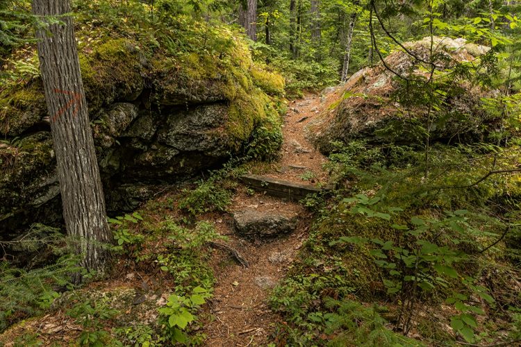
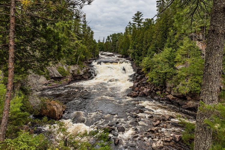
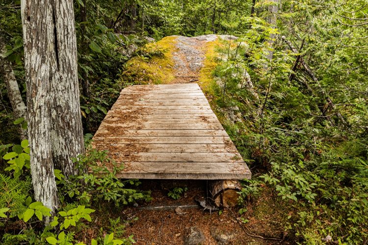
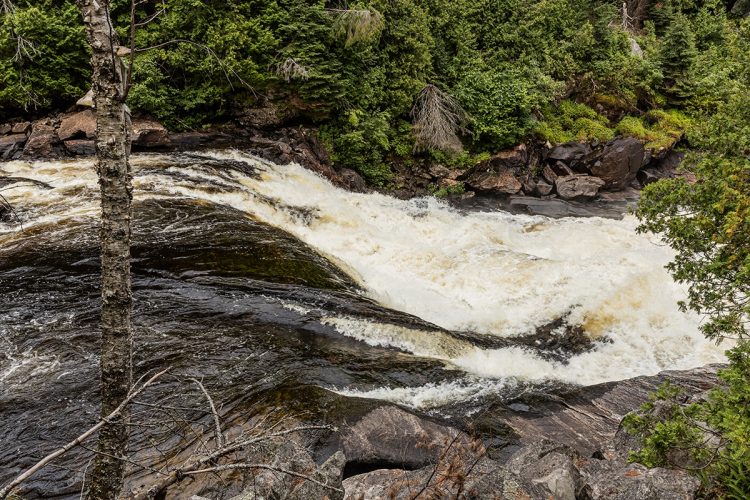
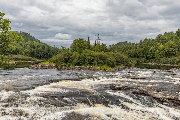
This zec covers a territory of 1,502 km2. The trails cross a mixed woodland. Some trails run along the Dumoine River, others lead to Six Miles Lake. The Dumoine trail follows the Wagon Trail, which was once used to feed forest farms. The Forest of the Great Ones loops over the mountain. Around the island runs Keal Island and offers a view of Lake Sangsues. The Mill Falls allows you to admire a series of falls.
- electrocardiogram Demanding
- mountain 26 Km (Mixed)
- calendar seasonal
Sections
Accès-Camp Trois Roche
- electrocardiogram Easy
- mountain 0.06 km (Linear)
Accès-Camps Fildegrand
- electrocardiogram Easy
- mountain 0.95 km (Linear)
Chemin d'accès-Camp Amik
- electrocardiogram Easy
- mountain 0.16 km (Linear)
Sentier-Belvédère Chemin de Portage Dumoine
- electrocardiogram Easy
- mountain 0.74 km (Linear)
Sentier-Chemin de Portage Dumoine
- electrocardiogram Easy
- mountain 26.10 km (Linear)
Sentier-Parcours Alternatif
- electrocardiogram Easy
- mountain 0.92 km (Linear)
Sentier-Point de vue de l'étang Steven
- electrocardiogram Easy
- mountain 0.08 km (Linear)
Traversée de la rivière Fildegrand
- electrocardiogram Easy
- mountain 0.06 km (Linear)
Trail-Chemin de Portage Dumoine
- electrocardiogram Easy
- mountain 26.10 km (Linear)
Trail-Point de vue de l'étang Steven
- electrocardiogram Easy
- mountain 0.08 km (Linear)
Trail-Belvédère Chemin de Portage Dumoine
- electrocardiogram Easy
- mountain 0.74 km (Linear)
Crossing of the Fildegrand River
- electrocardiogram Easy
- mountain 0.06 km (Linear)
Access-Camp Trois Roche
- electrocardiogram Easy
- mountain 0.06 km (Linear)
Access-Camps Fildegrand
- electrocardiogram Easy
- mountain 0.95 km (Linear)
Access Road-Camp Amik
- electrocardiogram Easy
- mountain 0.16 km (Linear)
Trail-Parcours Alternatif
- electrocardiogram Easy
- mountain 0.92 km (Linear)
Points of service and interest
Category Name
-
 Parking
Stationnement de la Grande Chute Dumoine
46°22'41.8"N
Parking
Stationnement de la Grande Chute Dumoine
46°22'41.8"N
77°46'26.0"O -
 Wild camping
Camp Aygina-gwasing Sibi
46° 12.980' N
Wild camping
Camp Aygina-gwasing Sibi
46° 12.980' N
77° 51.218'O -
Wild camping
Camp Rockcliffe
46° 13.774' N
77° 51.365'W -
Wild camping
Camp Mukwa Beweetig
46° 15.635'N
77° 51.088'O -
Wild camping
Camp Bateau de Drave
46° 15.913'N
77° 51.310'O -
Wild camping
Camp Trois Rochesh
46° 16.456' N
77° 51.180'O -
Wild camping
Camp Fildegrand
46° 17.470'N
77° 50.542'O -
 Panorama
Point de vue Belvédère Dumoine
46° 17.522' N
Panorama
Point de vue Belvédère Dumoine
46° 17.522' N
77° 51.287'O -
Wild camping
Camp Bertrands
46° 17.795'N
77° 51.040'O -
 Thin water
Traversée de la rivière Fildegrand
46° 17.807'N
Thin water
Traversée de la rivière Fildegrand
46° 17.807'N
77° 51.011'O -
Wild camping
Camp Amik
46° 17.825' N
77° 50.788'O -
Wild camping
Camp Pattrons Chute - A
46° 18.716'N
77° 50.359'O -
Wild camping
Camp Pattrons Chute - B
46° 18.758' N
77° 50.360'O -
Wild camping
Camp Racinnes de Pins
46° 19.167'N
77° 50.015'O -
Wild camping
Camp Potvin
46° 19.525' N
77° 49.565'O -
Wild camping
Camp l'heure du Thé
46° 19.770'N
77° 49.677'O -
Wild camping
Camps Cèdre
46° 20.171'N
77° 49.517'O -
Wild camping
Camps Bois Carré
46° 20.183'N
77° 49.499'O -
Wild camping
Camp Esker
46° 20.304' N
77° 49.268'O -
Wild camping
Camp Grande Pin
46° 20.297' N
77° 49.215' O -
Wild camping
Camp l'île Spectateur
46° 20.633' N
77° 48.975'O -
Wild camping
Camp C FODA
46° 21.041' N
77° 48.809'O -
Panorama
Point de vue sur l'étang Steven
46° 21.746' N
77° 49.333'O -
Wild camping
Camp Robinson-B
46° 21.801'N
77° 48.350'O -
Wild camping
Camp Robinson - A
46° 21.817' N
77° 48.331'O -
Wild camping
Camp Marque de Bois
46° 22.226' N
77° 47.005'O -
Wild camping
Camps Ankose
46° 22.351' N
77° 46.568'O -
Panorama
Point de vue Chemin de Portage Dumoine
46° 22.420' N
77° 46.462'O -
Wild camping
Camp Bellevue
46° 22.565' N
77° 46.392'O -
Wild camping
Camp Ponens
46° 22.683'N
77° 46.289'O
Accessibility
Access Rights
Payable : See the website of Zec Dumoine
Directions to the starting point
From Témiscaming, take route 635 to Rapides-des-Joachims. Register at the Zec Dumoine registration office, located at 3, rue Principale in Rapides-des-Joachims. Drive to the territory of the Zec Dumoine following the signs for the sector of Grande-Chute, located 26 km further.
Parking: $3 per day
Natural Environment
History
Formerly, the territory of zec Dumoine was frequented by the Otaguottouemins, members of an Algonquin community. The families of this community generally lived in semi-nomadism according to the needs of hunting, picking wild berries (strawberries, raspberries, bluets...), protection, Native American trade... Beaver flooding and forest fires were both constraints and benefits. Regrettably, the terrible Spanish grid of 1918 decimated this community entirely.
The logging of the present zec territory began in 1850 when two forestry enterprises (E. B. Eddy’s ancestors and Consolidated Bathurst) began cutting down the white pines that were abundant in the southeast of Temiskaming. Moreover, north of the Dumoine zec, two hydronyms are significant:
White Pine lake and the White Pine river. This type of wood was highly in demand on the shipbuilding market in Europe, as they were used in particular for masts of sailing boats.
Geography
The Zec Dumoine covers an area of 1,502 km2, making it the 4th largest Zec in Quebec.
The zec Dumoine is located north of the Ottawa River. Its territory is between:
- the Zec de Rapides-des-Joachims, which is on the east side. The Dumoine River (flowing south) serves as a boundary between these two zecs, between Laforge Lake (north) and the Ottawa River (at Holden Lake);
- the Restigo zec and the Maganasipi zec, which are located on the west side.
Wildlife
Game is abundant in the zec Dumoine. It includes, among others, the elm, the white-tailed deer, the black bear, the hare, the grouse and the grouse. The zec recorded more than 120 species of birds and noted a strong presence of turtles.
Flora
The zec territory is located at the intersection of two important ecosystems: the boreal forest and the mixed forest. This forest area has a diversity of habitats, each with its own unique characteristics, such as large mature trees, rare-species trees and areas where wildlife is abundant.
Toponymy
Originally, the name Dumoine referred to the territory of the Lake and Dumoine River watershed. Several historians consider that this toponym would have been retained in memory of a member of a famous family of French traders. In 1697, Sieur d'Iberville, his younger brother Jean-Baptiste Le Moyne and a handful of men paddled on the Ottawa River to confront the English at Hudson Bay. Later, they explored the Mississippi and Jean-Baptiste Le Moyne earned a place in history as founder of New Orleans.
According to the section of the Dumoine River, the Algonquins named it "Aginagwasi sipi", "Cakawitopikak Sipi" and "Ekonakwasi Sipi" meaning "River of Alder" because of the many alders found on each side of its banks and rivers of desire.
Comments social0
Tools ready to go
- mapsquare Download GPS track (GPX)
- Google driving directions
-
 Sunrise : 07:22
Sunset : 18:29 -
Equipment for rent Coop de L'Arrière-Pays
- pdf Planification Randonnee Apa
- pdf Equipement Randonnee Pedestre
- pdf Gestion Des Risques Randonnee Pedestre Apa
- pdf Sans Trace Apa
Info & advice
- Activité
- Animation et interprétation
- Camping
- Care
- Carte et orientation
- Caution
- Emergency
- Encadrement
- Equipment
- Jamais sans mon chien
- Nutrition
-
Prevention
- 10 articles de première nécessité
- Bien s'hydrater
- Comment lire la météo dans les nuages? Faire la pluie et le beau temps !
- Éviter les ampoules aux pieds
- Éviter les mauvaises rencontres en milieu sauvage
- Feu de camp sécuritaire : trois étapes à respecter
- Insectifuges
- Les moustiques
- Lunettes de soleil
- MALADIE DE LYME : PRÉVENIR LES PIQÛRES DE TIQUE EN RANDONNÉE
- Perdu en forêt : quoi faire?
- Se protéger contre le soleil
- Vaporisateur Chasse-ours
- Progression
- Réglementation
- Training
Caution
This sheet has been prepared from information provided by outdoor enthusiasts deemed sufficiently reliable and experienced. Errors or omissions are always possible and Tourisme Abitibi-Témiscamingue cannot accept responsibility for any problem or accident that may arise from this sheet or be attributed to its use. If you notice any errors or omissions during your expedition, we would be very grateful if you would let us know by email pleinair@atrat.org in order to keep our information up to date.
