
Récré-eau des Quinze Hiking trails
Récré-eau des Quinze Hiking trails
Saint-Eugène-de-Guigues, Angliers, Guérin, Notre-Dame-du-Nord et Timiscaming First Nation, Témiscamingue
![]()
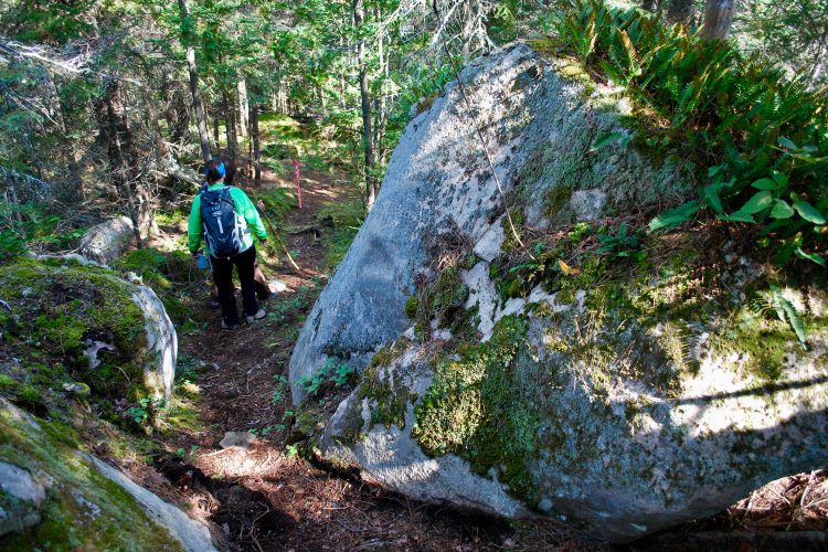
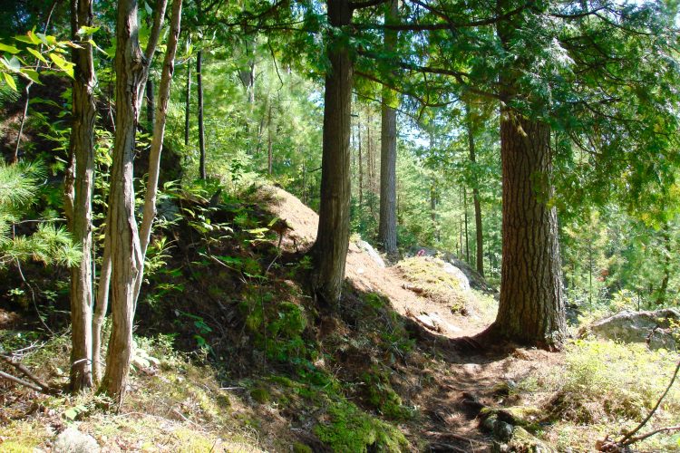
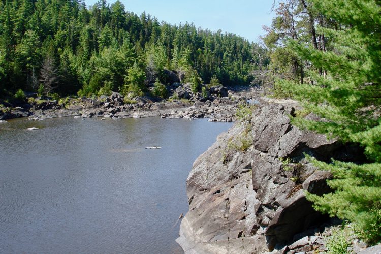
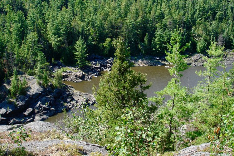
This group of five communities offers a walk in a watershed. The route was already taken by Indigenous peoples. Today, power stations join the walking trails. Each of the trails is marked by a body of water in addition to the many viewpoints from which you can enjoy splendid landscapes.
- electrocardiogram Easy to Moderate
- mountain 23.4 Km (Mixed)
- calendar seasonal
Sections
La Tour à Feuf
- electrocardiogram Easy
- mountain 0.94 km (Linear)
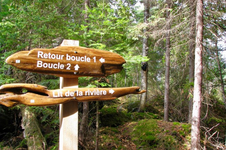
L'Explorateur Boucle 1
- electrocardiogram Moderate
- mountain 1.13 km (Loop)
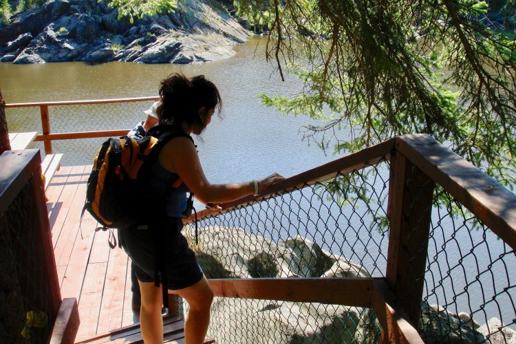
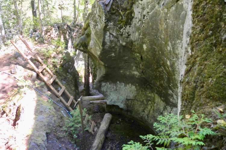
Access : On the Power Road, take the right branch and cross the Bailey Bridge to reach the grand staircase.
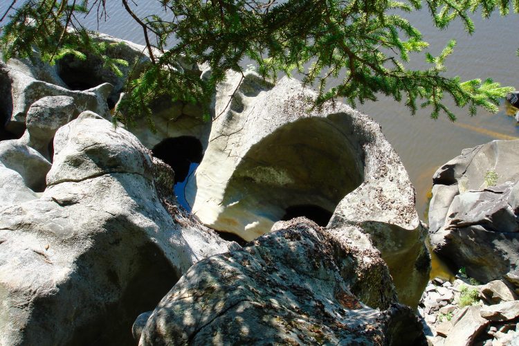
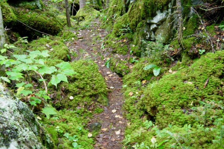
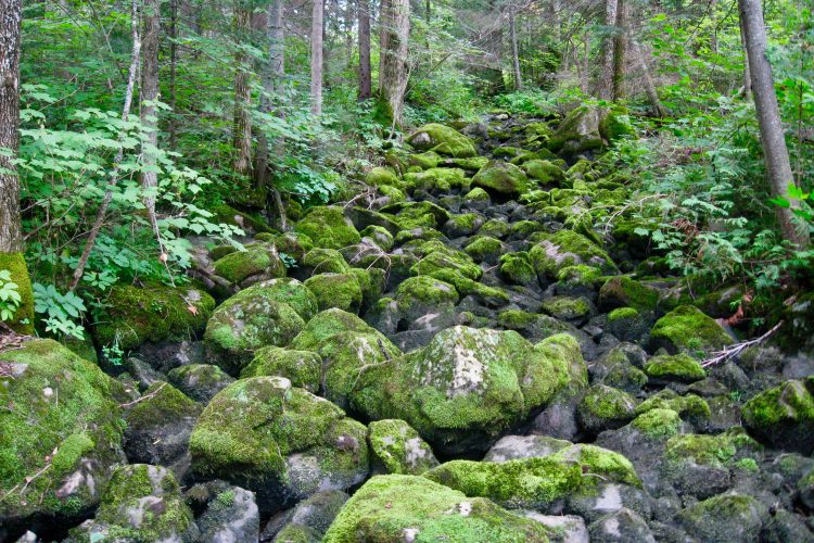
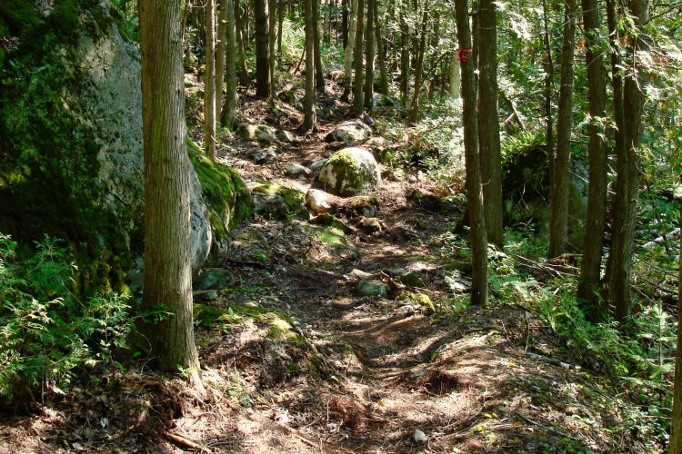
Interest : Intimate trail located on the island Kakaké, rock shelters, old waterfall, wetland, giant pots of 4 to 5 meters in diameter and depth, walks between two cliffs, mosses and lichens.
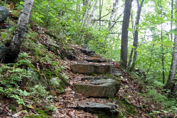
Danger : Rather steep in some places.
L'Explorateur Boucle 2
- electrocardiogram Moderate
- mountain 3.08 km (Loop)
Access : On the Power Road, take the right branch and cross the Bailey Bridge to reach the grand staircase.
Interest : On the Power Road, take the right branch and cross the Bailey Bridge to reach the grand staircase.
Danger : Rather difficult slope.
Détour Marmites L'Explorateur
- electrocardiogram Easy
- mountain 0.08 km (Linear)
La Tour à Feu
- electrocardiogram Easy
- mountain 0.94 km (Linear)
Access : Left on the road of Rapids-des-Iles after the fork with the way of Power.
Interest : Fire tower (observation tower used as a forest fire detection system at the time).
L'Île des Rapides
- electrocardiogram Easy
- mountain 3.19 km (Loop)
Access : Two access points, one near the Rapides-des-Îles power plant and the other on the edge of the second entrance parking lot.
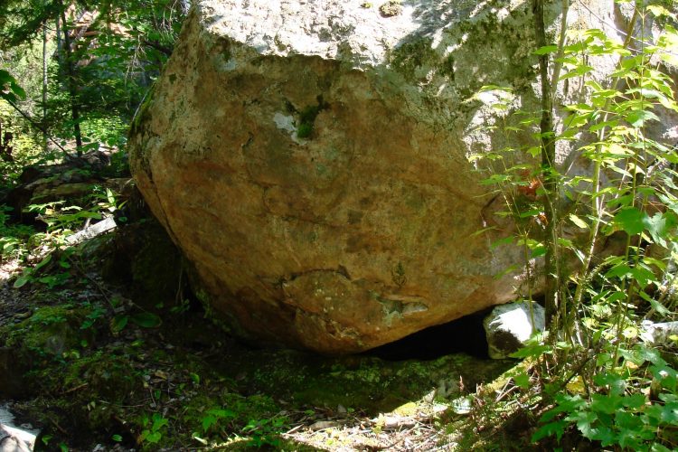
Interest : Island became a peninsula in 1964 following the construction of the hydroelectric power plant, path along the banks, various bays, majestic red pines, large erratic blocks, presence of water throughout the loop.
La Grande Île
- electrocardiogram Easy
- mountain 9.18 km (Loop)
Access : At the Bryson Bridge on Rapids Island Road.
Interest : Former spring portage of travellers and first nations. Meandering along Bryson Creek, mountain climb, series of small lakes, Bryson Dyke, lycopods ubiquitous.
L'Attaway
- electrocardiogram Easy
- mountain 3.47 km (Linear)
Access : Two entrances - on the way of the Rapids and on the way of the Power. Provide a vehicle at the exit regardless of your departure from east or west.
Interest : Several ecosystems and habitats, magnificent views of the Ottawa River, presence of water throughout this route, small islands.
Points of service and interest
Category Name
-
 Parking
Stationnement du sentier La Grande Île
47°35'05.5"N
Parking
Stationnement du sentier La Grande Île
47°35'05.5"N
79°21'19.7"O -
Parking
Stationnement
47°34'54.9"N
79°17'08.5"O -
Parking
Stationnement du sentier L'île des rapides
47°34'29.1"N
79°19'59.3"O -
Parking
Stationnement du sentier île des Rapides
47°34'20.8"N
79°20'46.7"O -
 Point of interest
Marmites
47°35'35,041"N
Point of interest
Marmites
47°35'35,041"N
79°17'24"O -
Point of interest
Petites marmites du sentier Attaway
47°34'43,799"N
79°19'16,201"O -
 Panorama
Point de vue sur le sentier Attaway
47°34'56,46"N
Panorama
Point de vue sur le sentier Attaway
47°34'56,46"N
79°18'41,821"O -
Panorama
Point d'intérêt sur le sentier Attaway
47°35'11,717"N
79°18'17,554"O -
Panorama
Point de vue sur le sentier de l''île des rapides
47°34'35,879"N
79°20'10,021"O -
Panorama
Point de vue sur le sentier L'île des rapides
47°34'20,219"N
79°20'36,96"O -
Panorama
Point de vue sur le sentier L'Explorateur
47°34'57,245"N
79°17'0,442"O -
Panorama
Point de vue sur le sentier La grande île
47°35'35,099"N
79°20'25,08"O -
 Picnic table
Point de vue sur le sentier La grande île
47°35'47,58"N
Picnic table
Point de vue sur le sentier La grande île
47°35'47,58"N
79°20'2,519"O -
Picnic table
Table de pique-nique
47°34'53,58"N
79°19'0,48"O -
Picnic table
Table de pique-nique
47°34'38.7"N
79°20'14.2"O -
Picnic table
Table de pique-nique
47°34'46,859"N
79°19'3,781"O -
Picnic table
Table de pique-nique
47°35'6,241"N
79°18'28,98"O -
Picnic table
Table de pique-nique
47°35'11,699"N
79°17'1,439"O -
Picnic table
Table de pique-nique
47°34'33,42"N
79°19'37,499"O -
Picnic table
Table de pique-nique
47°35'29,58"N
79°20'34,501"O -
Picnic table
Table de pique-nique
47°35'15,659"N
79°16'57,119"O -
 Wild camping
Camping sauvage du sentier L'île des rapides
47°34'38,701"N
Wild camping
Camping sauvage du sentier L'île des rapides
47°34'38,701"N
79°20'15,839"O
Accessibility
Access fee
![]() Free, no reception.
Free, no reception.
Directions to the starting point
ACCESS VIA NOTRE-DAME-DU-NORD (HIGHWAY 101)
From Notre-Dame-du-Nord, take Highway 101 north. Go through the village of Timiskaming First Nation, then after 1.2 km, turn right onto Hydro-Québec Road (1 km). From Rouyn-Noranda, turn left onto Hydro-Québec Road (1 km).
Turn left onto Rapides-des-Îles Road (7.8 km) to reach the Bryson Bridge, where the La Grande Île trailhead is located.
![]() View the route from your location on Google Maps
View the route from your location on Google Maps
Continue further along the Chemin des Rapides-des-Îles to reach the access point for the L'île des Rapides trail.
![]() View the route from your location on Google Maps
View the route from your location on Google Maps
Continue further along Chemin des Rapides-des-Îles to reach the access point for the L'Attaway trail.
![]() View the route from your location on Google Maps
View the route from your location on Google Maps
Continue further on Chemin des Rapides-des-Îles (5.3 km) then turn left onto Chemin du Pouvoir (2 km), then turn left to reach the access point (950 m) for the L'explorateur trail. Continue and cross the dike to join the Les Pouvoirs de l'Eau trail.
![]() View the route from your location on Google Maps
View the route from your location on Google Maps
The trails are also accessible in the opposite direction via the Giovani path in Angliers, but this is no longer maintained.
ACCESS VIA ANGLIERS (ROUTE 391)
![]() View the route from your location on Google Maps
View the route from your location on Google Maps
Contact
P 819 685-2301 Courriel : contact@recre-eaudesquinze.qc.ca
Markings
Driftwood and red and yellow paint.
Natural Environment
History
In 1920, the Northern Quebec Power Company decided to control the waters by building a hydroelectric power station.
Toponymy
ATTAWAY means "to sell" in Algonquin.
Comments social0
Tools ready to go
- map Guide map (PDF)
- mapsquare Download GPS track (GPX)
- Google driving directions
-
 Sunrise : 07:29
Sunset : 18:37 -
Equipment for rent Coop de l'Arrière-Pays
- pdf Planification Randonnee Apa
- pdf Equipement Randonnee Pedestre
- pdf Gestion Des Risques Randonnee Pedestre Apa
- pdf Sans Trace Apa
Info & advice
- Activité
- Animation et interprétation
- Camping
- Care
- Carte et orientation
- Caution
- Emergency
- Encadrement
- Equipment
- Jamais sans mon chien
- Nutrition
-
Prevention
- 10 articles de première nécessité
- Bien s'hydrater
- Comment lire la météo dans les nuages? Faire la pluie et le beau temps !
- Éviter les ampoules aux pieds
- Éviter les mauvaises rencontres en milieu sauvage
- Feu de camp sécuritaire : trois étapes à respecter
- Insectifuges
- Les moustiques
- Lunettes de soleil
- MALADIE DE LYME : PRÉVENIR LES PIQÛRES DE TIQUE EN RANDONNÉE
- Perdu en forêt : quoi faire?
- Se protéger contre le soleil
- Vaporisateur Chasse-ours
- Progression
- Réglementation
- Training
Caution
This sheet has been prepared from information provided by outdoor enthusiasts deemed sufficiently reliable and experienced. Errors or omissions are always possible and Tourisme Abitibi-Témiscamingue cannot accept responsibility for any problem or accident that may arise from this sheet or be attributed to its use. If you notice any errors or omissions during your expedition, we would be very grateful if you would let us know by email pleinair@atrat.org in order to keep our information up to date.
