
Collines Kékéko Hiking trails
Collines Kékéko Hiking trails
Rouyn-Noranda (Beaudry), Rouyn-Noranda
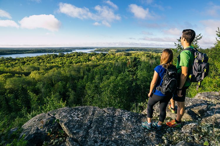
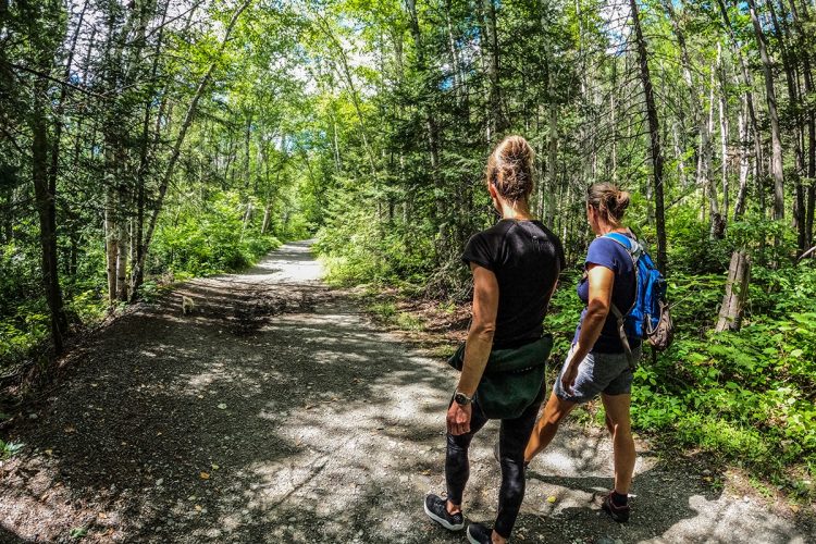
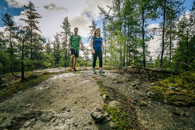
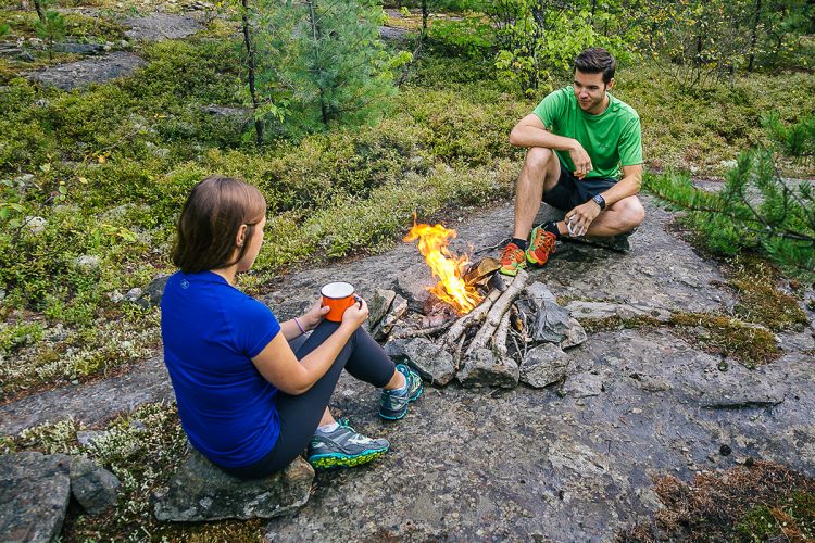
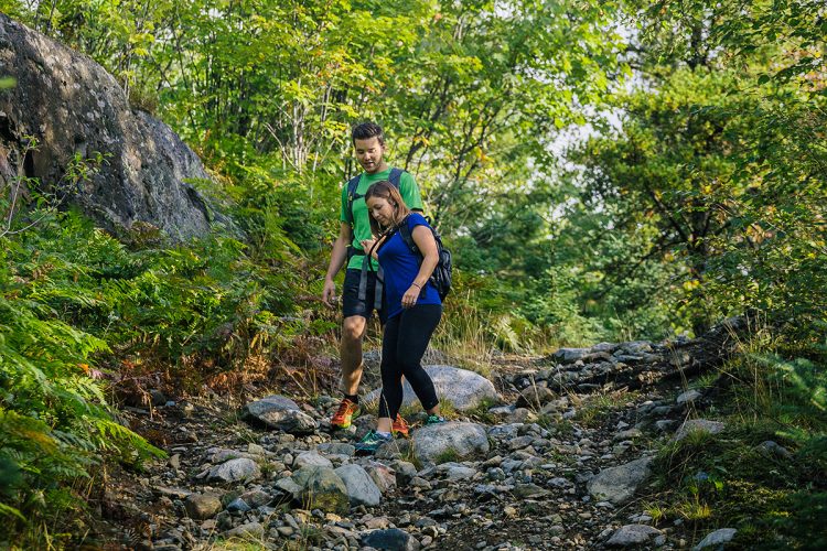
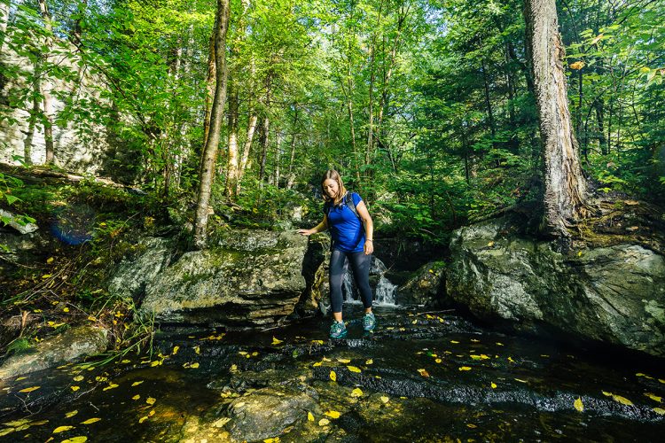
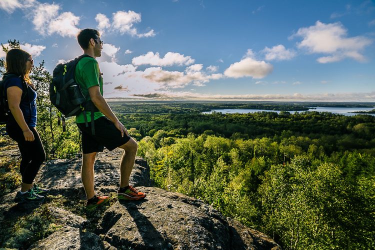
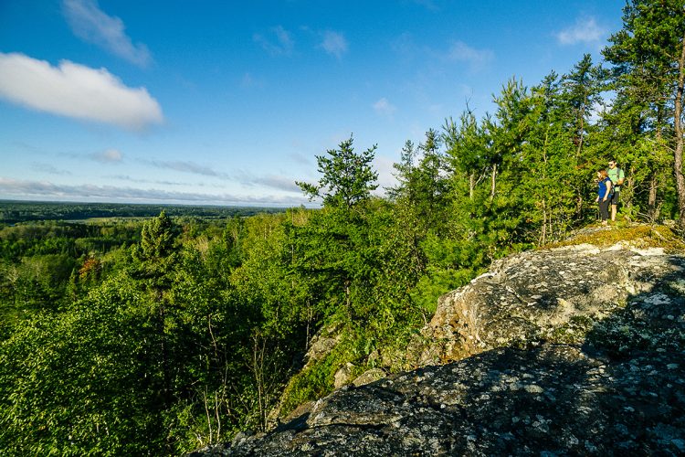
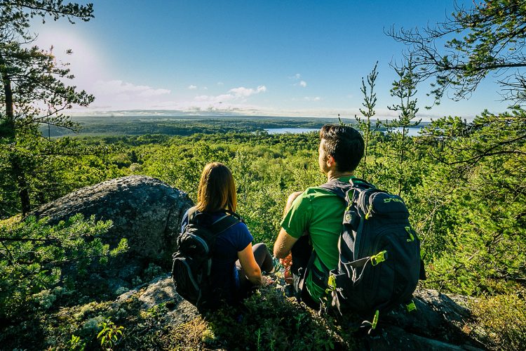
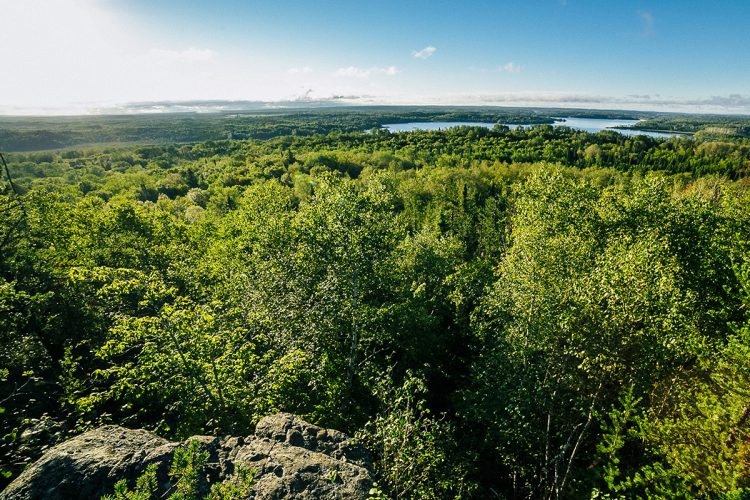
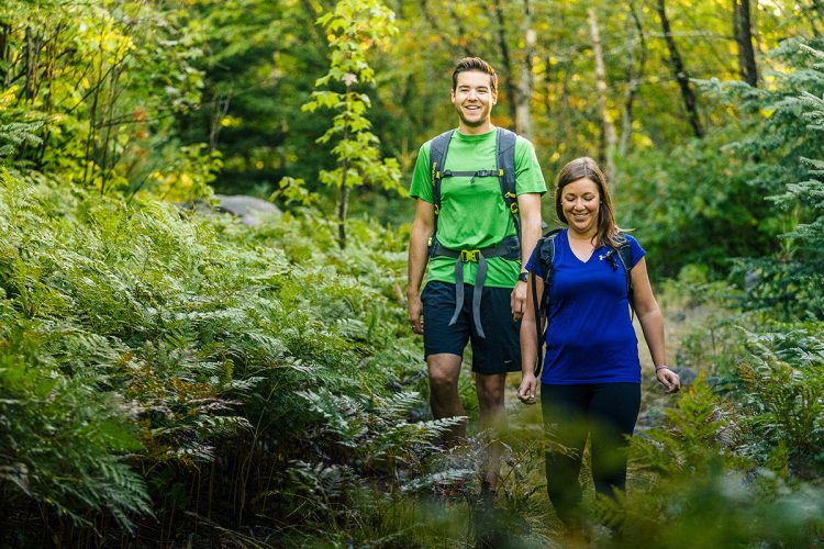
In Abitibi-Témiscamingue, the forest hides the trees, the distance blurs the details, the space erases the discreet beauties. But it is in the detail of a gaulee planted with birches and in the drape of a waterfall hidden in a cypress wood that lies much of the attraction of the region. Paradoxically for such a vast country, it is best to discover it by hiking, because only walking allows you to appreciate the intimate beauty of the forest. The Kékéko Hills cover about 32.2 km2 and offer you the tranquility and beauty of the forest. You will see watercourses, impressive rock cliffs, rock shelters, waterfalls and panoramas of the idyllic landscapes that frame the hills. These trails are designed to give any retina saturated with cathodic vision an overdose of espace.
- electrocardiogram Easy to Very demanding
- mountain 42 Km (Mixed)
- calendar seasonal
Sections
Petit chemin Kékéko
- electrocardiogram Easy
- mountain 3.50 km (Linear)
L'Orignal
- electrocardiogram Easy
- mountain 1.00 km (Linear)
Le Trappeur
- electrocardiogram Easy
- mountain 2.79 km (Mixed)
Le Panorama
- electrocardiogram Moderate
- mountain 0.54 km (Linear)
L'Aventurier
- electrocardiogram Very demanding
- mountain 1.26 km (Linear)
Boucle 2
- electrocardiogram Moderate
- mountain 2.60 km (Loop)
Boucle 1
- electrocardiogram Demanding
- mountain 3.86 km (Mixed)
Specification : SECTION CLOSED FOR REDEVELOPMENT
Le Réflecteur
- electrocardiogram Demanding
- mountain 1.36 km (Linear)
Le Prospecteur
- electrocardiogram Moderate
- mountain 1.28 km (Linear)
Le Panoramique Desperiers
- electrocardiogram Easy
- mountain 2.17 km (Linear)
Le Ruisseau
- electrocardiogram Moderate
- mountain 1.82 km (Linear)
Les Ramparts
- electrocardiogram Demanding
- mountain 1.44 km (Linear)
La Falaise
- electrocardiogram Very demanding
- mountain 2.03 km (Mixed)
Accès La Falaise
- electrocardiogram Moderate
- mountain 0.69 km (Linear)
Les Crevasses
- electrocardiogram Very demanding
- mountain 0.78 km (Mixed)
La Faille
- electrocardiogram Demanding
- mountain 2.19 km (Linear)
Transkékéko
- electrocardiogram Very demanding
- mountain 12.64 km (Linear)
La Kanda
- electrocardiogram Moderate
- mountain 1.88 km (Linear)
La Kanasuta
- electrocardiogram Demanding
- mountain 0.85 km (Mixed)
Points of service and interest
Category Name
-
 Parking
Stationnement principal
48°10'39,608"N
Parking
Stationnement principal
48°10'39,608"N
79°8'4,43"O -
Parking
Stationnement Beaudry (Collines Kékéko)
48°11'1,532"N
79°7'28,387"O -
Parking
Stationnement d"Arntfield (Collines Kékéko)
48°10'42.9"N
79°16'09.4"O -
 Observation tower
Nid de l'épervier
48°11'9,748"N
Observation tower
Nid de l'épervier
48°11'9,748"N
79°8'34,67"O -
 Point of interest
Chute en cascade
48°10'54,976"N
Point of interest
Chute en cascade
48°10'54,976"N
79°9'6,512"O -
 Panorama
Vue panoramique de la Boucle 2
48°11'33,765"N
Panorama
Vue panoramique de la Boucle 2
48°11'33,765"N
79°8'10,09"O -
Panorama
Vue panoramique de la Boucle 1
48°11'41,3"N
79°9'33,0"O -
 Steep slop
Pente raide de la Boucle 1
48°11'42,094"N
Steep slop
Pente raide de la Boucle 1
48°11'42,094"N
79°9'35,244"O -
Panorama
Vue panoramique du sentier Despérier
48°11'15,965"N
79°9'36,208"O -
Panorama
Vue panoramique Despérier
48°11'07,133"N
79°9'47,925"O -
Steep slop
Pente raide du sentier Despérier
48°11'0,593"N
79°9'52,013"O -
Steep slop
Pente raide du sentier Despérier
48°11'22.1"N
79°09'27.4"O -
Panorama
Panorama
48°11'2,35"N
79°8'47,443"O -
Panorama
Vue panoramique réflecteur
48°11'17,402"N
79°8'13,229"O -
Steep slop
Pente raide du sentier Le Réflecteur
48°11'1,072"N
79°8'50,198"O -
Steep slop
Pente raide du sentier Le Réflecteur
48°11'15,47"N
79°8'31,202"O -
Steep slop
Pente raide du sentier Le Prospecteur
48°11'4,958"N
79°8'36,08"O -
Steep slop
Pente raide du sentier L'Aventurier
48°11'12,109"N
79°8'28,343"O -
Steep slop
Pente raide du sentier L'Aventurier
48°11'8,899"N
79°8'29,006"O -
Panorama
Vue panoramique du sentier Le Prospecteur
48°11'3,17"N
79°8'39,592"O -
Panorama
Vue panoramique du sentier Le Panorama
48°11'11,8"N
79°8'4,077"O -
Panorama
Vue panoramique du sentier Les Remparts
48°10'44,62"N
79°9'29,632"O -
Steep slop
Pente raide du sentier Les Remparts
48°10'46,149"N
79°9'23,766"O -
Panorama
Vue panoramique du sentier Les Crevasses
48°10'44,376"N
79°10'12,774"O -
Steep slop
Pente raide du sentier Les Crevasse
48°10'43,203"N
79°10'14,703"O -
Panorama
Vue panoramique du sentier La Falaise
48°10'26,976"N
79°9'47,589"O -
Steep slop
Pente raide du sentier La Faille
48°10'32,186"N
79°9'45,794"O -
Steep slop
Pente raide du sentier La Falaise
48°10'43,702"N
79°10'14,702"O -
Panorama
Vue panoramique du sentier La Faille
48°10'38,048"N
79°10'47,399"O -
Steep slop
Pente raide du sentier La Faille
48°11'07,318"N
79°10'59,867"O -
Steep slop
Pente raide de la Transkékéko
48°11'2,687"N
79°10'12,496"O -
Panorama
Vue panoramique Transkékéko
48°11'3,761"N
79°10'13,61"O -
Panorama
Vue panoramique Transkékéko
48°11'10,044"N
79°10'52,573"O -
Panorama
Vue panoramique du sentier Transkékéko
48°10'48,619"N
79°15'28,296"O -
Steep slop
Pente raide de la Transkékéko
48°10'56,253"N
79°12'49,143"O -
Panorama
Vue panoramique du sentier La Kanda
48°11'06,302"N
79°15'49,662"O -
Panorama
Vue panoramique du sentier La Kanda
48°11'3,264"N
79°15'49,316"O -
Steep slop
Pente raide du sentier Kanda
48°11'0,09"N
79°15'49,59"O
Accessibility
Access Rights
Free, without visitor facilities.
Pets are allowed.
Directions to the starting point
From Rouyn-Noranda, take route 391 south (boulevard Témiscamingue towards the Beaudry district. Located 11 km from Avenue Québec, a large parking lot on the right gives access to the main trails 800 m past Chemin Lavigne Ouest.
Transkekékéko: West side to improvised parking by a paved section of the old highway 101, 400 m after the road stop, at the corner of highway 117 towards Mount Kanasuta.
Parking: Free.
Markage
Signs at the end of trails or intersections indicate the path entrance, and orange, blue, green or red ribbon indicates the way forward.
Natural Environment
Geology
The walls of the ramparts were built from glacial sediments about 2 billion years ago. Rocks of different origin are clearly visible, embedded in the clay matrix. The cleavage of conglomerate strata is made in absolutely perfect flat sections. One obtains, either large boulders with a totally smooth face, or plates of variable dimensions evoking sometimes funerary slabs, sometimes slates for schoolchildren of the Neolithic.
Flora
While at the top of the hill it is mainly a shrub vegetation regrowth where pines are most notable, we find below mainly hardwoods, birches, aspens, maples, merisiers mixed with some thujas and spinets. The hill is also surrounded by a great diversity of lichens.
This area has always been spared by forestry and mining companies, as well as urban development, so that it still enjoys a virtually virgin forest cover.
Toponymy
Designation derived from the Algonquin term "Kêkêk" which means hawk.
Comments social0
Tools ready to go
- map Guide map (PDF)
- mapsquare Download GPS track (GPX)
- Google driving directions
-
 Sunrise : 07:20
Sunset : 18:47
- pdf Planification Randonnee Apa
- pdf Equipement Randonnee Pedestre
- pdf Gestion Des Risques Randonnee Pedestre Apa
- pdf Sans Trace Apa
Info & advice
- Activité
- Animation et interprétation
- Camping
- Care
- Carte et orientation
- Caution
- Emergency
- Encadrement
- Equipment
- Jamais sans mon chien
- Nutrition
-
Prevention
- 10 articles de première nécessité
- Bien s'hydrater
- Comment lire la météo dans les nuages? Faire la pluie et le beau temps !
- Éviter les ampoules aux pieds
- Éviter les mauvaises rencontres en milieu sauvage
- Feu de camp sécuritaire : trois étapes à respecter
- Insectifuges
- Les moustiques
- Lunettes de soleil
- MALADIE DE LYME : PRÉVENIR LES PIQÛRES DE TIQUE EN RANDONNÉE
- Perdu en forêt : quoi faire?
- Se protéger contre le soleil
- Vaporisateur Chasse-ours
- Progression
- Réglementation
- Training
Caution
This sheet has been prepared from information provided by outdoor enthusiasts deemed sufficiently reliable and experienced. Errors or omissions are always possible and Tourisme Abitibi-Témiscamingue cannot accept responsibility for any problem or accident that may arise from this sheet or be attributed to its use. If you notice any errors or omissions during your expedition, we would be very grateful if you would let us know by email pleinair@atrat.org in order to keep our information up to date.
