
Hiking trails of the lac Beauchastel
Hiking trails of the lac Beauchastel
Rouyn-Noranda (Beaudry), Rouyn-Noranda
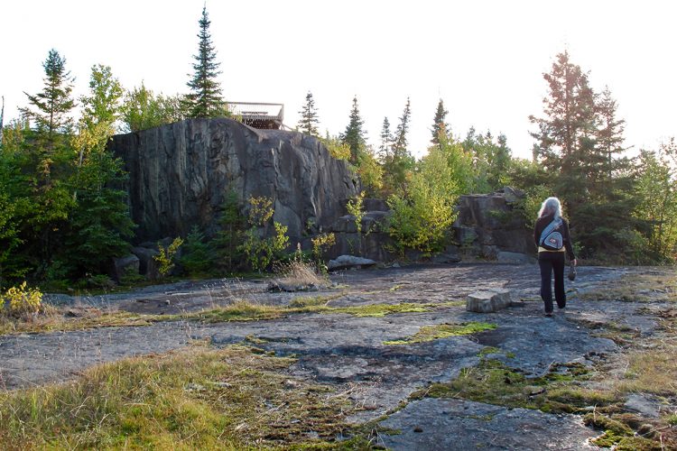
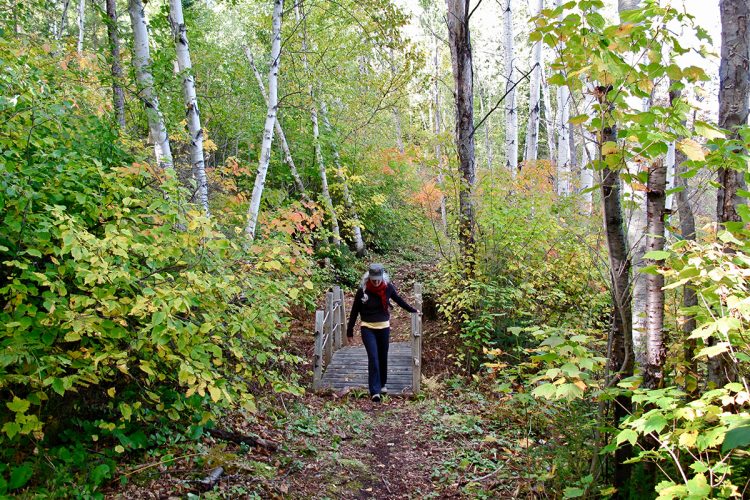
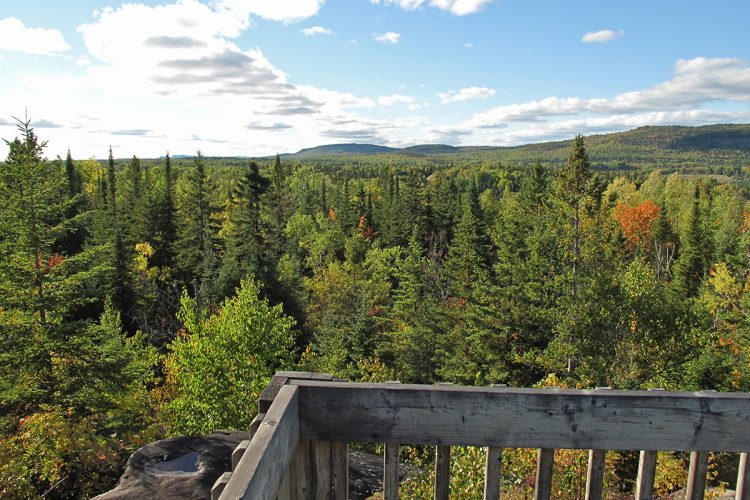
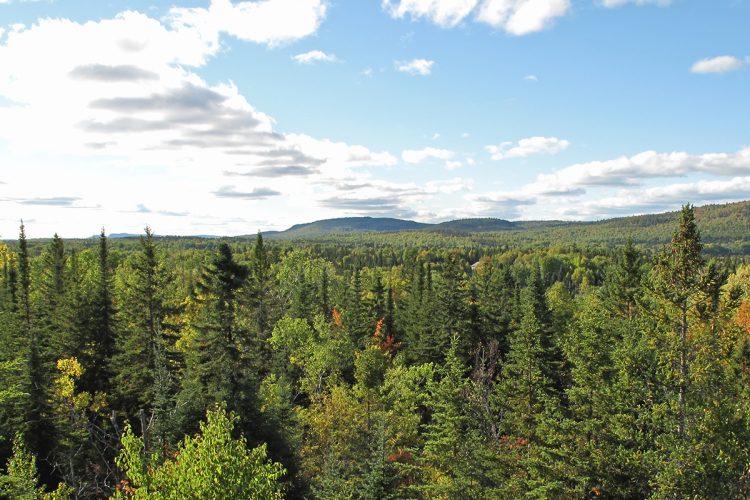
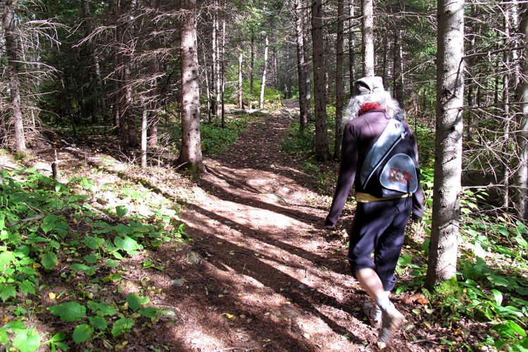
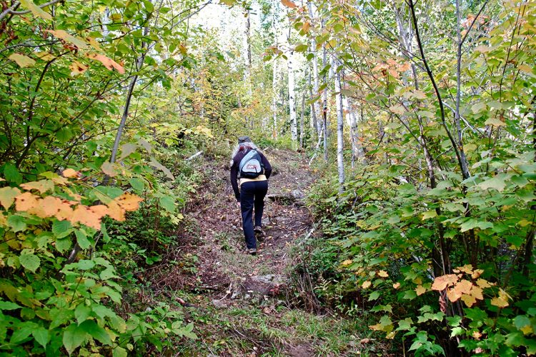
Accessible terrain with two viewpoints on rocky buttons offering panoramas on the hills Kekeko. The forest is varied and some portions of trails give a beautiful view and access to Lake Beauchastel (picnic area).
- electrocardiogram Easy
- mountain 6 Km (Loop)
- calendar seasonal
Sections
Du Zoo
- electrocardiogram Easy
- mountain 1.82 km (Linear)
De la Traverse
- electrocardiogram Easy
- mountain 1.43 km (Linear)
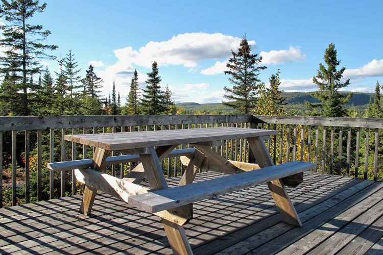
Des Belvédères
- electrocardiogram Easy
- mountain 2.14 km (Linear)
Du Panorama
- electrocardiogram Easy
- mountain 0.12 km (Linear)
Connexions
- electrocardiogram Easy
- mountain 0.30 km (Linear)
Connections
- electrocardiogram Easy
- mountain 0.30 km (Linear)
Des Trois Parcs
- electrocardiogram Easy
- mountain 1.58 km (Linear)
The Zoo
- electrocardiogram Easy
- mountain 1.82 km (Linear)
Specification : Mops Parks: there are many birds in winter | Not lost parks: place for children, play box, books for children | Oasis Park: quieter place, ideal for adults, for rest, books available
The Traverse
- electrocardiogram Easy
- mountain 1.43 km (Linear)
Interest : Parc Le Zoo: animals carved in wood by a local gentleman.
The Viewpoints
- electrocardiogram Easy
- mountain 2.14 km (Linear)
Interest : Panoramic viewpoints
Points of service and interest
Category Name
-
 Parking
Stationnement de la Randonne-Rit
48°08'54.7"N
Parking
Stationnement de la Randonne-Rit
48°08'54.7"N
79°08'52.1"O -
 Covered picnic table
Table à pique-nique couverteta
48°08'54.0"N
Covered picnic table
Table à pique-nique couverteta
48°08'54.0"N
79°08'51.8"O -
 Bench
Banc
48°9'11,129"N
Bench
Banc
48°9'11,129"N
79°8'14,436"O -
Bench
Bancba
48°9'2,434"N
79°8'50,858"O -
Bench
BancB
48°8'55,946"N
79°8'22,415"O -
Bench
Banc
48°8'59,768"N
79°7'54,56"O -
 Belvedere
Belvédère
48°9'11,097"N
Belvedere
Belvédère
48°9'11,097"N
79°8'42,532"O -
Belvedere
Belvédère
48°9'15,614"N
79°8'31,647"O -
 Sandy beach / Swimming
Plage de la Randonne-Rit
48°8'53,964"N
Sandy beach / Swimming
Plage de la Randonne-Rit
48°8'53,964"N
79°7'51,377"O -
 Picnic table
Table de pique-nique
48°8'57,127"N
Picnic table
Table de pique-nique
48°8'57,127"N
79°7'53,039"O -
 Wild camping
Camping sauvage de la Randonne-Rit
48°9'12,475"N
Wild camping
Camping sauvage de la Randonne-Rit
48°9'12,475"N
79°8'36,127"O -
 Point of interest
Parc des Mésanges
48°8'54,176"N
Point of interest
Parc des Mésanges
48°8'54,176"N
79°8'41,782"O -
Point of interest
Parc des Pas Perdus
48°8'54,649"N
79°8'38,117"O -
Point of interest
Parc Le Zooi
48°8'51,858"N
79°8'12,802"O -
Point of interest
Parc Le Zoo d
48°8'58,153"N
79°8'39,771"O
Accessibility
Access Rights
 Free, without welcome center
 ![]() Pets are allowed
Pets are allowed
Directions to the starting point
From Rouyn-Noranda, take route 391 South (boulevard Témiscamingue) towards the Beaudry district. 14 km from Avenue Québec, a small parking lot on the left, 300 meters after passing Rang de la Carrière just after a small hill in a bend.
Parking: free
Markup
Yellow and orange ribbons indicate the way forward.
Contact
T 819 797-3195
loisirsdebeaudry@hotmail.com
Specifications
2 gazebos
8 rest areas
Small campsite near the lake, room for a tent (wild camping)
4 small parks
- Chickadees parks: there are many birds in winter
- Parks of the lost steps: Place for the children, tray of games, books for children (exchange principle one takes one we give one
- The Zoo: Animals carved in wood by a local gentleman
- The Oasis: quieter place, ideal for adults, for rest, books available
Comments social0
Tools ready to go
- map Guide map (PDF)
- mapsquare Download GPS track (GPX)
- Google driving directions
-
 Sunrise : 07:20
Sunset : 18:47
- pdf Planification Randonnee Apa
- pdf Equipement Randonnee Pedestre
- pdf Gestion Des Risques Randonnee Pedestre Apa
- pdf Sans Trace Apa
Info & advice
- Activité
- Animation et interprétation
- Camping
- Care
- Carte et orientation
- Caution
- Emergency
- Encadrement
- Equipment
- Jamais sans mon chien
- Nutrition
-
Prevention
- 10 articles de première nécessité
- Bien s'hydrater
- Comment lire la météo dans les nuages? Faire la pluie et le beau temps !
- Éviter les ampoules aux pieds
- Éviter les mauvaises rencontres en milieu sauvage
- Feu de camp sécuritaire : trois étapes à respecter
- Insectifuges
- Les moustiques
- Lunettes de soleil
- MALADIE DE LYME : PRÉVENIR LES PIQÛRES DE TIQUE EN RANDONNÉE
- Perdu en forêt : quoi faire?
- Se protéger contre le soleil
- Vaporisateur Chasse-ours
- Progression
- Réglementation
- Training
Caution
This sheet has been prepared from information provided by outdoor enthusiasts deemed sufficiently reliable and experienced. Errors or omissions are always possible and Tourisme Abitibi-Témiscamingue cannot accept responsibility for any problem or accident that may arise from this sheet or be attributed to its use. If you notice any errors or omissions during your expedition, we would be very grateful if you would let us know by email pleinair@atrat.org in order to keep our information up to date.
