
Marais Antoine Hiking Trail
Marais Antoine Hiking Trail
Roquemaure, La Sarre et l'Abitibi-Ouest
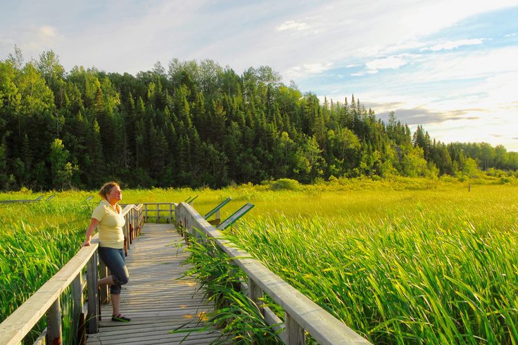
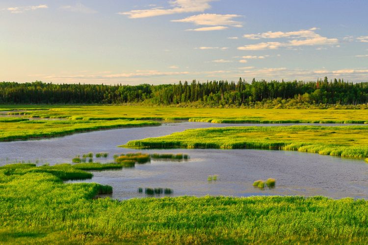
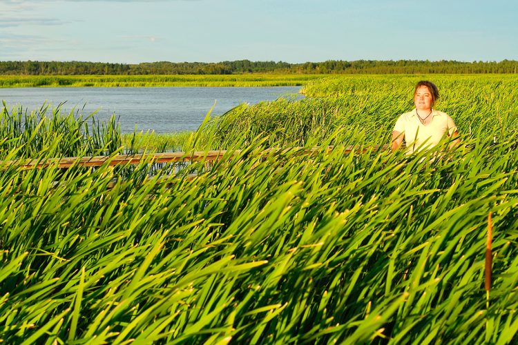
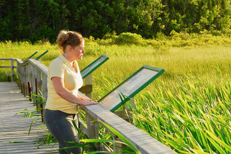
Recognized as a favourite waterfowl habitat, the Marais Antoine is one of the largest marshes in the region with its 2.8 km. Designed by Ducks unlimited, you will find it in the heart of the countryside, on the edge of the immense lake Abitibi. During the summer season, the marsh offers a magnificent spectacle that is constantly renewed. The scirpes, the carex, the cattails and the ribbons grow in abundance; 150 species of birds inhabit it or fly over it. Walking the trails, you cross fields before entering a swampy forest through a wooden sidewalk. You must then climb a hill covered with mixed forest composed of black spruce, aspen, birch and some larches to reach the top, a viewing point on a rocky cape that gives you an overview of the marsh as well as Lake Abitibi and the dam controlling the water level. A footbridge on stilts allows you to access the inside of the marsh.
Contact
T 819 787-6311 poste 221
Email : roquemaure@mrcao.qc.ca
Website: Click here
- electrocardiogram Easy
- mountain 1.58 Km (Linear)
- calendar seasonal
Sections
Sentier du marais Antoine (Secteur Nord)
- electrocardiogram Easy
- mountain 1.58 km (Linear)
Points of service and interest
Category Name
 Parking
 Belvedere
 Picnic table
Accessibility
Access Rights
Free, no welcome center.
Pets are allowed.
Directions to the starting point
From Rouyn-Noranda, follow Route 101 north for about 40 kilometres. Turn left towards Sainte-Germaine and then head for Roquemaure. The entrance to the trail is located 6 km west of Roquemaure, on the path of 2nd and 3rd Rank.
Parking : Free.
Comments social0
Tools ready to go
- pdf Planification Randonnee Apa
- pdf Equipement Randonnee Pedestre
- pdf Gestion Des Risques Randonnee Pedestre Apa
- pdf Sans Trace Apa
Info & advice
- Activité
- Animation et interprétation
- Camping
- Care
- Carte et orientation
- Caution
- Emergency
- Encadrement
- Equipment
- Jamais sans mon chien
- Nutrition
-
Prevention
- 10 articles de première nécessité
- Bien s'hydrater
- Comment lire la météo dans les nuages? Faire la pluie et le beau temps !
- Éviter les ampoules aux pieds
- Éviter les mauvaises rencontres en milieu sauvage
- Feu de camp sécuritaire : trois étapes à respecter
- Insectifuges
- Les moustiques
- Lunettes de soleil
- MALADIE DE LYME : PRÉVENIR LES PIQÛRES DE TIQUE EN RANDONNÉE
- Perdu en forêt : quoi faire?
- Se protéger contre le soleil
- Vaporisateur Chasse-ours
- Progression
- Réglementation
- Training
Caution
This sheet has been prepared from information provided by outdoor enthusiasts deemed sufficiently reliable and experienced. Errors or omissions are always possible and Tourisme Abitibi-Témiscamingue cannot accept responsibility for any problem or accident that may arise from this sheet or be attributed to its use. If you notice any errors or omissions during your expedition, we would be very grateful if you would let us know by email pleinair@atrat.org in order to keep our information up to date.
