
Hiking Trails – Parc-Aventure Joannès
Hiking Trails – Parc-Aventure Joannès
Rouyn-Noranda (McWatters), Rouyn-Noranda
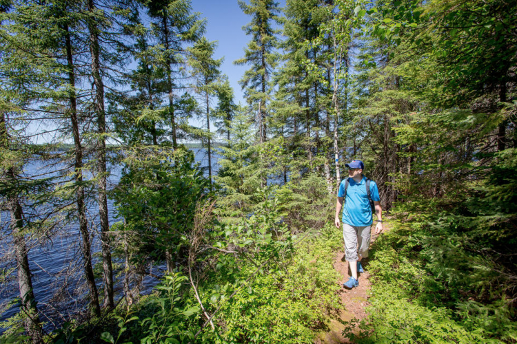
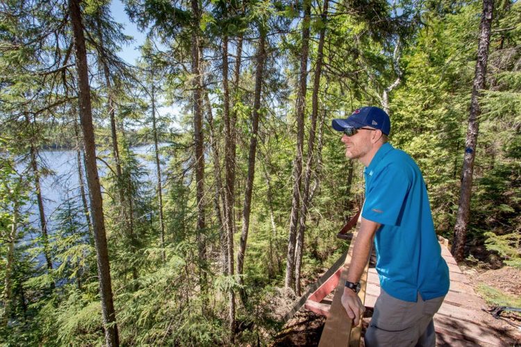
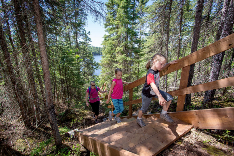
Put on your walking shoes, grab your water bottle and take off from one or the other of the seven roads that will lead you into the heart of the Vaudray-Joannès Lakes Biodiversity Reserve. Nine kilometres of prepared trails will allow you to discover the boreal flora and fauna that inhabit this protected area. Lake trail, the Clintonia... Trails for all tastes, all ages and all physical conditions! The staff will guide you in choosing your hike.
- electrocardiogram Easy to Moderate
- mountain 9 Km (Mixed)
- calendar seasonal
Sections
Des Pins
- electrocardiogram Easy
- mountain 4.18 km (Linear)
Cédrière
- electrocardiogram Easy
- mountain 1.04 km (Linear)
Clintonie
- electrocardiogram Easy
- mountain 1.03 km (Linear)
L'Entre-Deux
- electrocardiogram Easy
- mountain 0.32 km (Linear)
Bouts d'chou
- electrocardiogram Easy
- mountain 0.19 km (Linear)
Incendie
- electrocardiogram Easy
- mountain 0.32 km (Linear)
Pessière
- electrocardiogram Easy
- mountain 0.83 km (Linear)
Ptéridium
- electrocardiogram Easy
- mountain 0.30 km (Linear)
D'Hébertisme
- electrocardiogram Easy
- mountain 0.51 km (Linear)
Accueil
- electrocardiogram Easy
- mountain 0.47 km (Linear)
Plage
- electrocardiogram Easy
- mountain 0.24 km (Linear)
Points of service and interest
Category Name
-
 Reception et services
Dépanneur sur le site
48°10'34,764"N
Reception et services
Dépanneur sur le site
48°10'34,764"N
78°40'16,525"O -
 Parking
Stationnement du Parc Aventure Joannès
48°10'38,197"N
Parking
Stationnement du Parc Aventure Joannès
48°10'38,197"N
78°40'19,584"O -
 Hebertism
Piste d'hébertisme
48°10'36,033"N
Hebertism
Piste d'hébertisme
48°10'36,033"N
78°40'19,09"O -
 Mini Golf
Minigolf forestier
48°10'38,039"N
Mini Golf
Minigolf forestier
48°10'38,039"N
78°40'16,771"O -
 Labyrinth
es forestiers
48°10'36,05"N
Labyrinth
Labyrinthes forestiers
48°10'36,05"N
78°40'16,859"O -
Labyrinth
Labyrinthe enfant
48°10'29,71"N
78°40'31,677"O -
 Interpretation panel
Panneau d'interprétation de la tourbière
48°10'20,124"N
Interpretation panel
Panneau d'interprétation de la tourbière
48°10'20,124"N
78°39'55,934"O -
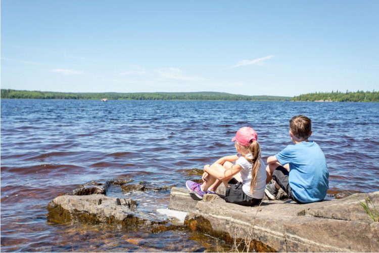
 Sandy beach / Swimming
Plage
48°10'39,7777"N
Sandy beach / Swimming
Plage
48°10'39,7777"N
78°40'29,143"O
Accessibility
Access Rights
Payable
Visitors Center
Directions to the starting point
From Rouyn-Noranda, take route 117 south towards Val-d'Or for 27 km, turn right on the way to the lakes Vaudray and Joannès and drive for a distance of 8 km. Follow the blue tourist signs.
Parking : free
Position : 48°10'37.9"N 78°40'21.0"O
Address :
10 068, Chemin de l'Aventure, Rouyn-Noranda (McWatters), Québec
Contact :
T 819 762-8867 SF 1 855 840-8867 | parcaventurejoannes@hotmail.com
Natural Environment
Geography
Formed in a crack in the earth’s crust, Vaudray and Joannès lakes are both generally oriented north-south. These two lakes with sandy bottoms differ from the other lakes in the Abitibia region, which are often made up of clay beds, by their great depth and greater transparency
Wildlife
The Biodiversity Reserve is home to a large number of mammals including the American porcupine, red squirrel, Canada beaver, Great Polatouche, muskrat, elm, American hare, long-tailed weasel, ermine, American marten, Pekan, American mink, striped skunk, river otter, black bear, grey wolf, coyote, red fox and Canadian lynx. There are also 118 species of birds, 98 of which nest here. Among those who nest are: the black duck, the winter teal, the great harle, the collar fuligule and the golden eye garrot. In the deciduous forests, we find the around the pigeon and the great woodpecker. We also find the brown harrier in the coniferous forests. Lake Joannes is frequented by 14 species of fish.
Flora
The forest consists mainly of coniferous stands on the heights or mixed clusters on the slopes. Black spruce is the dominant species. It is most often accompanied by white spruce, balsam fir, paper birch and aspen aspen.
Comments social0
Tools ready to go
- map Guide map (PDF)
- mapsquare Download GPS track (GPX)
- Google driving directions
-
 Sunrise : 07:29
Sunset : 18:35
- pdf Planification Randonnee Apa
- pdf Equipement Randonnee Pedestre
- pdf Gestion Des Risques Randonnee Pedestre Apa
- pdf Sans Trace Apa
Info & advice
- Activité
- Animation et interprétation
- Camping
- Care
- Carte et orientation
- Caution
- Emergency
- Encadrement
- Equipment
- Jamais sans mon chien
- Nutrition
-
Prevention
- 10 articles de première nécessité
- Bien s'hydrater
- Comment lire la météo dans les nuages? Faire la pluie et le beau temps !
- Éviter les ampoules aux pieds
- Éviter les mauvaises rencontres en milieu sauvage
- Feu de camp sécuritaire : trois étapes à respecter
- Insectifuges
- Les moustiques
- Lunettes de soleil
- MALADIE DE LYME : PRÉVENIR LES PIQÛRES DE TIQUE EN RANDONNÉE
- Perdu en forêt : quoi faire?
- Se protéger contre le soleil
- Vaporisateur Chasse-ours
- Progression
- Réglementation
- Training
Caution
This sheet has been prepared from information provided by outdoor enthusiasts deemed sufficiently reliable and experienced. Errors or omissions are always possible and Tourisme Abitibi-Témiscamingue cannot accept responsibility for any problem or accident that may arise from this sheet or be attributed to its use. If you notice any errors or omissions during your expedition, we would be very grateful if you would let us know by email pleinair@atrat.org in order to keep our information up to date.
