
Opémican National Park Hiking trails, Pointe-Opémican area
Opémican National Park Hiking trails, Pointe-Opémican area
Témiscaming, Témiscamingue
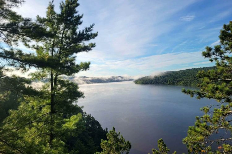
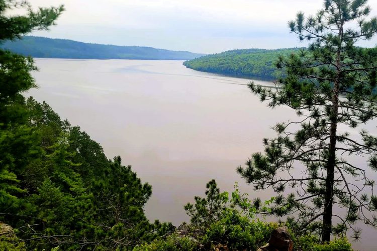
It is difficult to remain frozen in front of such a beautiful territory.
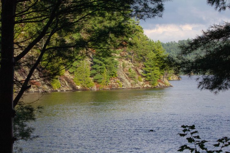
The Opémican National Park has the essential elements to compose a remarkable landscape: rugged and low relief accompanied by many rocky walls that are mainly inserted along the Témiscamingue lake. Here, nature and culture come together to offer you a privileged contact with an exceptional natural environment. While the Discovery sector of Pointe Opémican is the family destination par excellence, the Kipawa River Adventure sector knows how to please lovers of great nature.
Visit the Opémican National Park website
- electrocardiogram Easy to Moderate
- mountain 20 Km (Mixed)
- calendar seasonal
Sections
Accès Scierie
- electrocardiogram Easy
- mountain 0.25 km (Linear)
Sentier-Chemin Jodoin
- electrocardiogram Easy
- mountain 1.91 km (Linear)
Sentier-Eclaireur
- electrocardiogram Easy
- mountain 5.03 km (Linear)
Sentier-Estacade
- electrocardiogram Easy
- mountain 3.04 km (Linear)
Sentier-Piers
- electrocardiogram Easy
- mountain 1.38 km (Linear)
Sentier-Prucherais
- electrocardiogram Easy
- mountain 1.53 km (Linear)
Points of service and interest
Category Name
-
 Parking
Stationnement de la Pointe Opémican
46°50'05.2"N
Parking
Stationnement de la Pointe Opémican
46°50'05.2"N
79°11'36.7"O -
 Reception et services
Centre de service de la pointe Opémican et boutique nature
46°50'6,592"N
Reception et services
Centre de service de la pointe Opémican et boutique nature
46°50'6,592"N
79°11'34,221"O -
 Sandy beach / Swimming
Pit de sable
46°50'3.817”N
Sandy beach / Swimming
Pit de sable
46°50'3.817”N
79°11'31.3”O -
 Rocky escarpment
Plage de la baie d’Opémican
46°49'58.5”N
Rocky escarpment
Plage de la baie d’Opémican
46°49'58.5”N
79°11'21.759”O -
 Point of interest
Auberge Jodoin
46°49'54,485"N
Point of interest
Auberge Jodoin
46°49'54,485"N
79°11'30,857"O -
Sandy beach / Swimming
Plage de l'auberge Jodoin de la pointe Opémican
46°49'53.3"N
79°11'30.8"O -
Point of interest
Garage
46°50'0,361"N
79°11'32,55"O -
Point of interest
Forge
46°49'56,176"N
79°11'29,052"O -
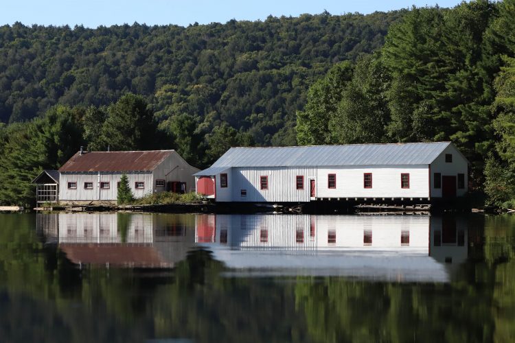
Point of interest
Menuiserie / Chalouperie
46°49'56.1"N
79°11'29.2"O -
 Discovery
Moulin à scie
46°50'2,449"N
Discovery
Moulin à scie
46°50'2,449"N
79°12'14,225"O -
Point of interest
Château d'eau
46°49'54,608"N
79°11'33,217"O -
Point of interest
Hangar à estacades
46°50'1,488"N
79°11'31,062"O -
 Commercial campsite
Camping 2 services (eau, électricité), secteur des Draveurs (boucle A)
46°50'5,919"N
Commercial campsite
Camping 2 services (eau, électricité), secteur des Draveurs (boucle A)
46°50'5,919"N
79°11'45,241"O -
Commercial campsite
Camping sans service sur l'emplacement, secteur des Cageux (boucle B)
46°50'12,786"N
79°11'49,498"O -
 Ready-to-camp for rent
Prêt-à-camper Étoile, secteur des Remorqueurs (boucle C)
46°50'0,924"N
Ready-to-camp for rent
Prêt-à-camper Étoile, secteur des Remorqueurs (boucle C)
46°50'0,924"N
79°11'48,665"O -
Reception et services
Opémican
46°49'54.872”N
79°11'29.756”O -
 Toilet
Bloc sanitaire
46°50'6,53"N
Toilet
Bloc sanitaire
46°50'6,53"N
79°11'51,34"O -
 Panorama
Point de vue du sentier des Piers 1
46° 50.021''N
Panorama
Point de vue du sentier des Piers 1
46° 50.021''N
79° 11.260''O -
Panorama
Point de vue du sentiers des Piers 2
46° 50.077''N
79° 11.409''O -
Panorama
Point de vue sentier des Éclaireurs
46° 50.676''N
79° 12.199''O
Natural Environment
Geography
Opémican National Park protects a sample of the southern Laurentians natural region. Covering an area of 252.5 km2, the park is divided into three distinct sectors: the Rivière-Kipawa sector, the Pointe-Opémican sector, and the Lac-Marsac sector.
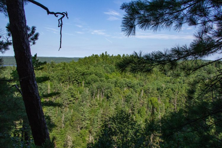
Flora
This unique place of discoveries, characterized by the dominant presence of large white and red pines, symbol of the junction of the leafy and boreal areas on its territory.
Comments social0
Tools ready to go
- map Guide map (PDF)
- mapsquare Download GPS track (GPX)
- Google driving directions
-
 Sunrise : 07:28
Sunset : 18:37 -
Equipment for rent Parc national d'Opémican Coop de l'Arrière-Pays
- pdf Equipement Randonnee Pedestre
- pdf Planification Randonnee Apa
- pdf Gestion Des Risques Randonnee Pedestre Apa
- pdf Sans Trace Apa
Info & advice
- Activité
- Animation et interprétation
- Camping
- Care
- Carte et orientation
- Caution
- Emergency
- Encadrement
- Equipment
- Jamais sans mon chien
- Nutrition
-
Prevention
- 10 articles de première nécessité
- Bien s'hydrater
- Comment lire la météo dans les nuages? Faire la pluie et le beau temps !
- Éviter les ampoules aux pieds
- Éviter les mauvaises rencontres en milieu sauvage
- Feu de camp sécuritaire : trois étapes à respecter
- Insectifuges
- Les moustiques
- Lunettes de soleil
- MALADIE DE LYME : PRÉVENIR LES PIQÛRES DE TIQUE EN RANDONNÉE
- Perdu en forêt : quoi faire?
- Se protéger contre le soleil
- Vaporisateur Chasse-ours
- Progression
- Réglementation
- Training
Caution
This sheet has been prepared from information provided by outdoor enthusiasts deemed sufficiently reliable and experienced. Errors or omissions are always possible and Tourisme Abitibi-Témiscamingue cannot accept responsibility for any problem or accident that may arise from this sheet or be attributed to its use. If you notice any errors or omissions during your expedition, we would be very grateful if you would let us know by email pleinair@atrat.org in order to keep our information up to date.
