
De la Pointe-aux-Roches Park

De la Pointe-aux-Roches Park
Latulipe-et-Gaboury, Témiscamingue
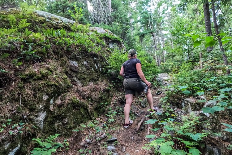
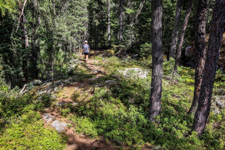
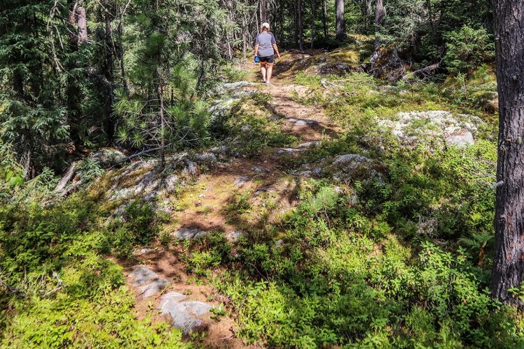
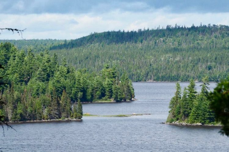
Pointe-aux-Roches Park is more than 12 kilometres of forest trails where hiking and mountain biking take place in an enchanting setting.
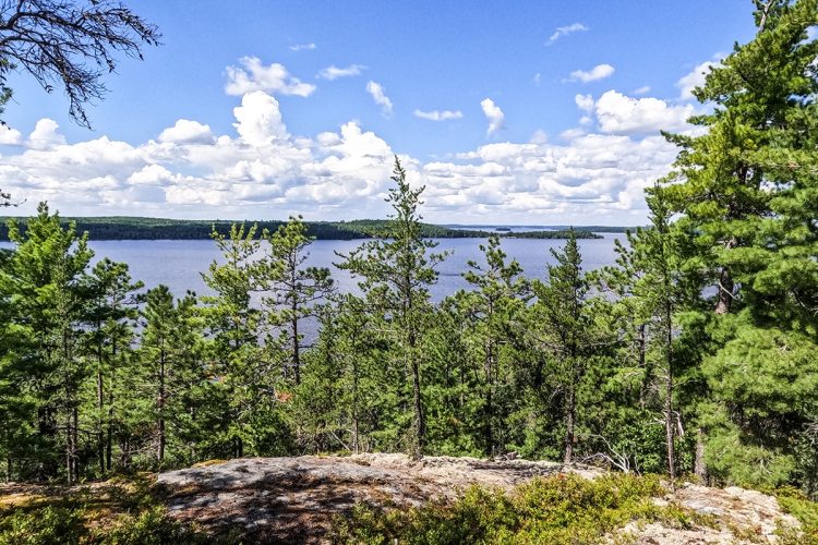
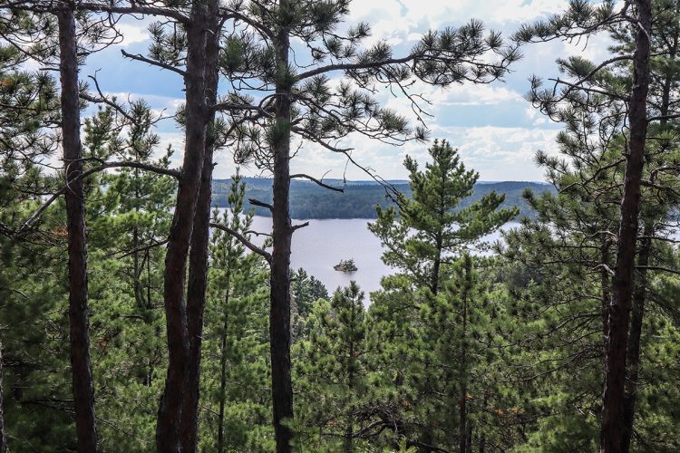
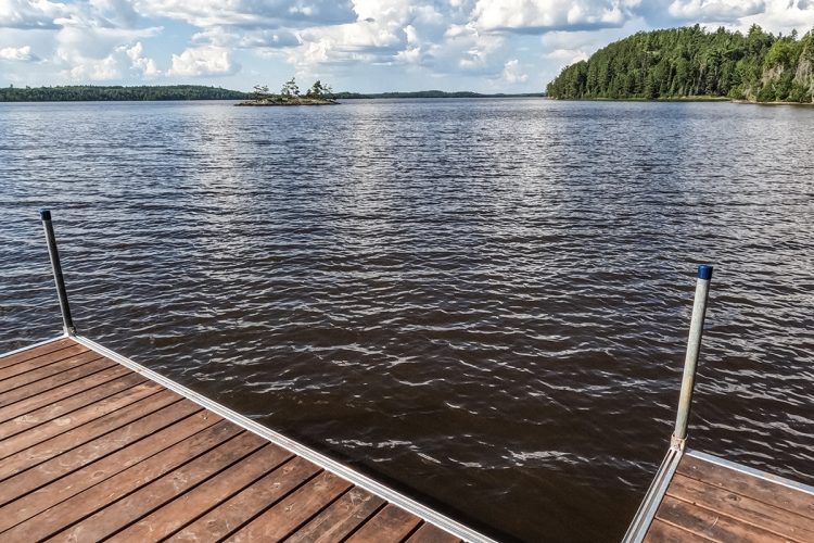
Located a few minutes from the municipality of Latulipe-et-Gaboury, in mountainous terrain, they overlook the spectacular Lac des Quinze on 3 cardinal points and lead to five viewpoints.
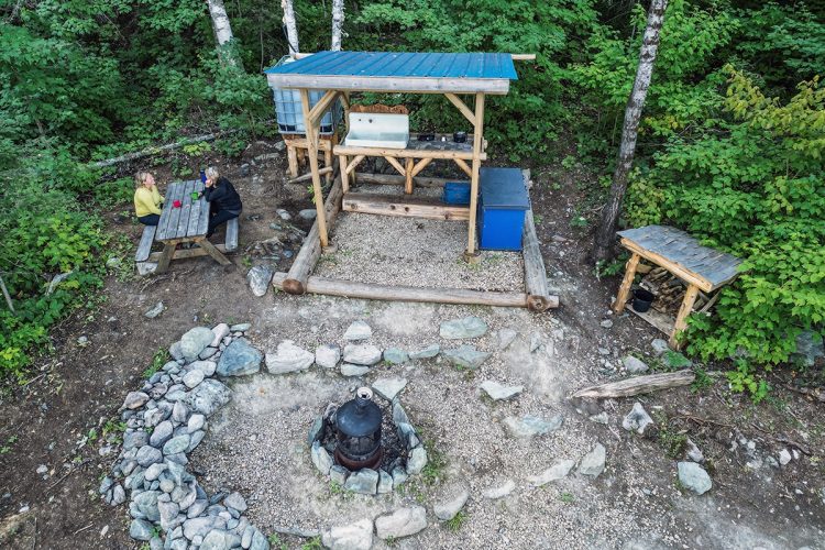
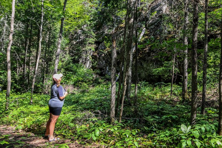
It is an ideal place for outings with family and friends where you can make picnics and also wild camping (for a fee) and without trace. Contact the municipality for the reservation and payment of a site.
Come and soak up this beautiful wild nature by walking these trails, rich in wildlife and flora characteristic of Témiscamingue.
- electrocardiogram Easy to Demanding
- mountain 12 Km (Mixed)
Sections
La Forêt
- electrocardiogram Easy
- mountain 1.17 km (Linear)
Access : Through the parking lot.
La Traversée
- electrocardiogram Moderate
- mountain 2.36 km (Linear)
Access : Through the parking lot.
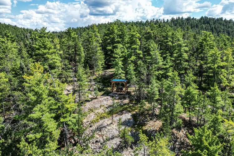
Interest : Panoramic view at the point of the trail.
Le Sommet
- electrocardiogram Demanding
- mountain 0.48 km (Linear)
Access : By the trail La Traversée.
Interest : Panoramic view
La Grande Virée
- electrocardiogram Moderate
- mountain 4.26 km (Linear)
Access : By the La Forêt trail.
Interest : Access to the lake, many views on the water, dry toilet.
La Pointe Panoramique
- electrocardiogram Demanding
- mountain 1.13 km (Linear)
Access : By the La Grande Virée trail.
Interest : Panoramic view of the Lac des Quinze.
Les Panoramas Arsenault
- electrocardiogram Easy
- mountain 0.43 km (Linear)
Access : By the trail La Grande Virée.
Interest : Two panoramic views of Arsenault Bay.
Points of service and interest
Category Name
-
 Parking
Stationnement des sentiers de la Pointe-aux-Roches
47°28'17,764"N
Parking
Stationnement des sentiers de la Pointe-aux-Roches
47°28'17,764"N
79°3'55,843"O -
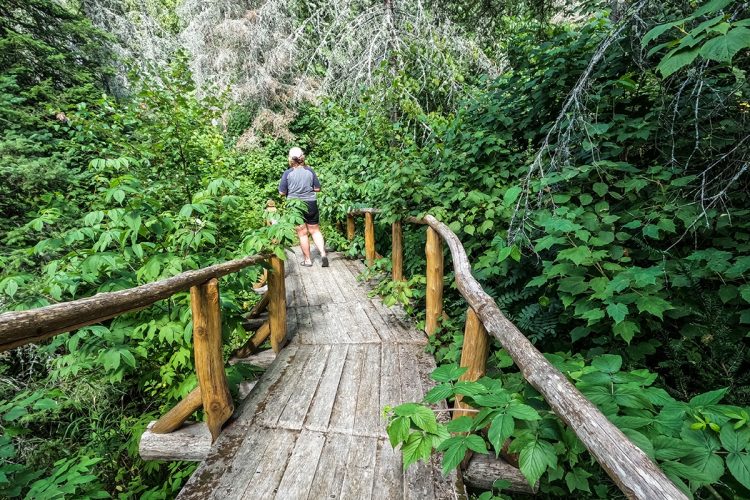
 Bridge
Pont de bois du sentier de la Pointe-aux-Roches
47°28'42,377"N
Bridge
Pont de bois du sentier de la Pointe-aux-Roches
47°28'42,377"N
79°5'3,703"O -
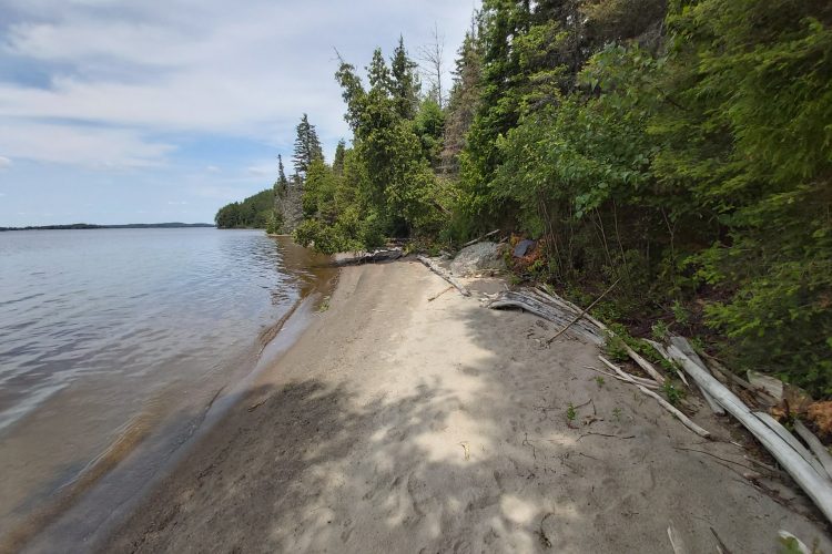
 Sandy beach / Swimming
Plage du sable du sentier de la Pointe-aux-Roches
47°28'36.8"N
Sandy beach / Swimming
Plage du sable du sentier de la Pointe-aux-Roches
47°28'36.8"N
79°05'09.3"O -
 Panorama
Vue panoramique de la Baie Arsenault
47°29'16,069"N
Panorama
Vue panoramique de la Baie Arsenault
47°29'16,069"N
79°4'14,312"O -
Panorama
Vue panoramique de la Baie Arsenault
47°29'9,486"N
79°4'11,141"O -
Panorama
Vue panoramique sur le lac des Quinze
47°29'16,94"N
79°4'22,642"O -
Panorama
Vue panoramique sur le lac des Quinze
47°28'50,170"N
79°5'5,824"O -
Panorama
Vue panoramique sur le lac des Quinze
47°29'28,446"N
79°4'47,129"O -
Panorama
Vue panoramique sur le lac des Quinze
47°28'49,418"N
79°4'51,337"O -
 Covered picnic table
Table de pique-nique couverte
47°29'0,834"N
Covered picnic table
Table de pique-nique couverte
47°29'0,834"N
79°4'36,019"O -
 Toilet
te sèche
47°28'31,112"N
Toilet
Toilette sèche
47°28'31,112"N
79°5'10,849"O -
Toilet
Toilette sèche
47°29'1,705"N
79°4'35,548"O -
Toilet
Toilette sèche
47°28'17,638"N
79°3'56,581"O -
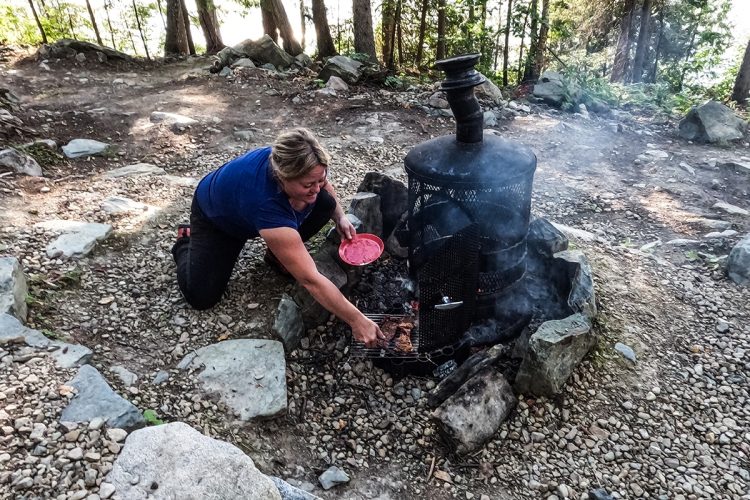
 Picnic table
Cuisine en plein air
47°28'30.8"N
Picnic table
Cuisine en plein air
47°28'30.8"N
79°05'11.2"O -
 Paid wild camping
Camping rustique Pointe-aux-Roches
47°28'30.4"N
Paid wild camping
Camping rustique Pointe-aux-Roches
47°28'30.4"N
79°05'11.7"O
Accessibility
Right of access
![]() Free, without visitors infrastructure.
Free, without visitors infrastructure.
![]() Pets allowed.
Pets allowed.
Directions to reach the starting point
From Latulipe, take the 5e et 6e Rang north and turn left at the intersection. At the end of the road, turn right onto 10e Rang. Parking is at the end of the road.
Parking: free outside.
Position: 47°28'10.2"N 79°03'56.2"W
![]() View the route from your location on Google Maps
View the route from your location on Google Maps
Contact
10e Rang, Latulipe, Québec
T 819 747-4281
Email : pointe.aux.roches@gmail.com
See Facebook page
Municipality de Latulipe-et-Gaboury
1-B, rue Principale Ouest
Latulipe (Québec) J0Z 2N0
819 747-4281
dg@latulipeetgaboury.ca
Comments social0
Tools ready to go
- map Guide map (PDF)
- mapsquare Download GPS track (GPX)
- Google driving directions
-
 Sunrise : 07:29
Sunset : 18:37 -
Equipment for rent Coop de l'Arrière-Pays
- pdf Planification Randonnee Apa
- pdf Equipement Randonnee Pedestre
- pdf Gestion Des Risques Randonnee Pedestre Apa
- pdf Systemes Communications
- pdf Sans Trace Apa
Info & advice
- Activité
- Animation et interprétation
- Camping
- Care
- Carte et orientation
- Caution
- Emergency
- Encadrement
- Equipment
- Jamais sans mon chien
- Nutrition
-
Prevention
- 10 articles de première nécessité
- Bien s'hydrater
- Comment lire la météo dans les nuages? Faire la pluie et le beau temps !
- Éviter les ampoules aux pieds
- Éviter les mauvaises rencontres en milieu sauvage
- Feu de camp sécuritaire : trois étapes à respecter
- Insectifuges
- LA PRÉPARATION DU CYCLISTE : PORT DU CASQUE PROTECTEUR
- Les moustiques
- Lunettes de soleil
- MALADIE DE LYME : PRÉVENIR LES PIQÛRES DE TIQUE EN RANDONNÉE
- Perdu en forêt : quoi faire?
- Se protéger contre le soleil
- Vaporisateur Chasse-ours
- Progression
- Réglementation
- Training
Caution
This sheet has been prepared from information provided by outdoor enthusiasts deemed sufficiently reliable and experienced. Errors or omissions are always possible and Tourisme Abitibi-Témiscamingue cannot accept responsibility for any problem or accident that may arise from this sheet or be attributed to its use. If you notice any errors or omissions during your expedition, we would be very grateful if you would let us know by email pleinair@atrat.org in order to keep our information up to date.
